Posts

2024 Study Architecture Student Showcase - Part XVI

Welcome to the final installment of the 2024 Study Architecture Student Showcase! It’s been a pleasure to celebrate these inspiring student projects.

Part XVI features student work that reimagines various housing typologies. From high-rise developments and mixed-use buildings to affordable single-family units, each project thoughtfully addresses critical housing issues. The presented design solutions involve incorporating machine learning into the design process, integrating various housing types, and much more. Scroll down for a closer look!

Reducing Architecture by Thomas Steven Tencer, M. Arch ‘24
University of Toronto | Advisor: Carol Moukheiber

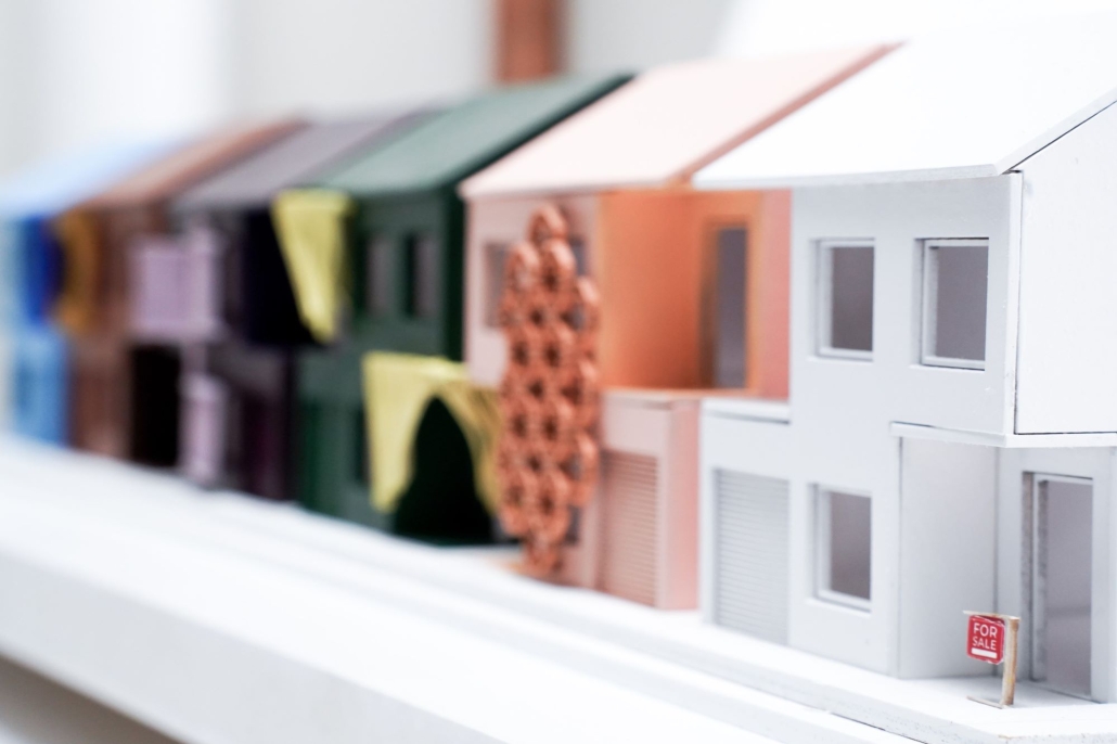
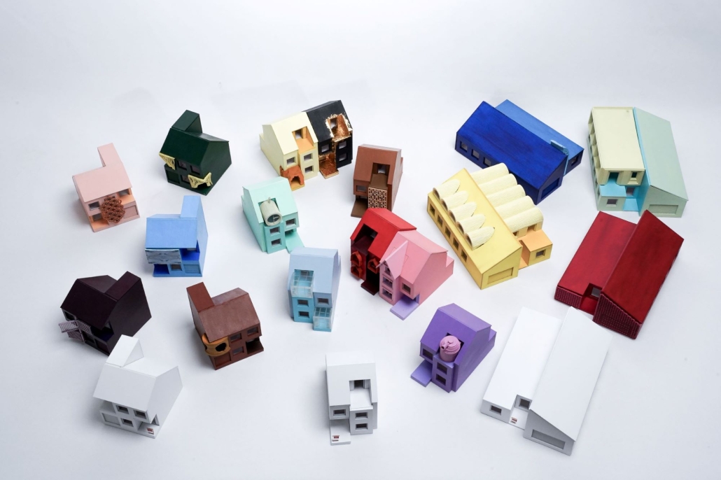
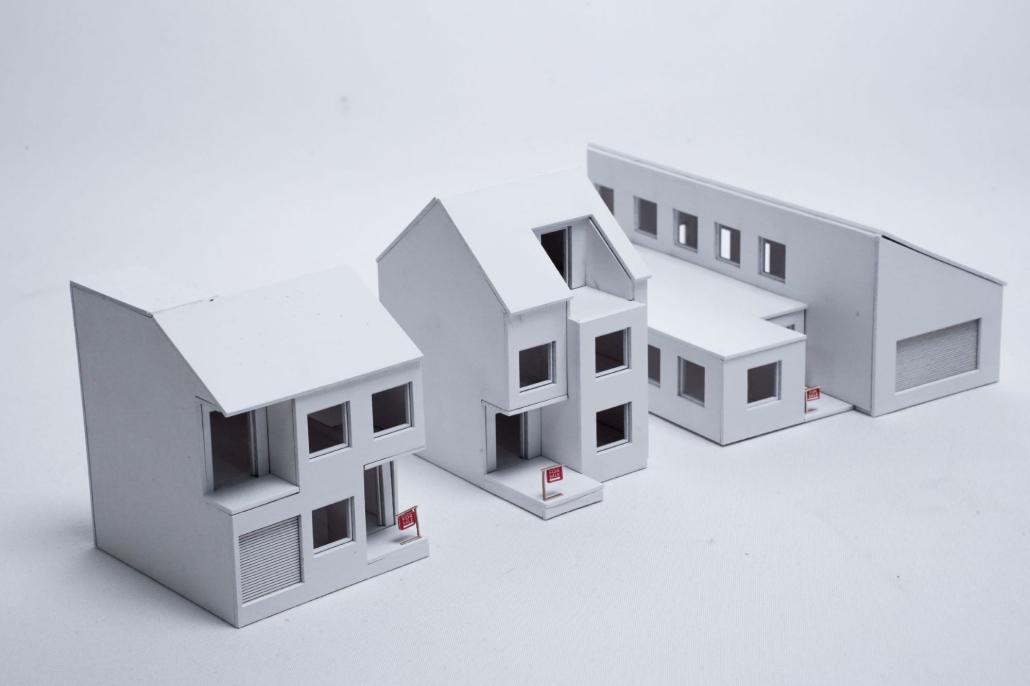
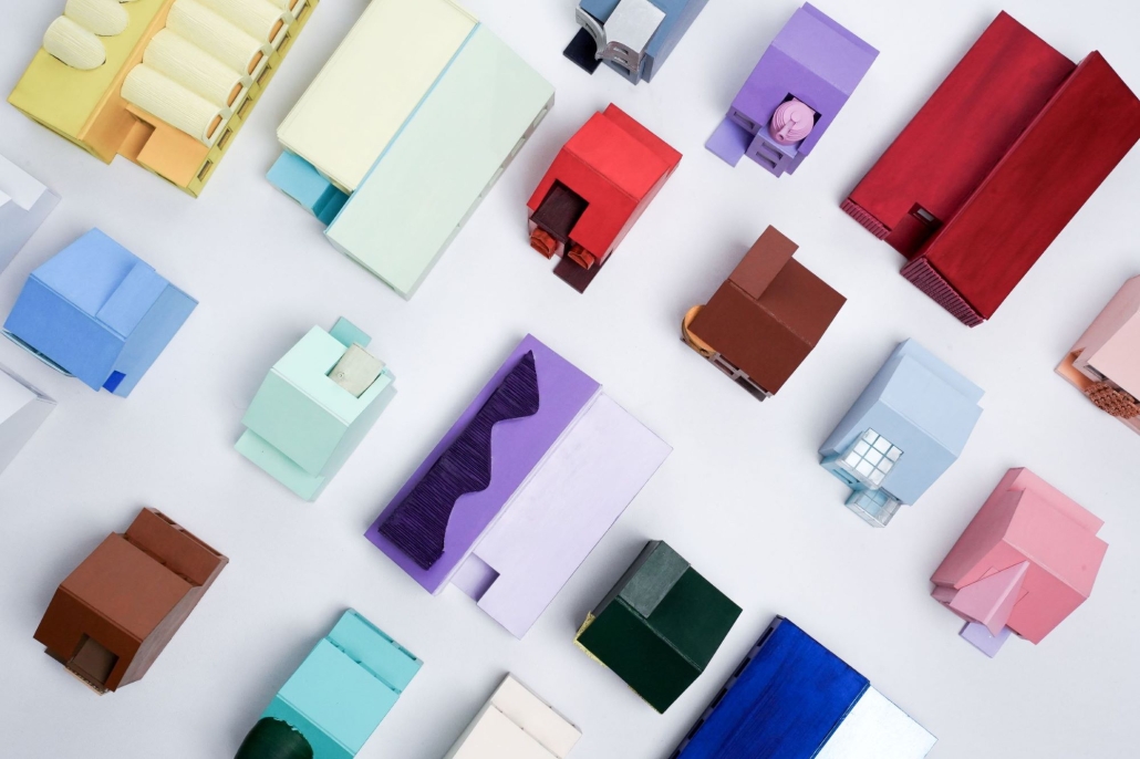
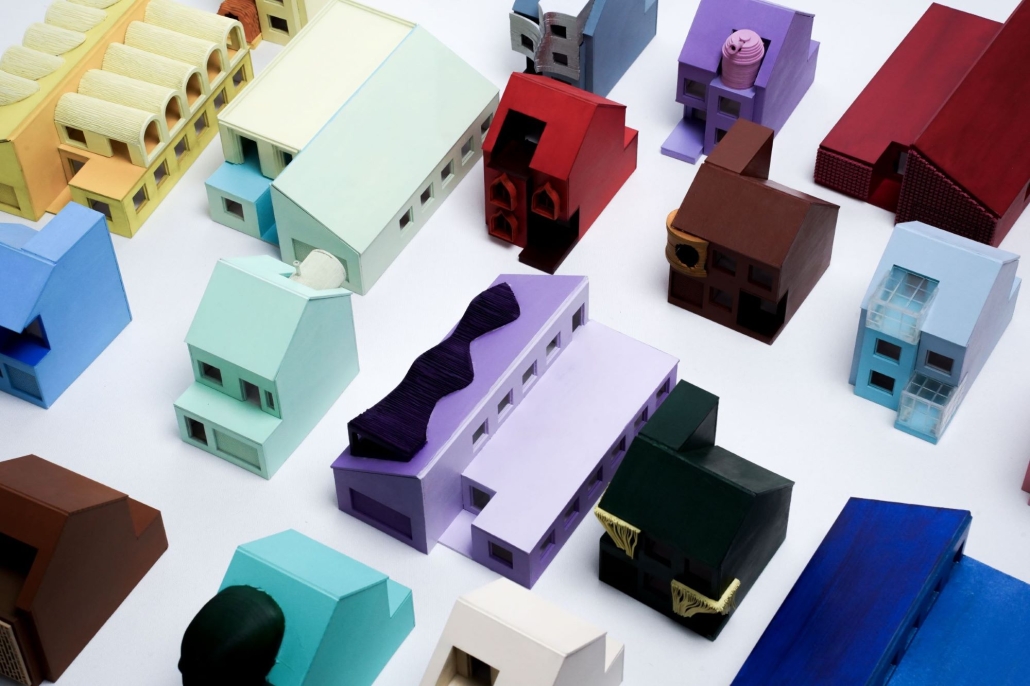
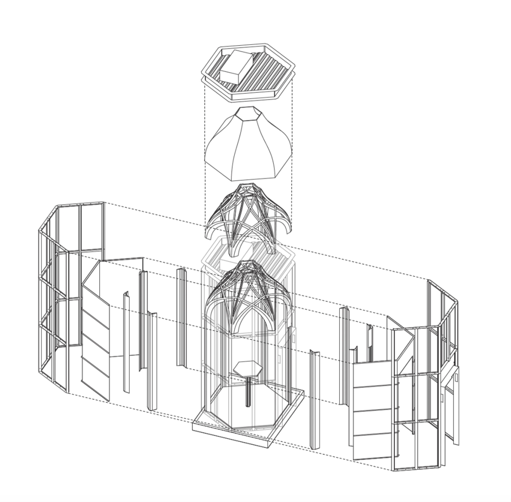
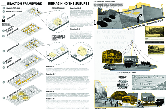
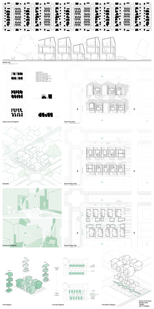
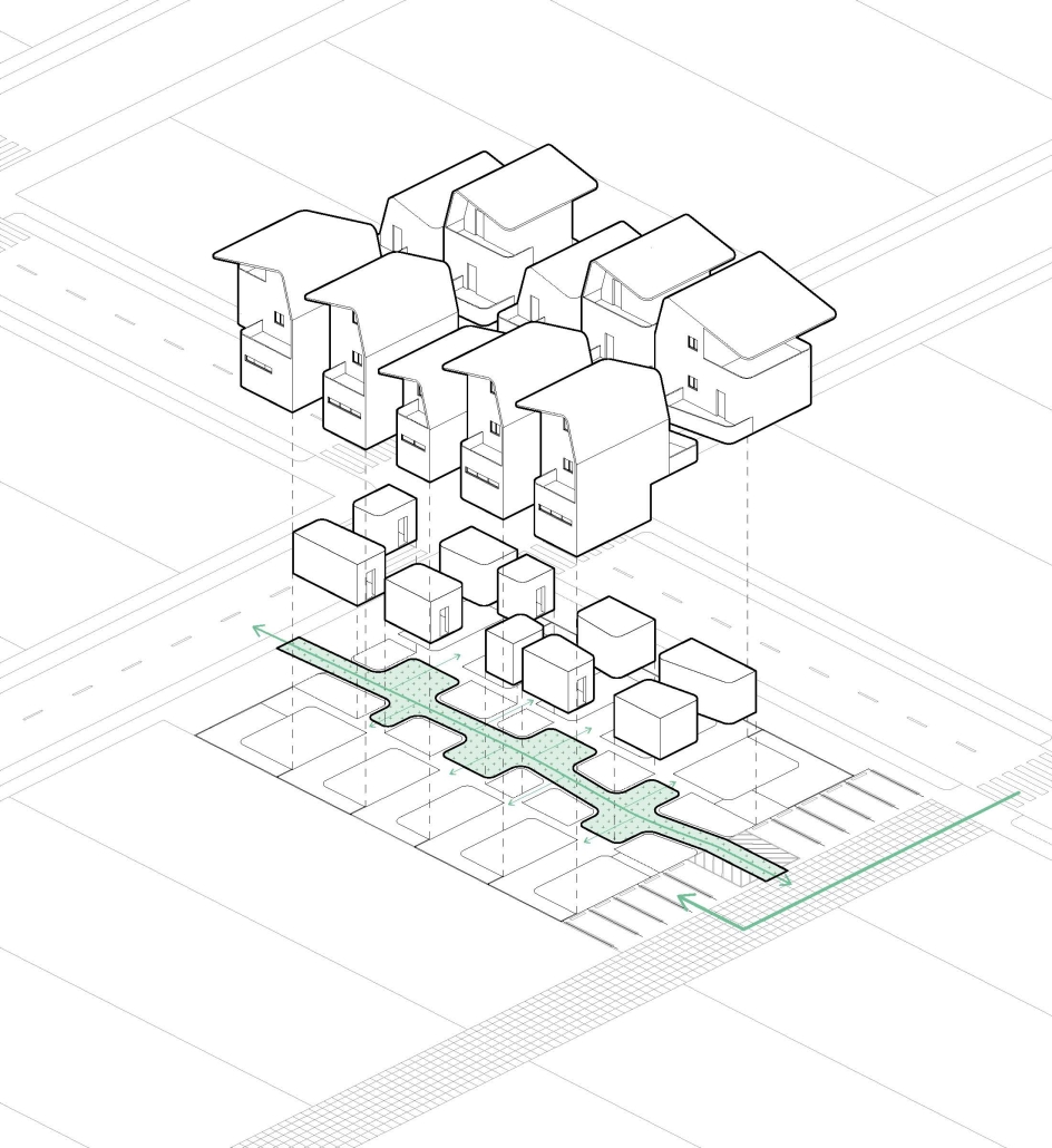
Reducing Architecture is a system-based design approach that strives to make the expression of architectural identity more accessible. Architectural discourse often critiques suburban sprawl and the suburban aesthetic (it is unaffordable in an urban context, lacks density, projects outdated images of domesticity, and promotes land ownership which some consider criminal). However, since architecture is so disconnected from the development and design of single-family homes (influencing the design of less than ten percent of this housing type), 1) the practice is incapable of engaging with, disrupting, or affecting the future of the single-family medium.

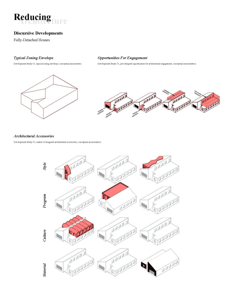
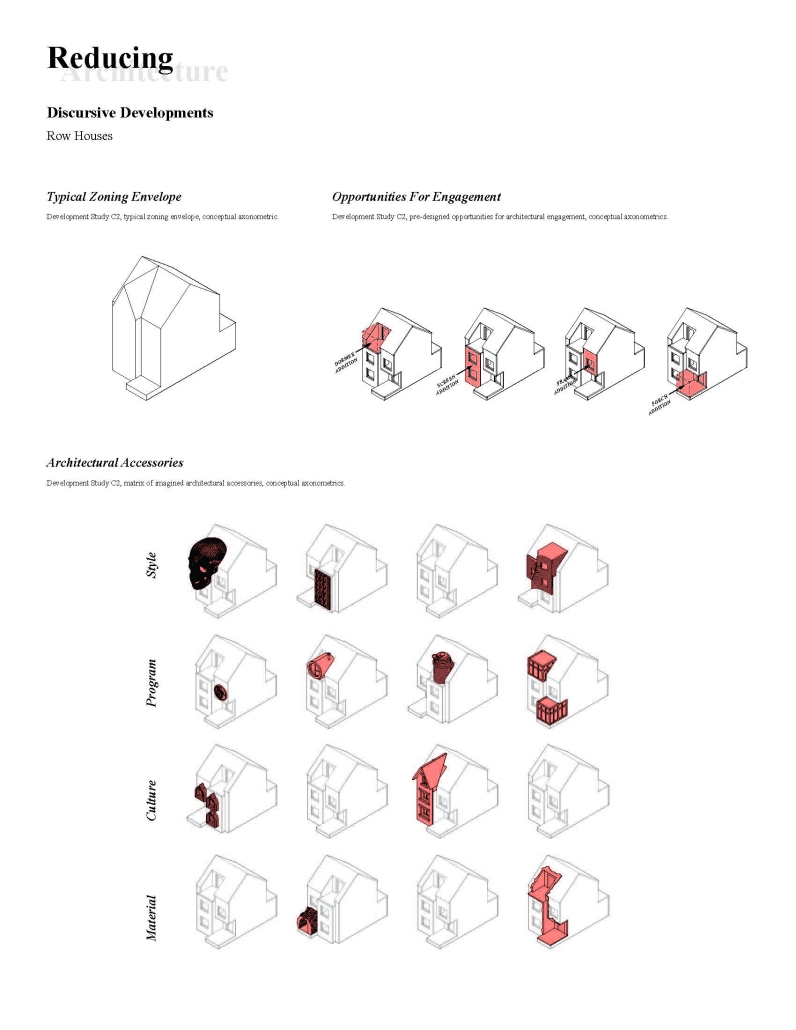
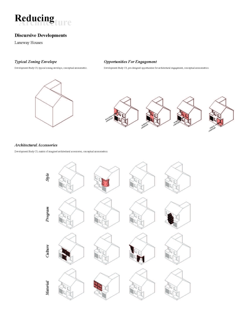
Reducing Architecture proposes that architecture re-engage single-family housing, which remains Canada’s predominant housing type. 2) By disconnecting architectural expression from longer-lasting building layers, the creation of longer-lasting, higher

performing, and less costly houses is enabled; “A Primed Canvas.” 3) Onto this “canvas” distilled and articulated architectural expressions can be applied, at smaller scales and lower costs, so as not to disrupt the economies of scale achieved by mass-produced developer-built single-family housing. The result is a novel method for the expression of architectural identity, which is accessible, affordable, and efficient. Re-engaging single-family housing enables a discourse that may allow architecture to begin to influence the suburban aesthetic and morphology, rather than ignoring the medium in an act of architectural complacency.

Through Reducing Architecture, the single-family home could become more beautiful, more efficient, more culturally relevant, or more environmentally sensitive, so long as the architectural expressions that result from these objectives remain efficient, affordable, accessible, and desirable to consumers.

1. John Brown, “The Architect and the Single-family House,” Canadian Architect, September 30, 2002.

2. Government of Canada, “Type of Dwelling Reference Guide, Census of Population, 2021,” Statistics Canada, 2022.

3. Bernard Leupen, essay, in “Frame and Generic Space a Study into the Changeable Dwelling; Proceeding from the Permanent,” 010 Publishers, 2009, 33-34.

Instagram: @tommytencer

UrbanBots by Karan Patel, Mike Saad & Jacob Sam, M.SC in Architecture ‘24
New York Institute of Technology | Advisor: Sandra Manninger

Overview:

ARCH 702B is the second Advanced Architecture Design Studio in the Master of Science in Architecture, Digital Technologies program at the School of Architecture & Design at the New York Institute of Technology. The studio adopts an applied research approach, focusing on computational design through the development of digital experiments. Depending on the project, students engage with architectural challenges via expert and learning systems in individual, group, or class-wide projects. The studio critically examines the impact of technological advancements on design and fabrication patterns.

Project Focus:

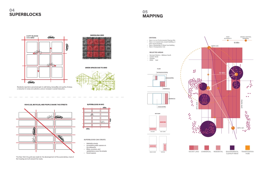
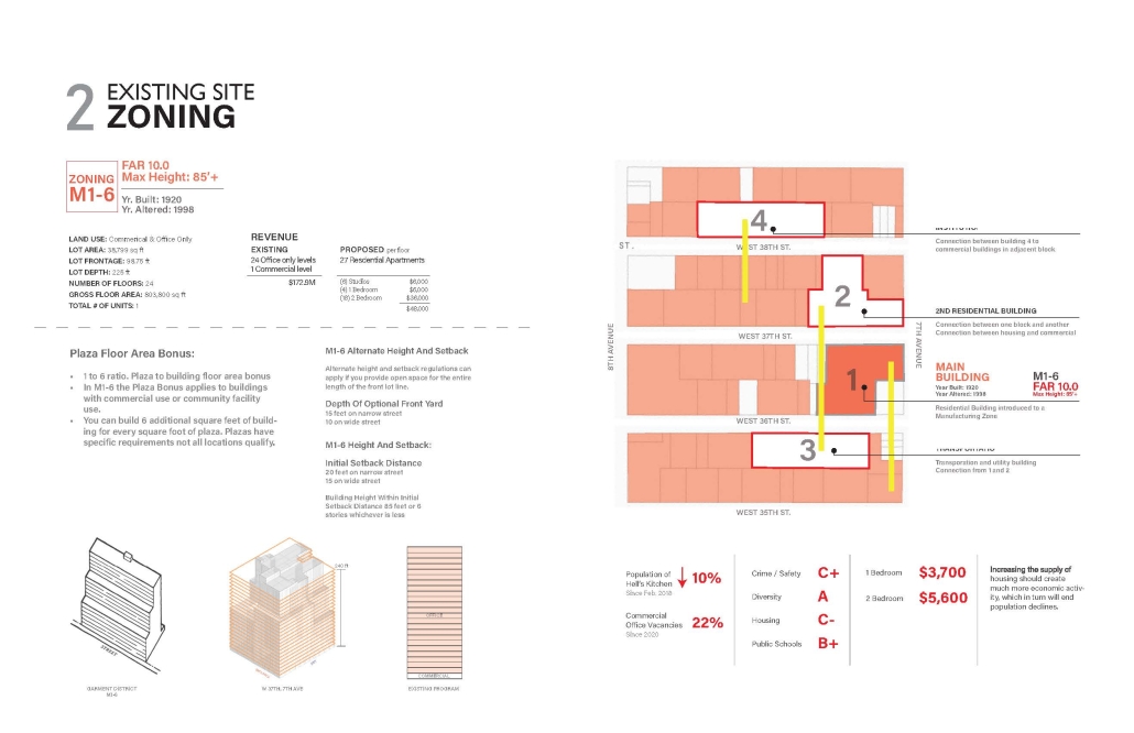
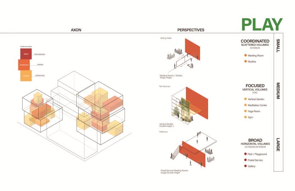
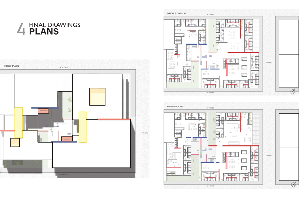
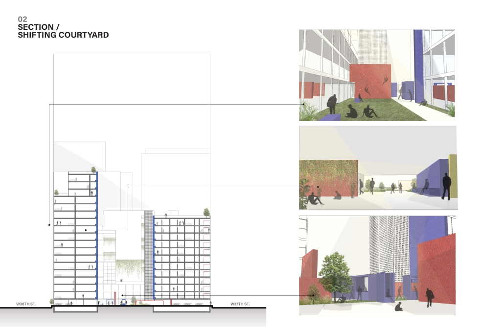
This term, the studio’s focus is on mixed-use housing projects in Manhattan’s Garment District, inspired by the City of Yes initiative by the Department of City Planning. The initiative aims to update New York City’s zoning regulations to support small businesses and create affordable housing. One key strategy is converting underused office spaces and other non-residential areas into mixed-use housing, particularly targeting buildings constructed post-1961.

Motivation:

With hybrid work models becoming the norm, cities must adapt to address escalating housing shortages and rising rents. This transformation is crucial, especially given the national office vacancy rate of 18.6%, as reported by Cushman & Wakefield. The NYC Office Conversion Accelerator program has enrolled 46 buildings, with four already undergoing transformation to yield over 2,100 housing units.

Scope of the Project:

Location: Manhattan, New York

Boundaries: 23rd Street to 40th Street and 5th Avenue to 8th Avenue.

Methods of Assessment:

The assessment methods integrate machine learning (ML) techniques into the design protocol. The process involves three key stages:

Data Retrieval and Dataset Generation:

Collecting and organizing data relevant to the project

Creating comprehensive datasets to inform the design process.

Developing Protocols for 2D Information/Data:

Generating 2D representations and analysis from the datasets

Utilizing computational tools to explore design iterations and visualizations.

Developing Protocols for 2.5D Information/Data:

Extending 2D data into 2.5D models, adding depth and complexity to the visualizations

Applying ML techniques to refine and adapt these models to specific project requirements.

This structured approach ensures that students not only engage with advanced computational tools but also develop practical skills in generating and manipulating data for architectural design. Through this project, students gain valuable experience in leveraging generative AI and ML to address real-world urban challenges, positioning them at the forefront of technological innovation in architecture.

Instagram:@msact_nyit, @sandramanninger_studio

Ascending Worlds by Jose Power, M. Arch ’24
University of Toronto | Advisor: Jeannie Kim

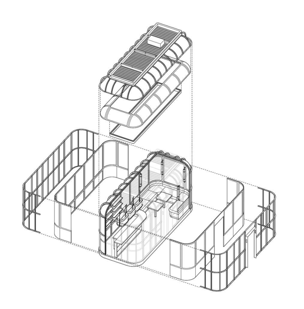
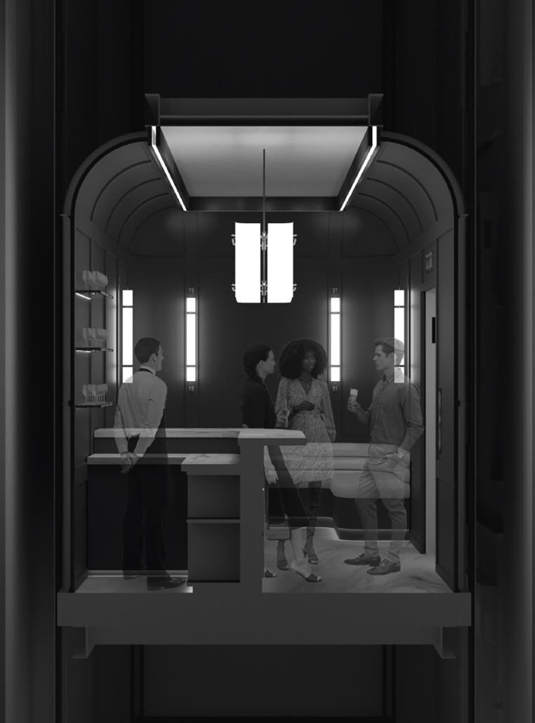
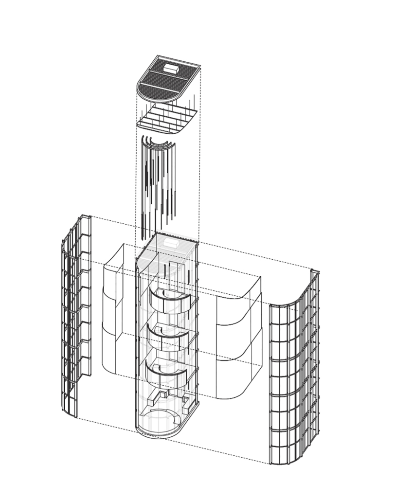
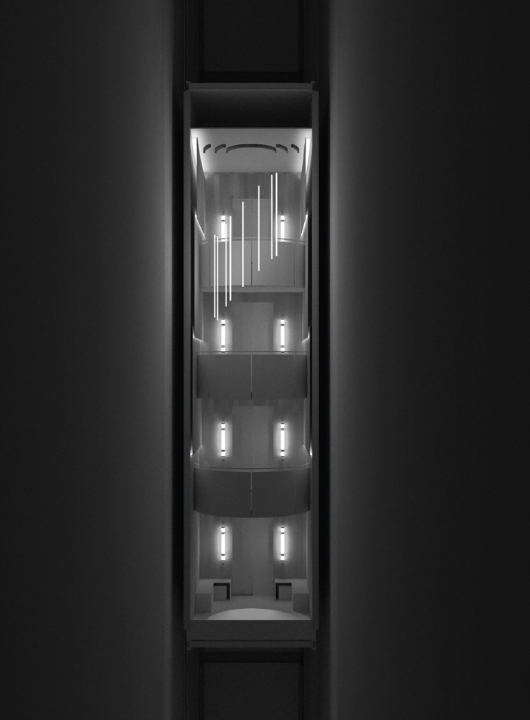
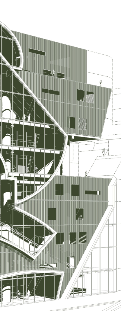
The social landscape of the residential high-rise has precipitated a disinterested and isolated vertical microcosm. The elevator, facilitator of this smooth vertical metropolitan condition, emerges as a pivotal yet neglected architectural space. Despite the expected brevity of our occupation of this instrument of density, the elevator also serves as a momentary junction where the anonymous lives of residents converge. This thesis delves into the elevator’s history and spatial conditions – including its velocity, scale, and temporality – to unveil a space rich in social potential. It aims to redefine the elevator as an instrument of architectural invention capable of reshaping the communal dynamics within residential high-rises.

Instagram: @jose_power21

Leveraging Density –  A proposal for increased density permissions in exchange for affordable housing in Toronto’s Missing Middle by Joshua Giovinazzo, M. Arch ‘24
University of Toronto | Advisor: Carol Moukheiber

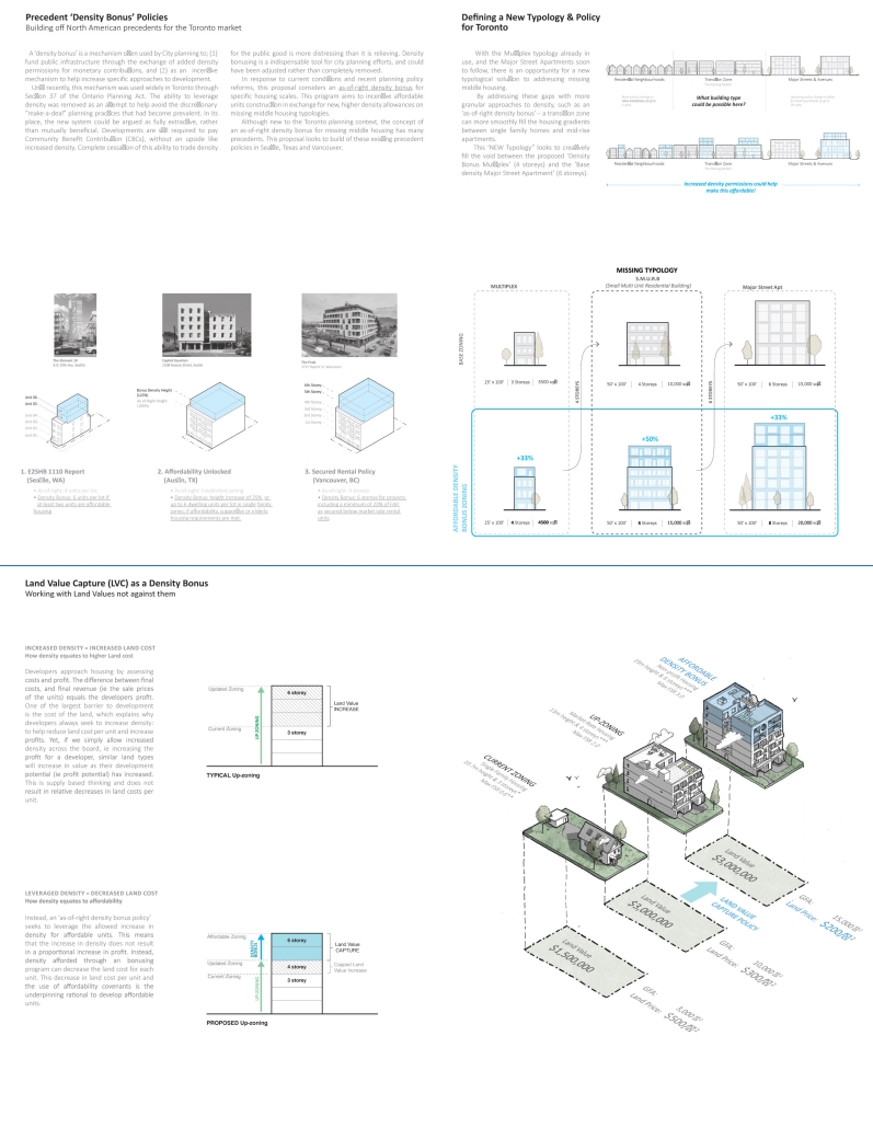
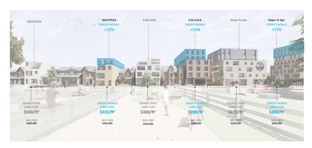
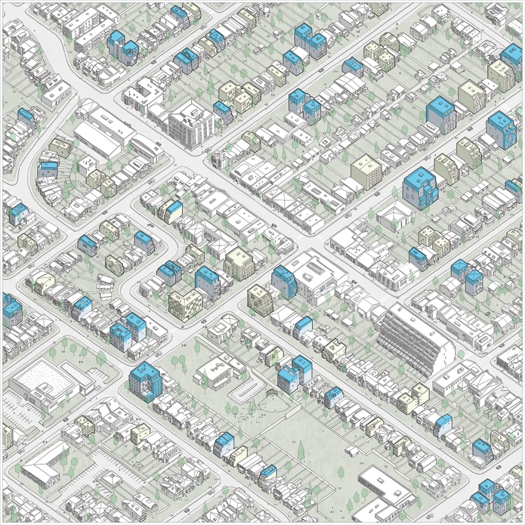
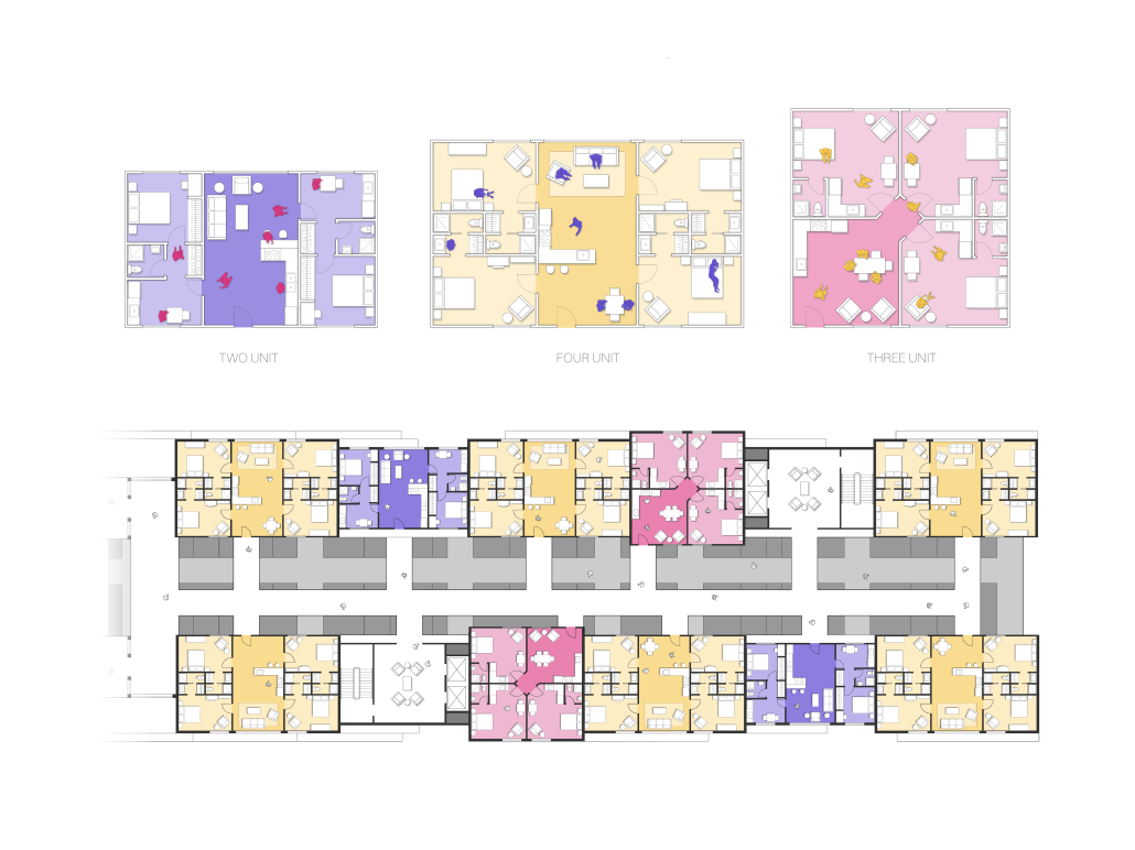
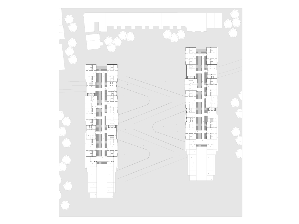
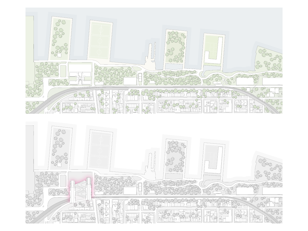
This thesis focuses on the intersection between the study of small-scale multi-unit housing typologies and a proposed new planning policy to directly create affordable housing in Toronto’s emerging missing middle. 

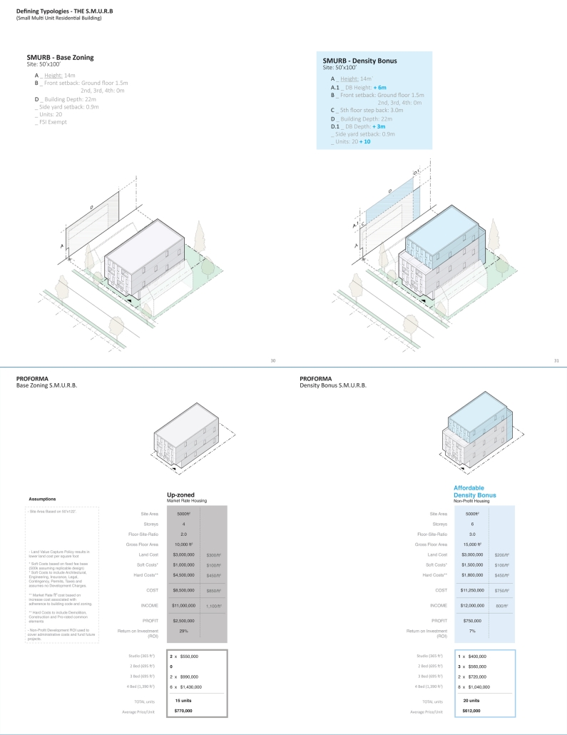
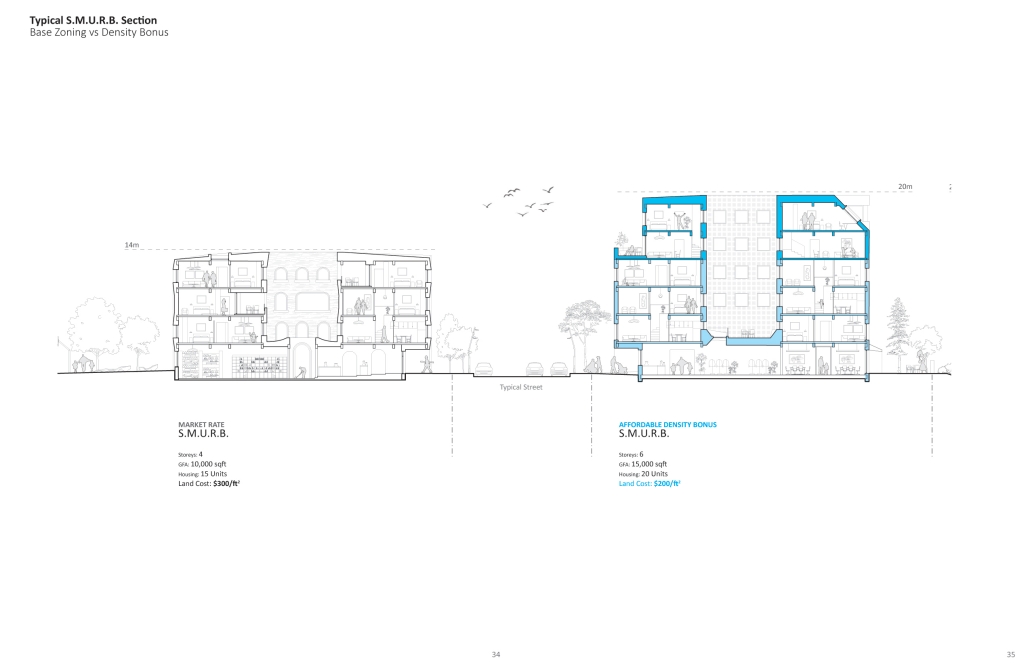
Working off existing conceptions of the transition zone, the S.M.U.R.B (Small Multi-Unit Residential Building) is proposed to help fill the density gradient between the existing multiplex and the upcoming Major Street Apartment. This formal solution is then complemented by the proposition of an as-of-right density bonus to systematically increase the supply of affordable units in our neighborhoods as they experience such a significant morphological change.

This policy-based solution is a response to Canada’s current myopic attempt to solve affordability through increased supply. Their approach, which embraces blanket upzoning – fails to define clear affordability targets, resulting in more of the same market-rate development. Learning from precedent policies in Seattle, Texas and Vancouver, the density bonus applied to small-scale housing looks to leverage these increases in density permissions by requiring a portion of the development as affordable housing.

‘Leveraging Density’ is rooted heavily in planning policy and construction finance, because housing is fundamentally the result of city planning and financial decision-making. This work does not focus strictly on an architectural resolution but rather looks to define a realistic framework for multi-unit housing affordability. This project is about the powerful systems that determine the built environment – defining what gets built and who benefits from it

This project won the Daniels Graduating Award. 

Instagram: @joshua.giovinazzo.realtor, @UofTDaniels

The Half-House by Elodie Price, BS in Architecture ’24
University of Virginia | Advisor: Mona El Khafif

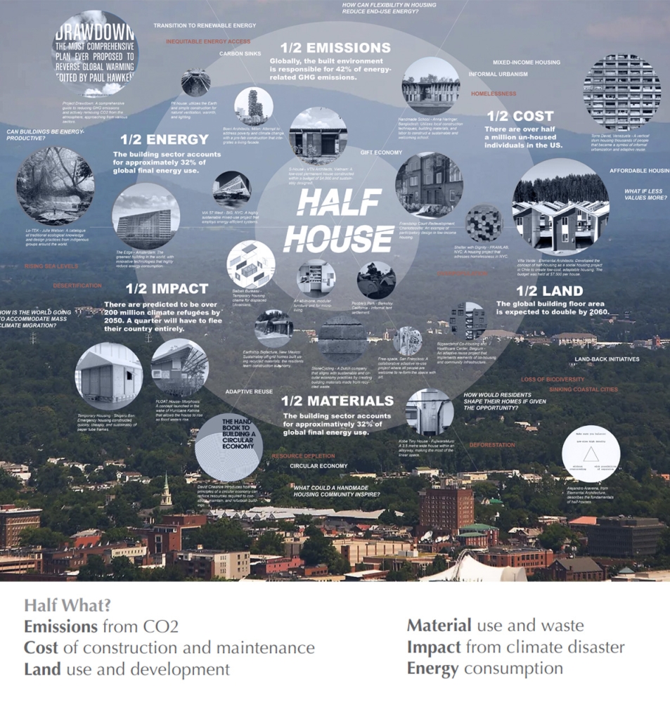
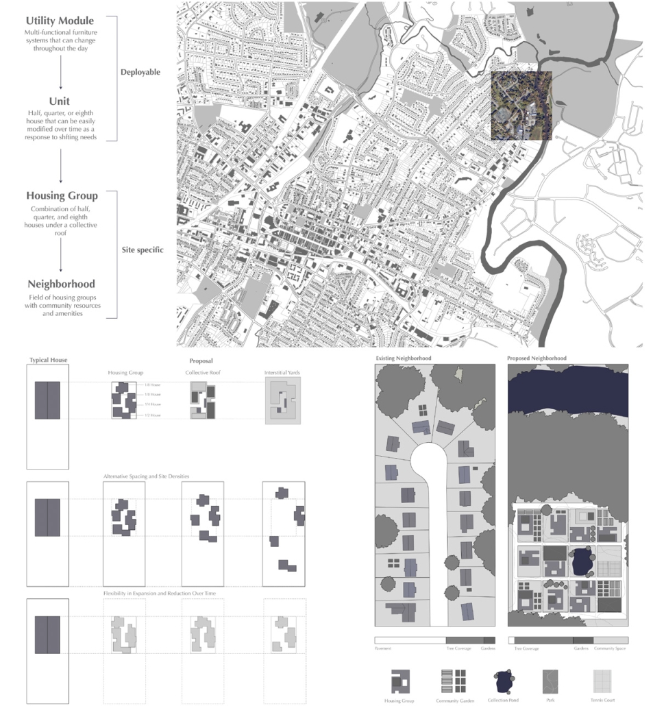
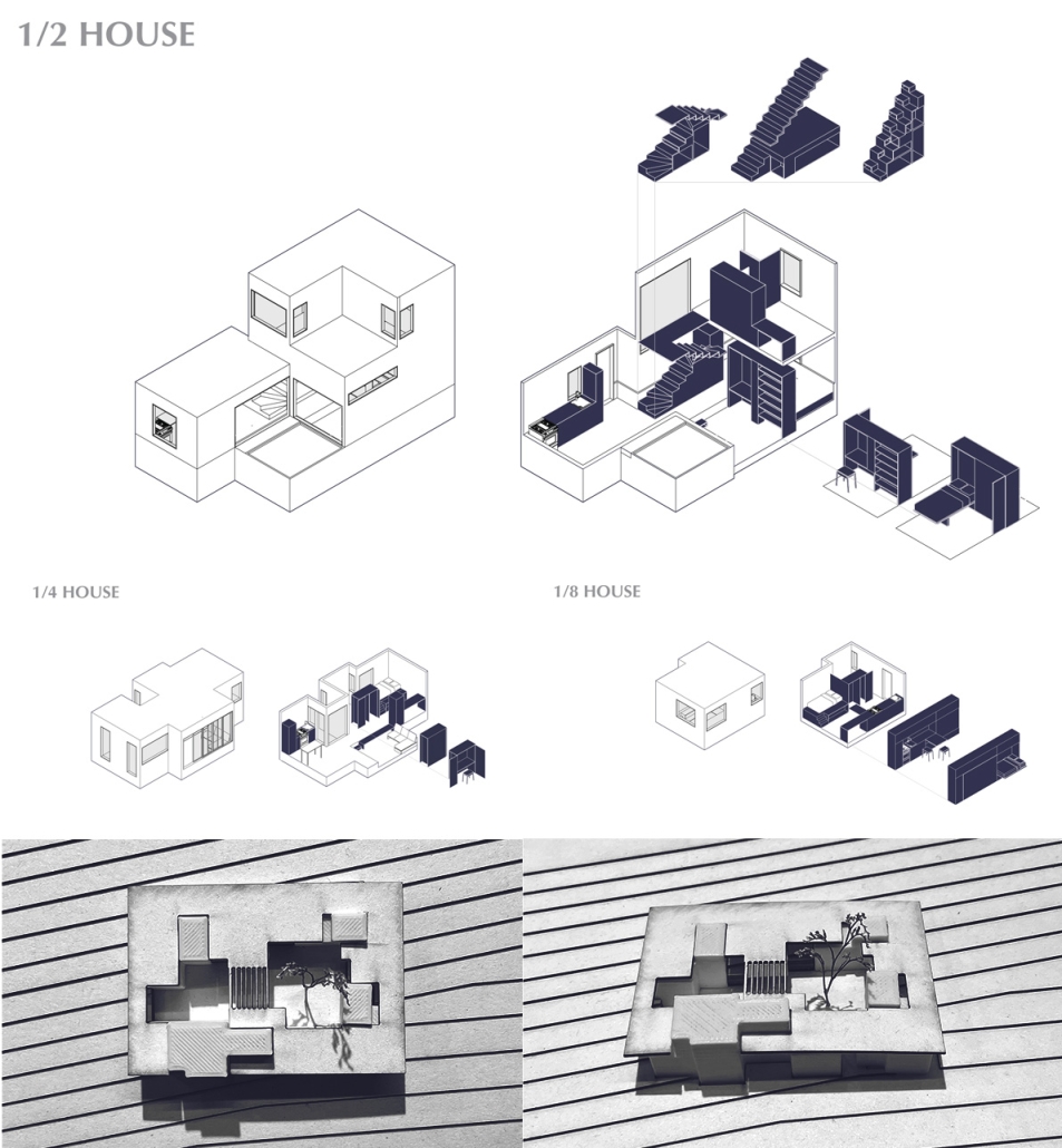
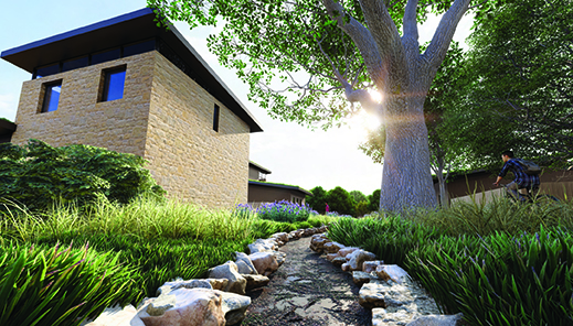
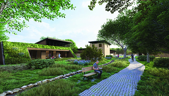
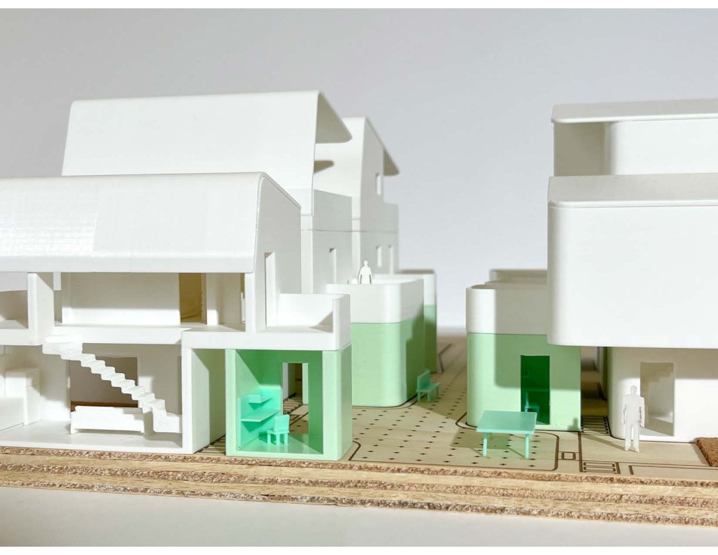
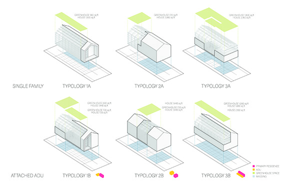
The Half House is a generative housing community that expands and contracts depending on changing needs and demographics within a community. The Half House intends to respond to the increasing socio-economic and environmental pressures the world is facing at a global and local scale while promoting the agency of the individual residents in conjunction with community enrichment. In contrast to the typical US house, the Half House minimizes itself in size, material usage, embodied energy, associated carbon emissions, and waste, while maintaining the same amenities and utilities as its counterpart. 

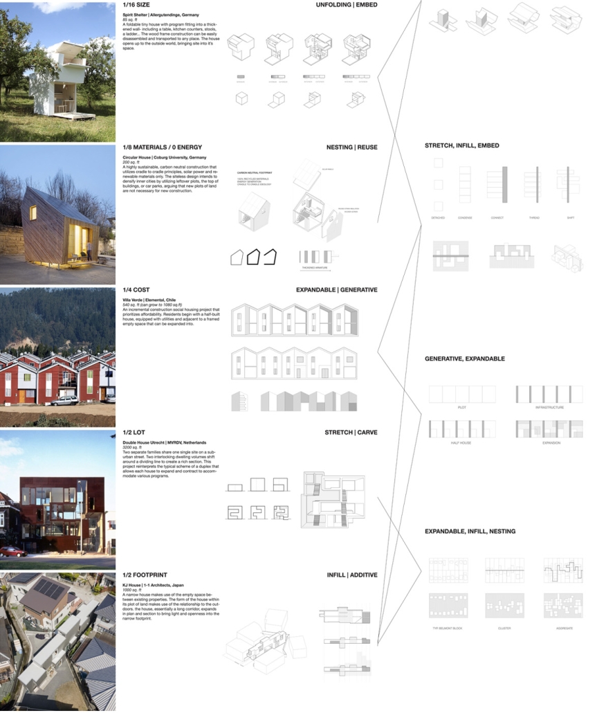
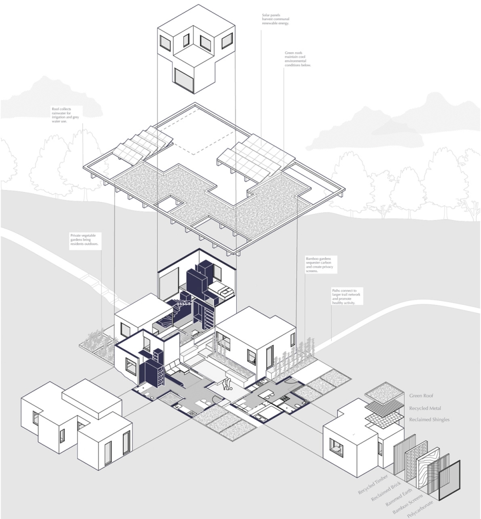
This project takes a stance on neighborhood planning, including shared spaces and the potential for growth and densification over time. Organized into housing groups, a combination of units co-exist below a collective roof, sharing exterior spaces, amenities and resources to contribute to a more environmentally and economically responsible lifestyle. In each housing group, there are solar panels collecting renewable energy, rainwater stored for gray water usage and irrigation, bamboo gardens that sequester carbon and naturally create privacy screens, and vegetable gardens to feed the community and provide healthy outdoor activities. Each unit follows a standardized set of dimensions in such a way that necessary additions (and redactions) can be easily made. The design of the individual unit is firmly based on precedent research and an investigation of the spatial strategies employed throughout a vast array of projects, including nesting rooms within each other, carving into a thickened wall, and flexible furniture. This project negotiates at the scale of the furniture module up to neighborhood planning, and furthermore, as a siteless, deployable object utilized for emergency housing, urban infill sites, or even accessory dwelling units (ADU’s) to densify suburbia. 

The Half House embodies the idea that there is value in less. In a spotlighted prototype of a housing group arrangement that is a focus of this project, fractional units make up the square footage of an average American house, yet can accommodate as much as 4x the amount of people. This is achieved through space-saving strategies, flexibility and modulation, and an intentional design of the space between the units as equally important as the space inside each unit. The housing group has the ability to change over time, reflecting the shifting needs and demographics of the residents. Thus, it is a housing intervention that responds to the social, economic, and environmental needs of its occupants as well as the ecological site.

Instagram: @aschool_uva, @elodiemprice

Miami Made: Housing in the Tropics by Felipe Palacio Trujillo & Nicole Niava, M. Arch ’24
Yale University | Advisors: Adib Cure, Carrie Penabad & Deborah Garcia

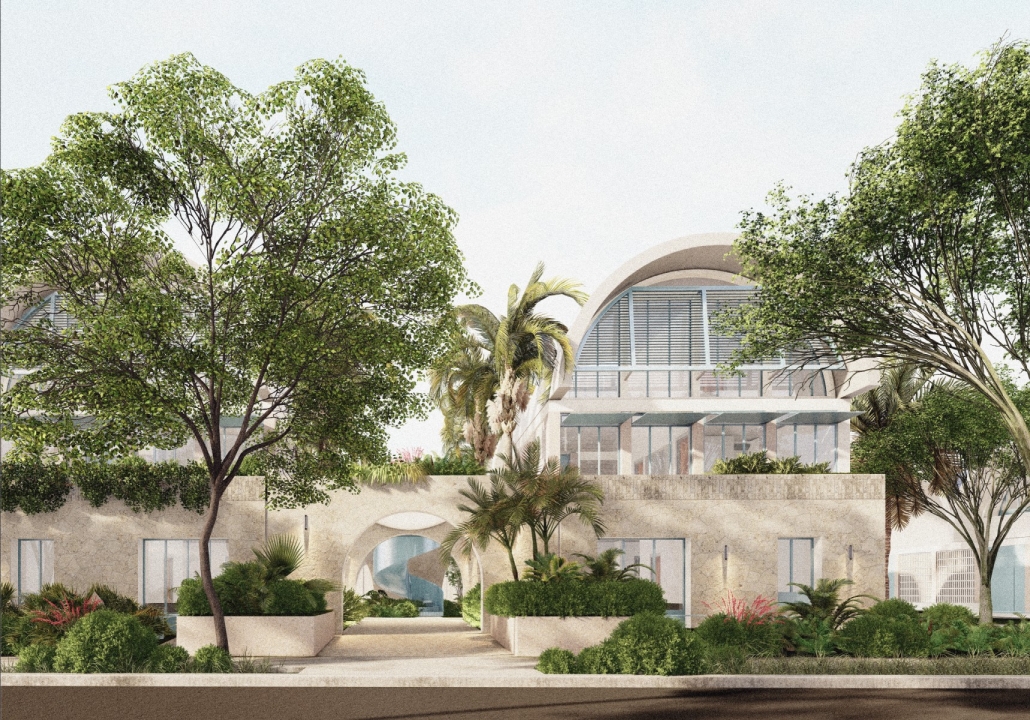
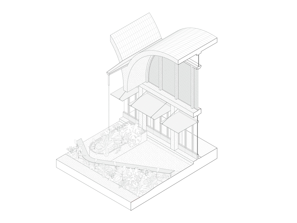
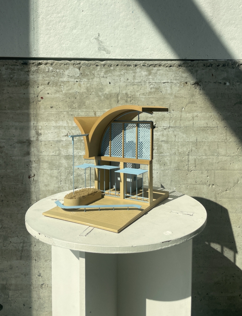
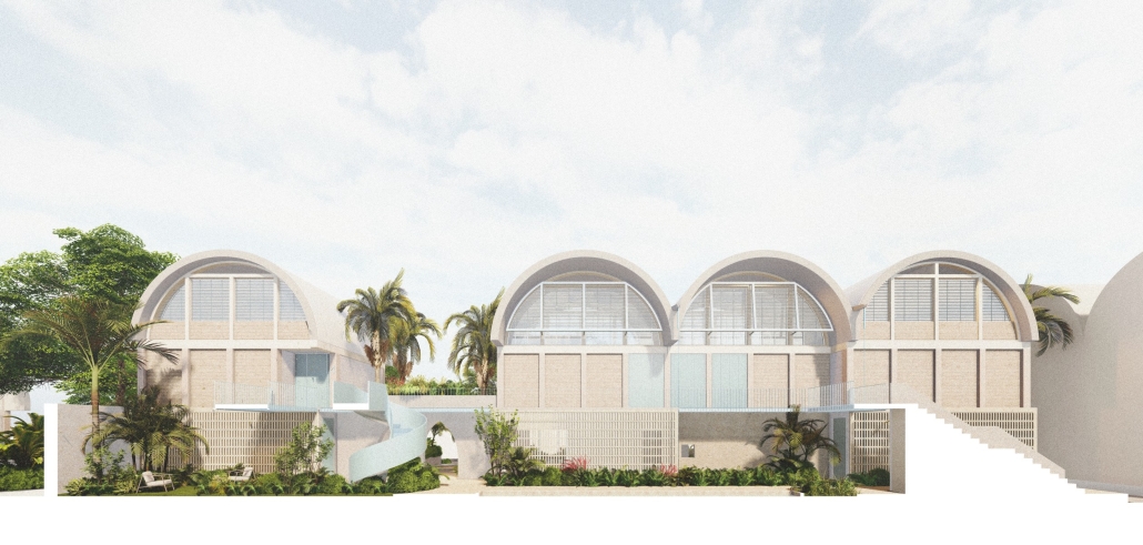
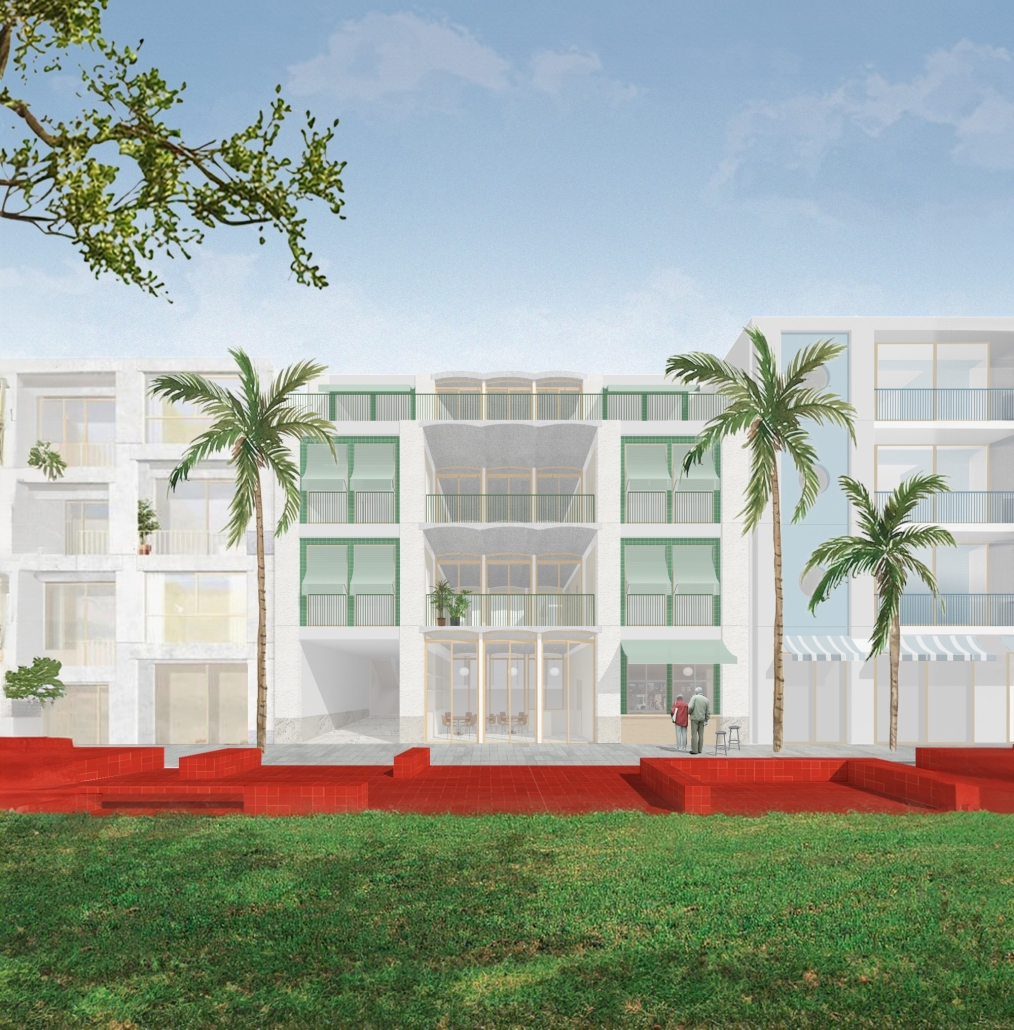
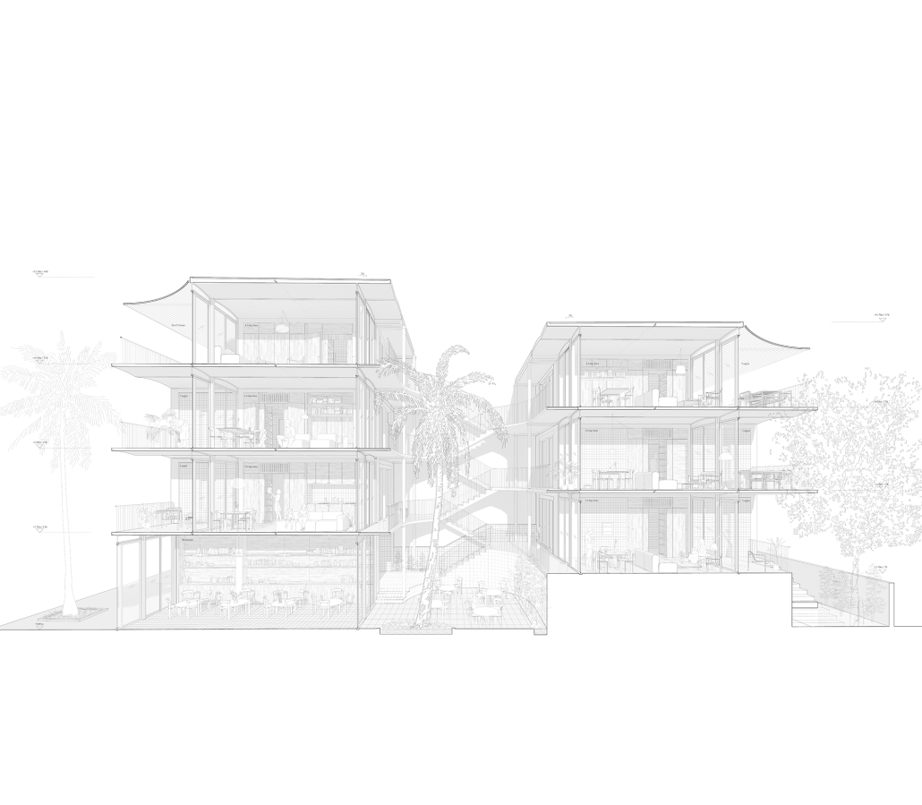
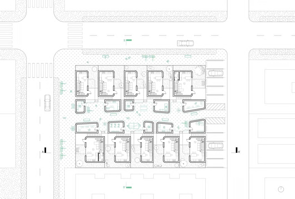
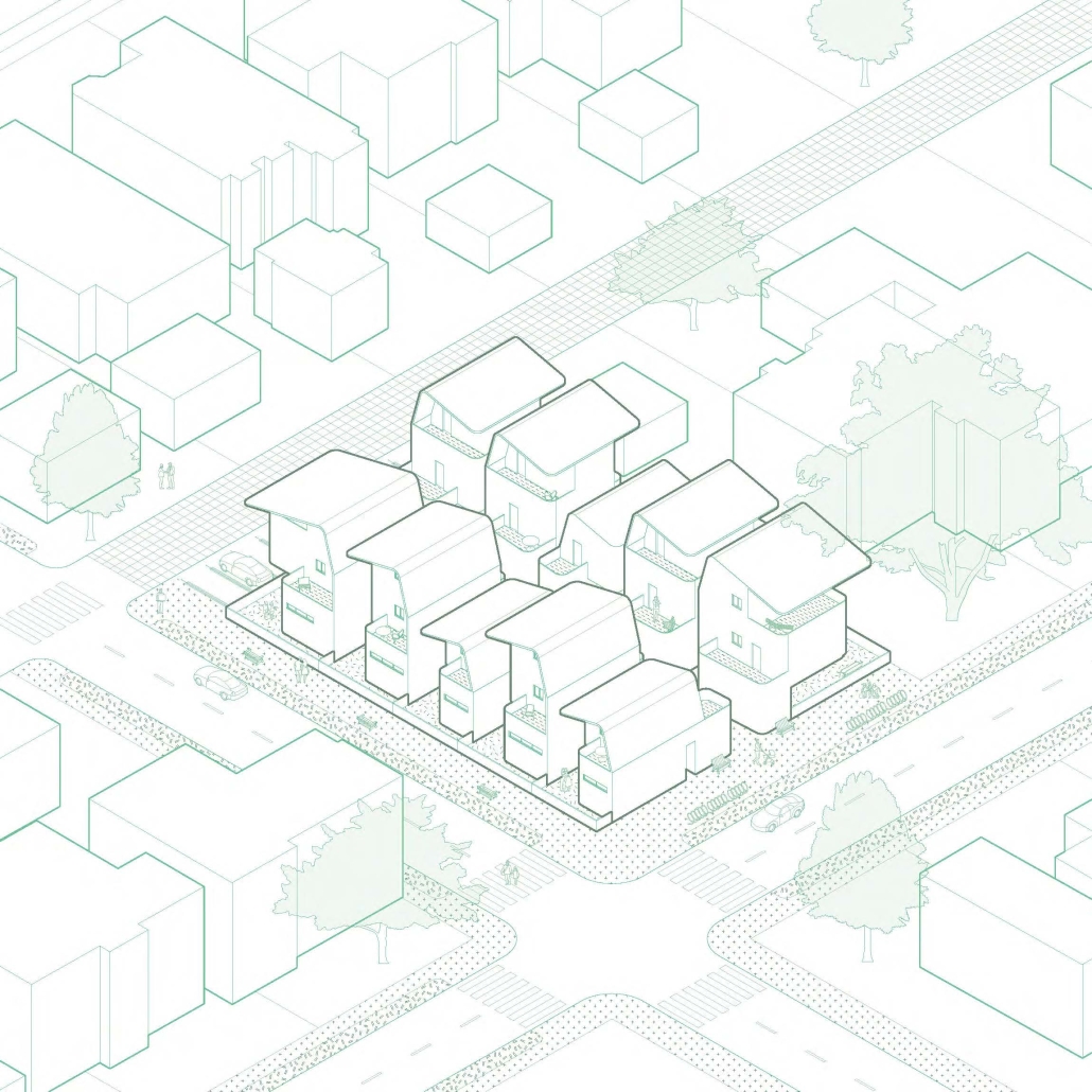
Housing in Miami primarily features two typologies: the single-family detached home and the multi-story apartment block. The large gaps in the housing market prompted our studio to explore alternative solutions by imagining new housing typologies. Our project finds a middle ground, envisioning a mid-density housing typology inspired by the back bay townhouse and influenced by the “casa patio”—a traditional housing style of Latin America. 

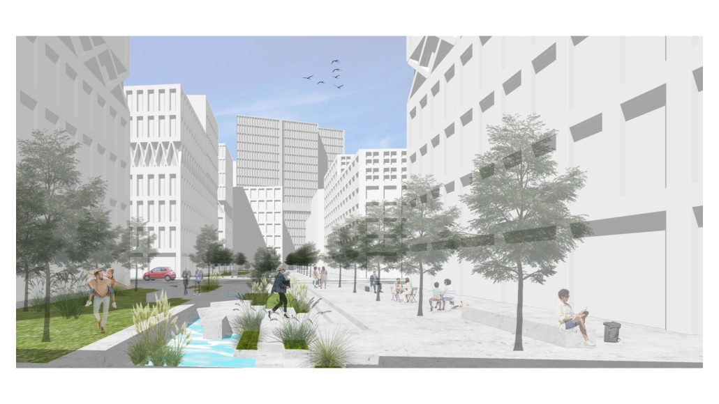
The studio selected a 30-acre site located between Little Havana and Flagami. This site presented a tabula rasa condition which allowed us to rethink urbanism for these new typologies. Our design extends the Miami grid to integrate the site into the city while halving the typical Miami lot width from 50′ to 25′. This increased density facilitated the inclusion of a public park in the center of the lot, achieving greater density than typical Miami blocks. We envisioned urbanism as incremental, with each block functioning as a micro-neighborhood that could be built by small developers, thereby supporting incremental urbanism in the city. The arrangement of the block also decreases overall parking space while ensuring at least one parking spot per unit.

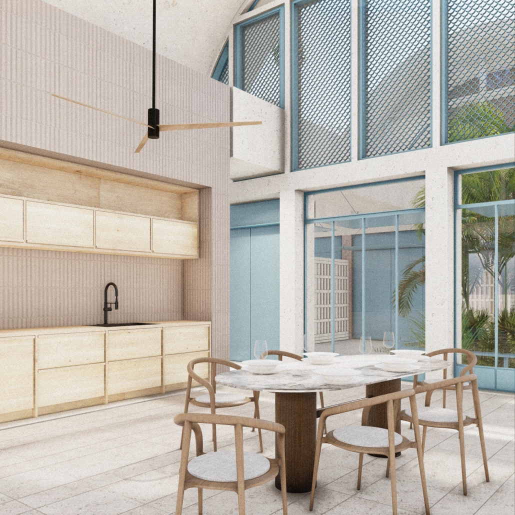
Within the block, we proposed two distinct housing typologies to foster diversity in sizes, ages, and incomes: a townhouse and an apartment building. The townhouse layout includes two areas: one for living, kitchen, and dining, and another for bedrooms and support spaces, connected by a courtyard. This design allows for cross-ventilation and access to nature. While designed for mechanical ventilation, the architecture encourages the use of passive systems for most of the year. The units are constructed using local materials and techniques, such as concrete block, precast vaults, tile, metalwork, and keystone. Emphasis on material and vegetation ensured a connection to the weather, nature, and culture of Miami.

The apartment block adapts features from the townhouse, tailored for communal living. The 25′ lot width remains consistent, with the townhouse elevated into a podium. This configuration creates six apartments on the first floor and six double-height apartments above, ranging from studios to three-bedroom units. The courtyard, featuring a water element and lush vegetation, provides a communal gathering space that ensures cross-ventilation while maintaining privacy for residents.

This project was published in Retrospecta 47. 

Instagram: @fptrujillo, @nicoleniava, @cureandpenabad

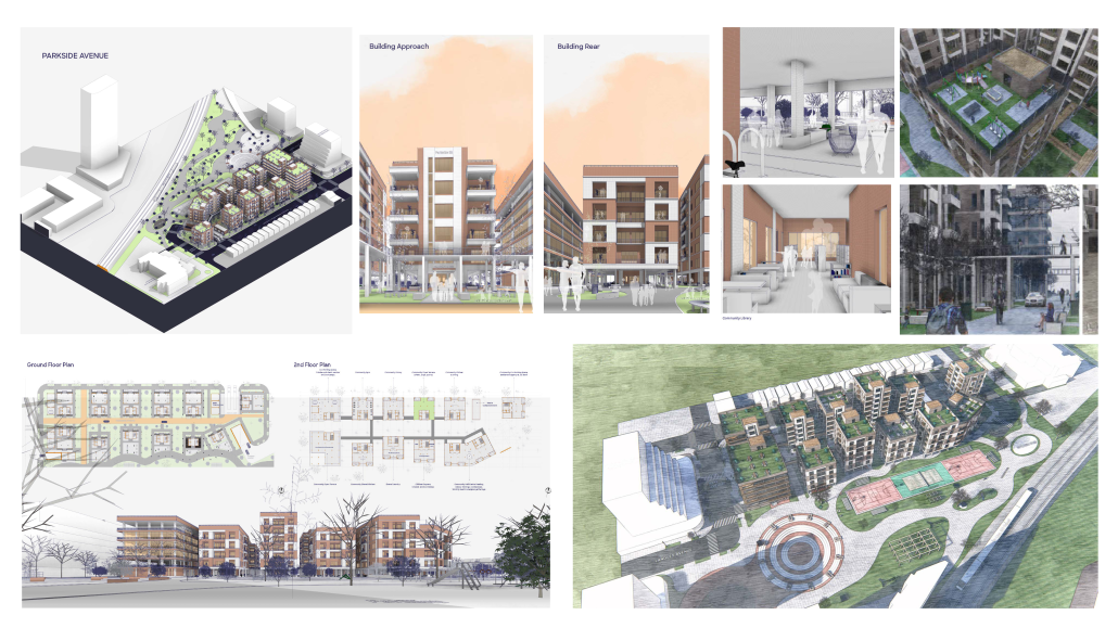
Parkside Avenue: Transforming Toronto’s Mid-Central Residential Neighbourhood by Oluwatobiloba Babalola Oluwaseun, M. Arch ’24
University of Waterloo | Advisors: Val Rynnimeri & Samantha Eby

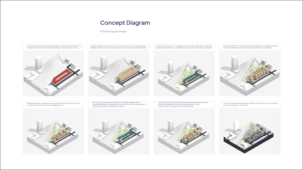
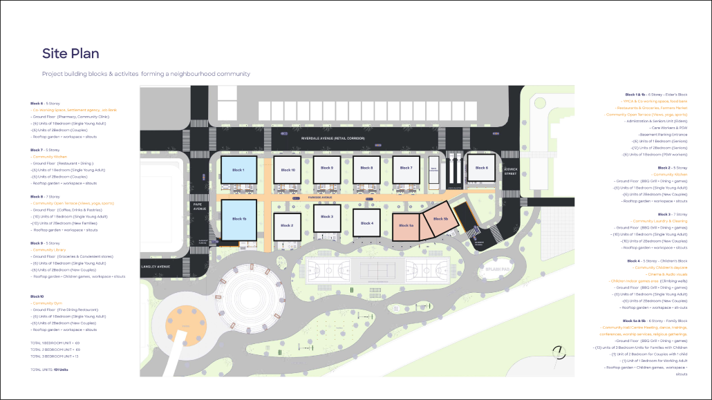
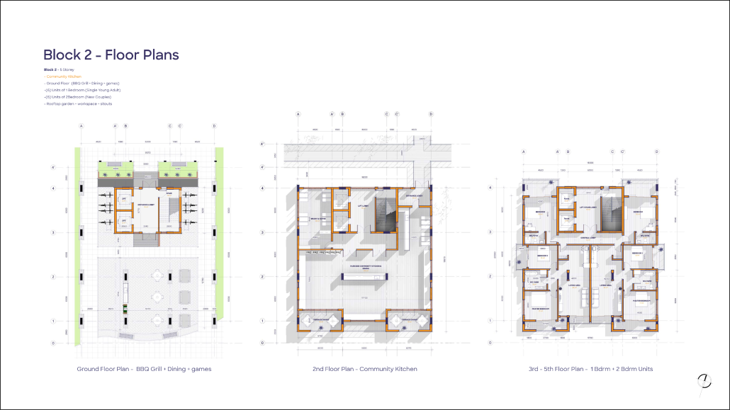
The Parkside Avenue project addresses critical housing issues in Toronto’s mid-central residential neighborhoods, particularly within the “Yellow Belt,” known for its older single-family homes. This initiative aims to create a balanced urban solution that integrates market-based residential buildings with non-profit cooperative housing and other alternative models. The primary objective is to enhance housing affordability and mitigate the shortage of affordable housing options in the area.

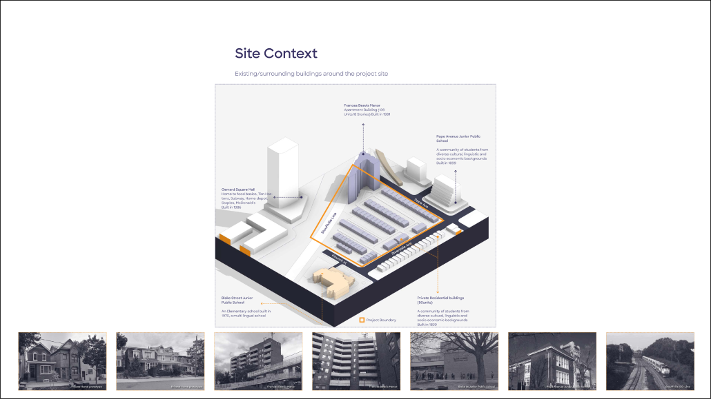
Located between Pape Avenue and Gerrard Street, the project site encompasses approximately 50 private single-family homes. Its strategic location, near the high-traffic Gerrard Station and adjacent to Blake Street Junior School and Pape Avenue Junior School, makes it a prime area for redevelopment. The Parkside Avenue project plans to replace the existing 50 single-family units with 109 new residential units.

This development represents a significant shift in urban planning for the neighborhood, aiming to accommodate a diverse range of residents and provide more inclusive housing solutions. By integrating various housing types and focusing on affordability, the project seeks to foster a more vibrant, sustainable, and accessible community. The Parkside Avenue project stands as a model for addressing urban housing challenges while preserving the character and livability of Toronto’s established neighborhoods.

This project won the Design Studio Award, the Highest standing in ARCH 690 in the MB semester.

Instagram: @oluwatobilobababalola_

The Room is the Building is the City: Open-Ended Approach to Miami’s Housing Crisis by Sharona Cramer & Yotam Oron, M. Arch ’24
Yale University | Advisors: Adib Cúre, Carie Penabad & Deborah Garcia

Introduction (The Site, the Brief, and Our Approach):

Miami, currently the most unaffordable major city in America, faces a housing crisis with limited and unsuitable options for its growing needs. The city is dominated by detached single-family homes and high-rise condos, contributing to suburban sprawl and high land costs. Mid-rise housing models, offering innovative urban living solutions, have been largely overlooked.

The studio’s task was twofold: to propose a master plan for a 38-acre vacant parcel on the outskirts of Little Havana, addressing Miami’s urban morphology, and to design a new mid-rise urban housing typology for Miami, featuring mixed-use buildings with commercial/office spaces at ground level and various apartment types above.

To tackle these issues, which characterize Miami but are not limited to, the project operates at a wide range of scales, from the single room to the urban fabric, promoting an approach of open-ended locality. This combines consideration of climate, materiality, culture, and economy with flexible, rational, and modular architectural solutions.

The City:

Due to its limitations and restrictions, Miami’s current zoning, led by its parking regulation, makes building complicated and expensive. The market lacks competition, which makes housing unaffordable and attracts mainly big developers, prioritizing profit-making over building and architectural quality. The typical development project is done by conglomerating lots to develop ‘luxurious’ huge-scale anti-urban and anti-social residential compounds.

By suggesting a much more flexible and open alternative zoning system and limiting the conglomeration of lots, the project seeks to invite multiple players to participate in the city’s future development, creating quality, affordable, and diverse urban spaces and housing stock.

Additionally, the project proposes a series of site-specific design decisions: To connect the site to Miami’s urban fabric, we decided to continue the grid through the site and divide it into urban blocks similar in size to the adjacent blocks, then divide each block into lots in the typical Miami lot size: 50* 100 feet. Learning from successful urban spaces in the city, we propose a series of pedestrian streets and a linear park connecting all blocks from south to north. 

The Building:

In the project, we developed a mid-rise courtyard infill type. While the flexible zoning system allows multiple typologies, we chose to develop an infill building since Miami currently lacks this type. Furthermore, we believe that infill typologies offer potential in terms of high density, and the sort of streets they generate.

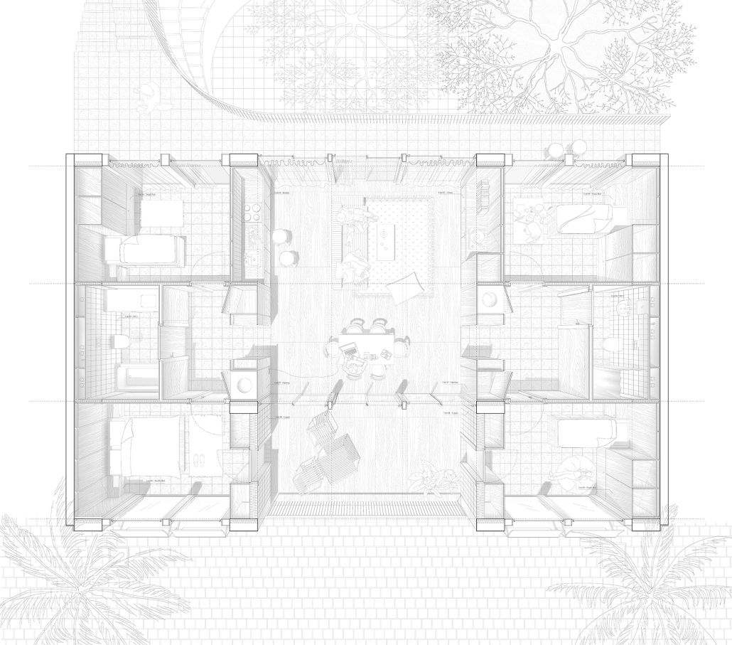
Inspired by similar typologies like the Berlin courtyard houses, the Mexican Vecindad, and the Creole townhouses, we created a local interpretation that reacts to the regional tropical climate and contemporary Miami standards. On one single lot, two relatively thin volumes are positioned, leaving a space for a central courtyard. The interior rooms, which have two orientations, are cross-ventilated and naturally cooled.

The building is designed using repetitive modules, thus increasing affordability and efficiency, making it easy to construct. Through sensitivity to details, use of materials, and small, subtle architectural gestures, these are realized without sacrificing architectural and spatial quality.

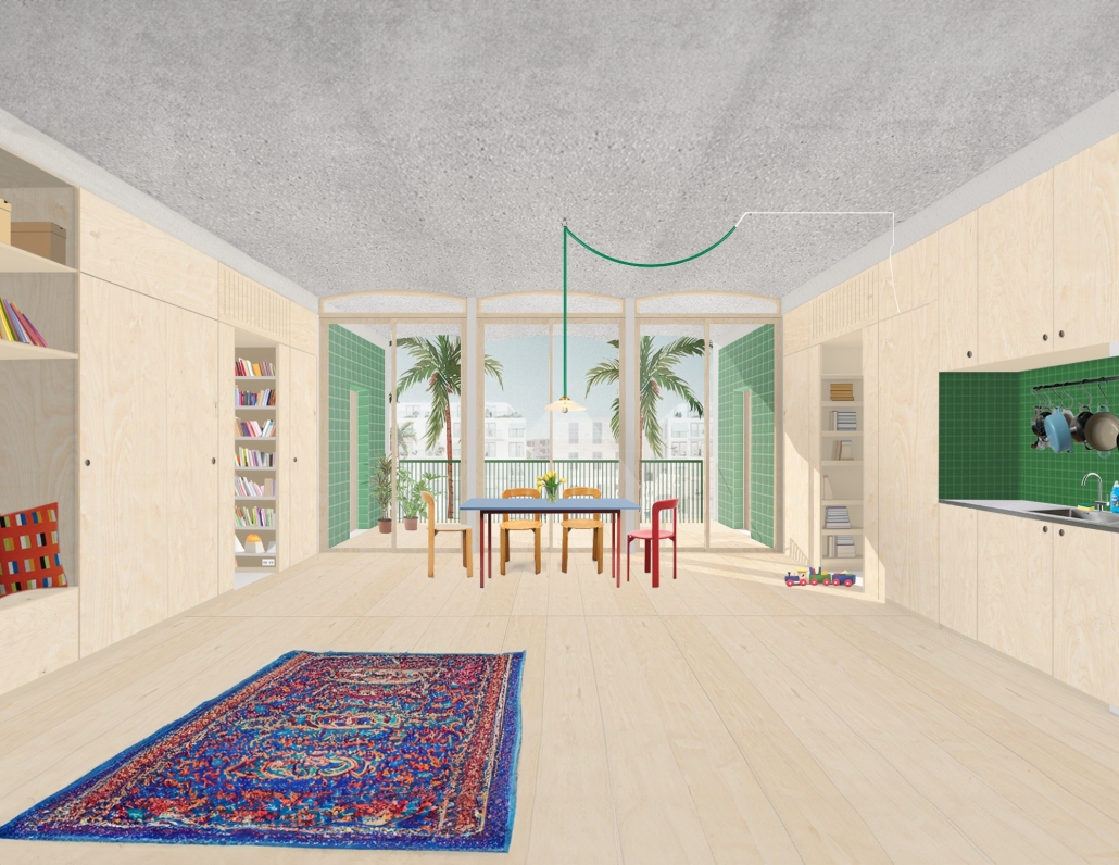
The building is divided into two distinct sections: “service” wings; housing private rooms, and an open flexible central “served” space. These sections are treated differently in terms of materials and construction techniques. The service wings hold all systems, structures, and storage, allowing the central area to remain free of these elements. This central space features light concrete precast vaulted slabs, which give the building its unique architectural character. The thicker floor sections in the service wings provide flexibility for plumbing fixtures, enabling them to drain through the floors to the vertical pipes that are located along the party walls – maximizing flexibility and allowing multiple apartment layouts.

The Room:

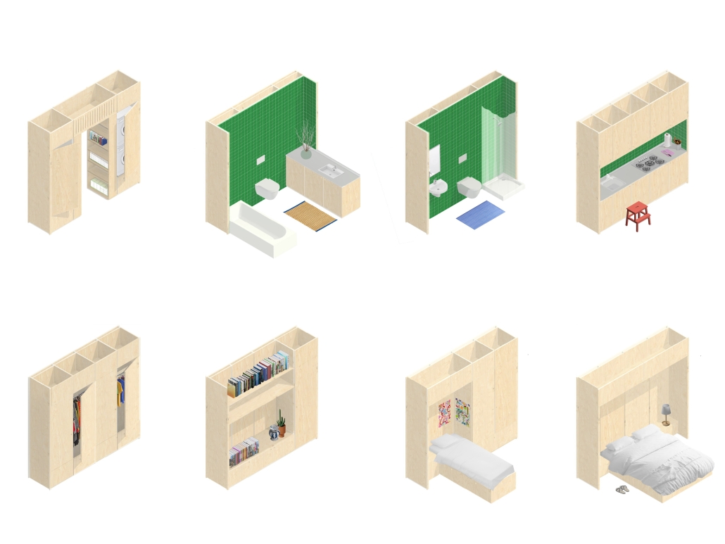
Instead of conventional drywall partitions, the project incorporates a modular furniture system that maximizes usable open space and provides flexibility. These modules can serve as walls, partitions, storage spaces, or even house plumbing fixtures. The variety and placement of these modules enable different floor plan configurations, allowing the housing units to be divided into two separate units—a main apartment and a studio—or to modify the internal layout of the apartment itself. 

The central open living space is designed to respond to and take advantage of the local tropical climate. Drawing inspiration from traditional and vernacular tropical architecture, deep loggias and shaders provide protection from the harsh sun during certain hours, while also serving as outdoor rooms that integrate the outdoors into daily life. The central living space opens up to the loggias, creating a cross-ventilated indoor-outdoor environment.

This project was Nominated for the Feldman Prize at Yale School of Architecture.

Morphological Growth of Raleigh by Raja Manikam Bandari, M. Arch, PhD in Design Candidate ’24
North Carolina State University | Advisors: Sara Queen & Tania Allen

Across the US, we are witnessing a housing crisis catalyzed by a pandemic-related housing shortage and exaggerated by income inequality resulting in a disproportionate burden on the poor and non-homeowners. This visual essay examines historic and contemporary data to interrogate many of the complex factors that have contributed to the current state of housing in Raleigh, the Triangle, North Carolina, and the US. The primary aim of this research is to create more equitable, effective and innovative design and planning approaches to the future of housing and urban development writ large.

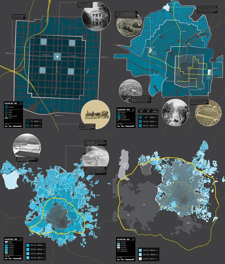
Spatial Morphology (1)

This map series charts Raleigh’s historical expansion, tracing how the city’s footprint has expanded over time. Historical context illuminates pivotal moments of growth and development, showcasing the transformation of rural landscapes into urban areas and residential neighborhoods.

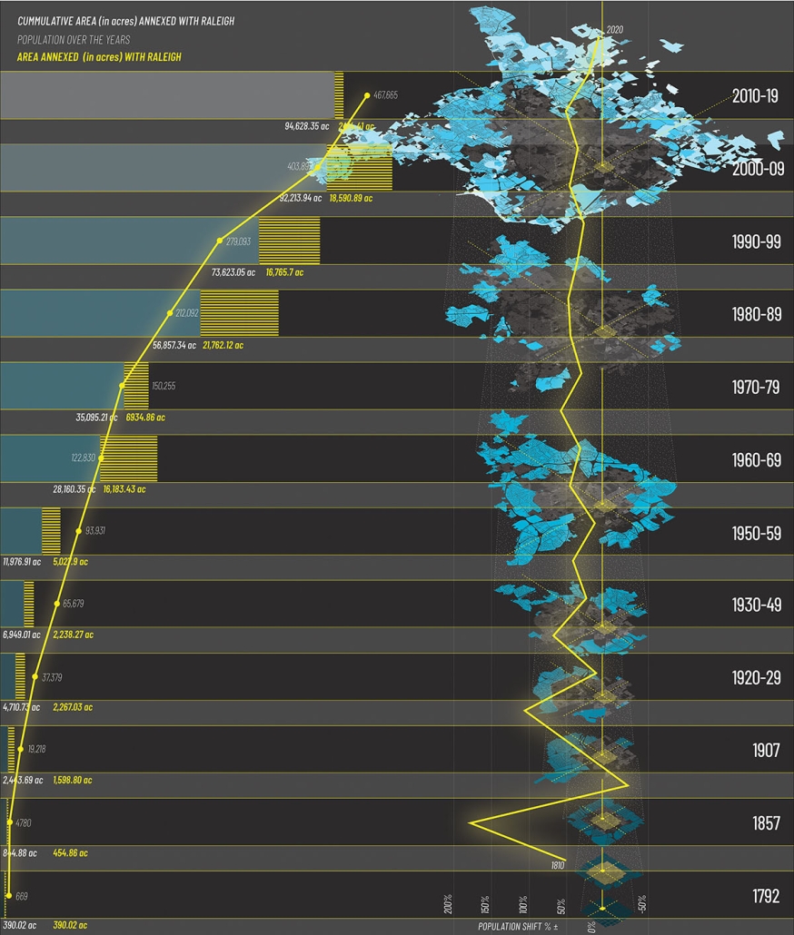
Temporal Morphology of Raleigh (2) 

This map illustrates the city’s expansion over time, showcasing the interplay between population influx and territorial expansion. Since its master planning by William Christmas in 1792, Raleigh has undergone significant transformation driven by diverse factors such as commerce, education, trade and natural opportunities. This timeline serves as a chronological thread, connecting historical milestones with the city’s expanding boundaries and changing demographics.

Proximity Growth Analysis of Raleigh (3) 

This map reveals a detailed analysis of Raleigh’s morphological growth pattern from 1792 to 2019 through proximity radar charts centered on the State Capitol Building which tracks annexed lands in relation to the city’s geographical center. Each radar chart depicts the distance in miles between the State Capitol and annexed parcels of land during a specific time period. The central graph illustrates the cumulative annexations over time.

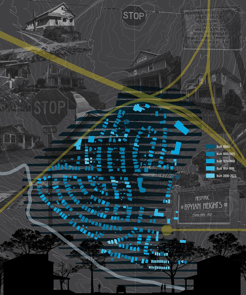
Morphological Growth of Boylan Heights (4)

This map offers an intimate exploration of the morphological characteristics and unique layout of Boylan Heights, a neighborhood distinguished by its sloping topography and curvilinear street design. Situated on elevated terrain, Boylan Heights descends gradually from its highest point at Montfort Hall towards the east, south and west directions. Unlike the traditional right-angle grid common in earlier Raleigh developments, Boylan Heights features the city’s first curvilinear street grid, designed to harmonize with the natural slope of the land.

This project was selected as a finalist for the APDU Data Story Telling Award, AIA ASPIRE Student Design Award, and NC State Research Image Award.

Instagram: @raja_manikam_brv, @tanialeighallen, @rainrainqueen

Zoning Policy & Housing by Kole Retterath, B. Arch ’24
North Carolina State University | Advisors: Sara Queen & Tania Allen

Across the US, we are witnessing a housing crisis catalyzed by a pandemic-related housing shortage and exaggerated by income inequality resulting in a disproportionate burden on the poor and non-homeowners. This visual essay examines historic and contemporary data to interrogate many of the complex factors that have contributed to the current state of housing in Raleigh, the Triangle, North Carolina, and the US. The primary aim of this research is to create more equitable, effective and innovative design and planning approaches to the future of housing and urban development writ large.

Zoning and Affordability Incentives (1)

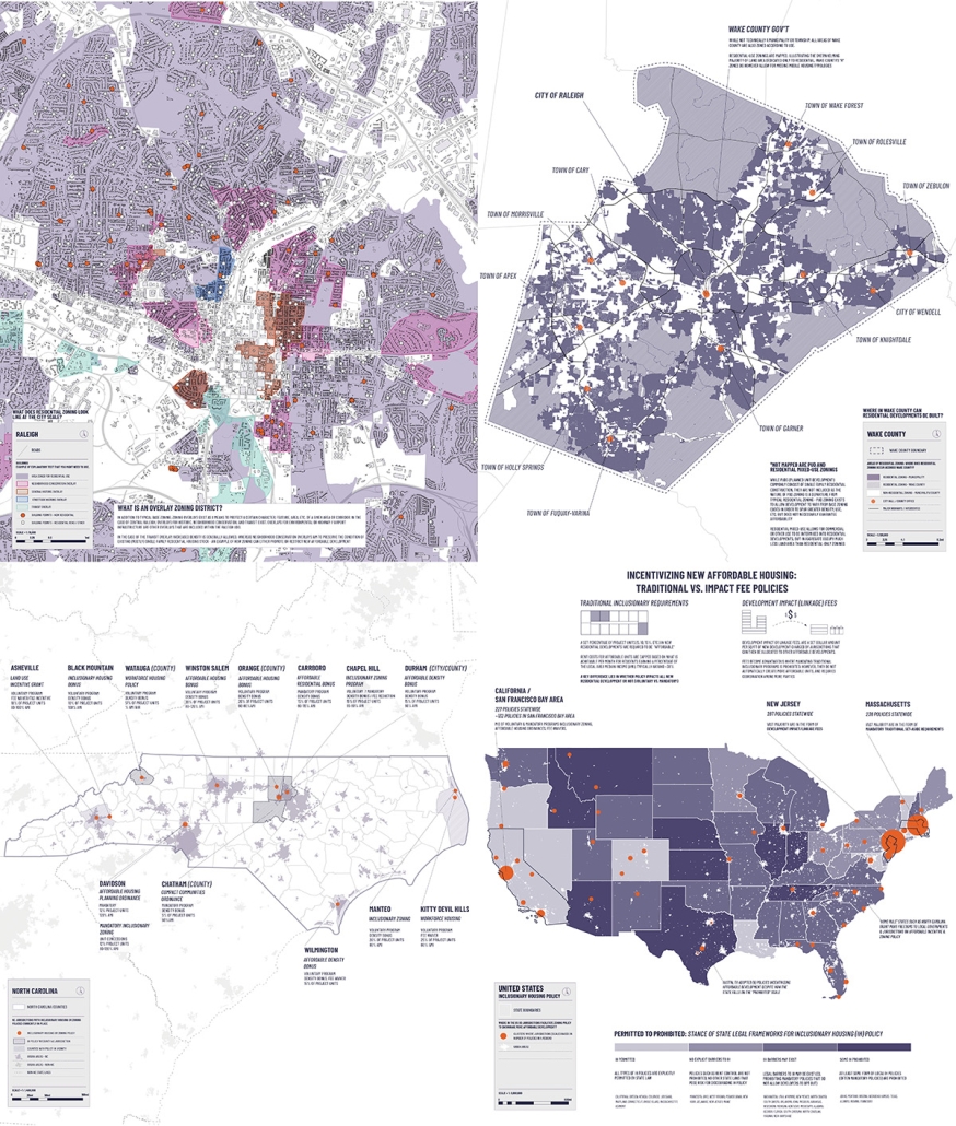
This map series explores the influential forces of zoning and affordable development policies on the current housing crisis. Zoning has major implications for cost, availability and affordability by indirectly impacting the supply and demand of housing stock. By highlighting how restrictive zoning policies historically privileged single-family typologies and reduced the opportunity for diverse affordable housing units, these maps illustrate how we have arrived at our current “Missing Middle” condition.

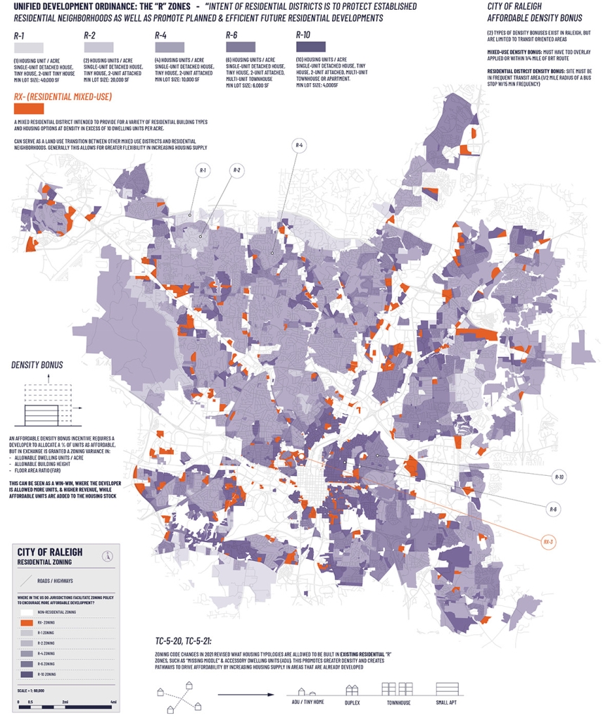
Residential Zoning in Raleigh (2)

This map isolates residential zoning categories and illustrates the dominance of residential single-family zoning (R-1 to R-10) in a purple gradient in contrast to the emerging pockets of residential mixed-use zoning (RX) in orange. The white negative space of the map indicates large institutional footprints and transportation corridors with industrial and commercial land uses.

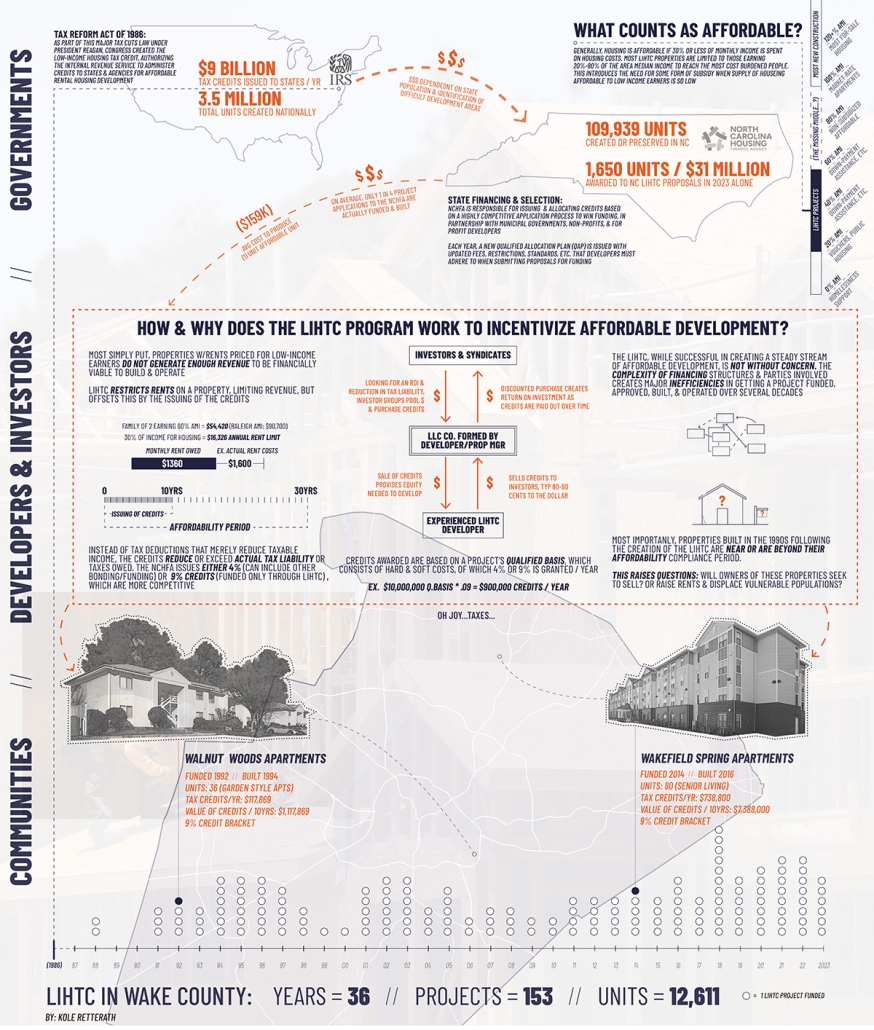
Understanding the Low-Income Housing Tax Credit (3)

This map visualizes all LIHTC projects in Raleigh and their respective values. Created in 1986, LIHTC is a method of financing rental unit development that caps rent amounts in exchange for equity-building tax credits. LIHTC remains one of the most important tools to finance affordable rental units, but drawbacks include that rent amounts are not permanently capped and very low-income renters often still require assistance to pay rent.

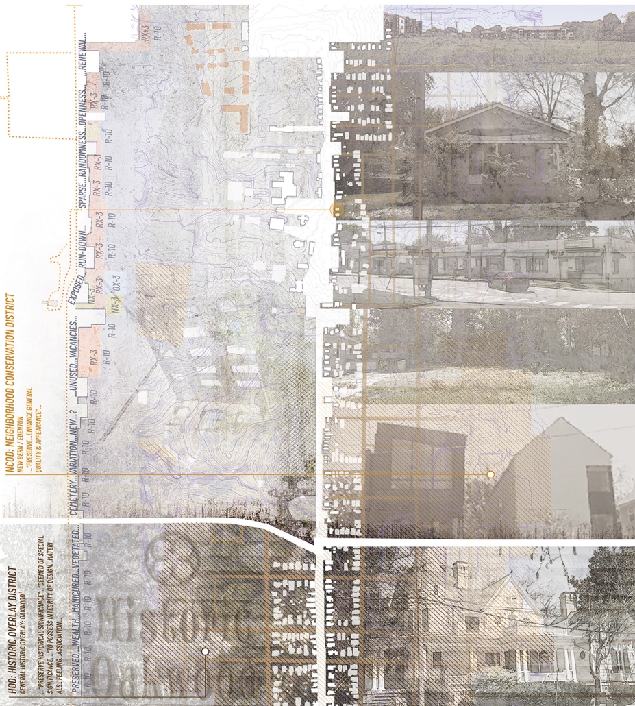
Perceptions of Zoning Policy: Oakwood Ave (4)

This perceptual collage depicts the diverse conditions along Oakwood Avenue which runs east-west from College Park and Washington Terrace neighborhoods to the Historic Oakwood neighborhood and exemplifies the impact of zoning overlay districts and preservation incentives in appearance and investment.

This project was selected as a finalist for the APDU Data Storytelling National Award, AIA ASPIRE Regional Student Design Award, and NC State Research Image Award.

Instagram: @tanialeighallen, @rainrainqueen

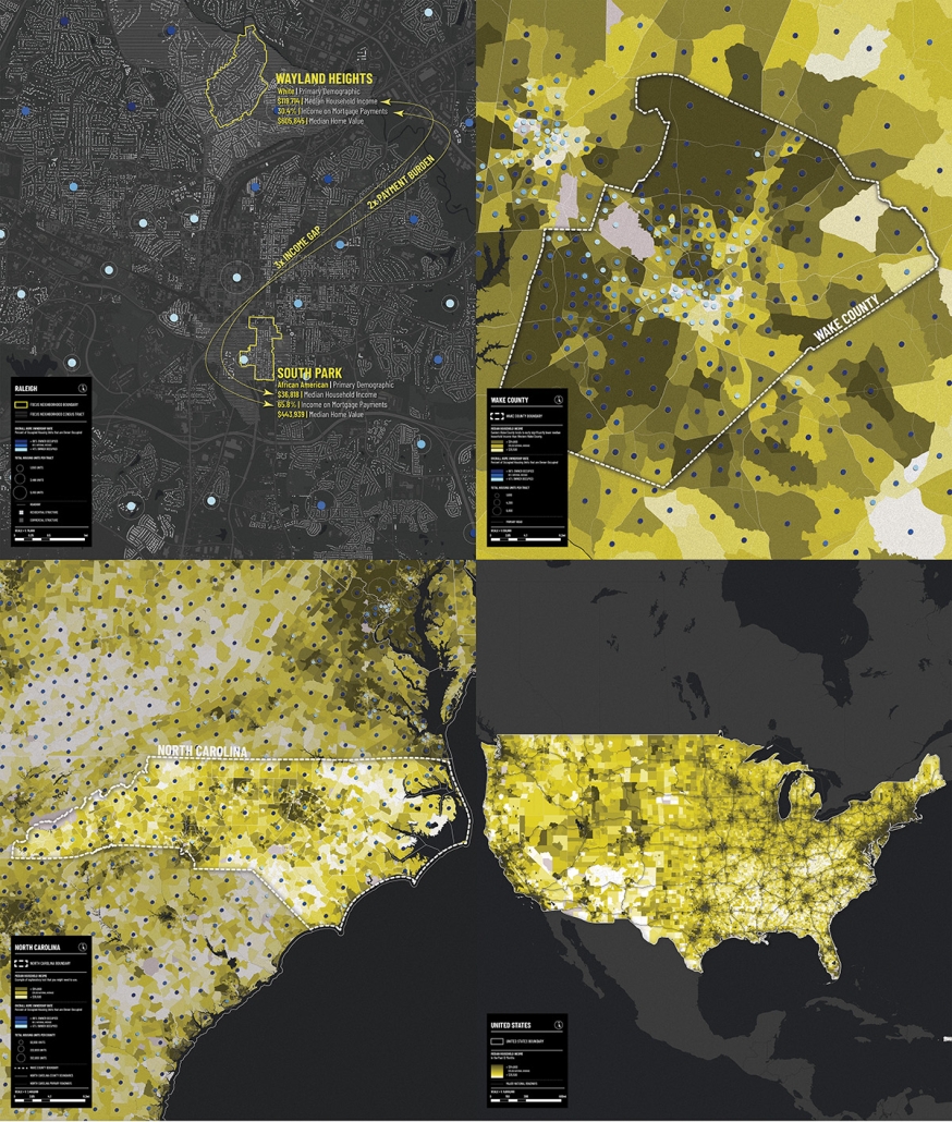
Homeownership & Economic Prosperity by Dillon Patel, B. Arch ’24
North Carolina State University | Advisors: Sara Queen & Tania Allen

Across the US, we are witnessing a housing crisis catalyzed by a pandemic-related housing shortage and exaggerated by income inequality resulting in a disproportionate burden on the poor and non-homeowners. This visual essay examines historic and contemporary data to interrogate many of the complex factors that have contributed to the current state of housing in Raleigh, the Triangle, North Carolina, and the US. The primary aim of this research is to create more equitable, effective and innovative design and planning approaches to the future of housing and urban development writ large.

Homeownership, Median Income and Urbanity (1)

This map series highlights the intricate relationship between homeownership rates and median income levels at four different scales. Nationally, urban areas are concentrated alongside major infrastructure, enhancing economic prospects. In NC, rural regions exhibit significantly higher homeownership rates, despite lower median incomes, compared to urban counterparts that attract higher incomes but fewer homeowners.

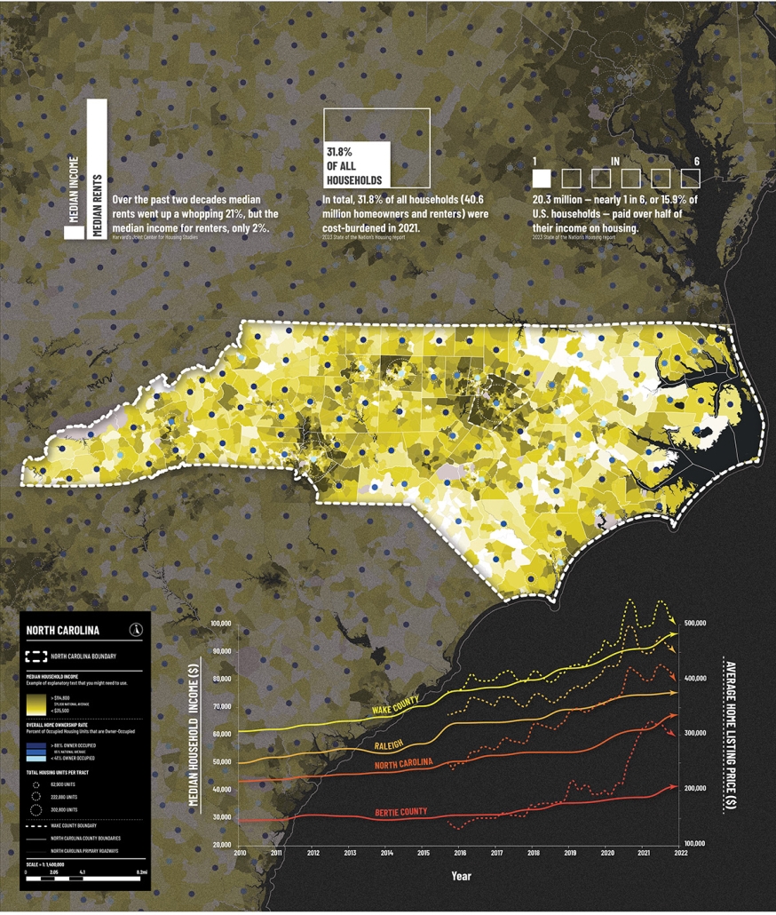
Median Income and Housing Affordability (2)

This map sheds light on contrasting economic landscapes within NC while highlighting the intricate interplay between income, housing costs, and the pursuit of homeownership. The graph traces the evolution of median incomes and average house listing prices to underscore the stark economic disparities within the state. It reveals Wake County as an apex of economic and housing market vitality as compared to Raleigh, the broader state, and Bertie County.

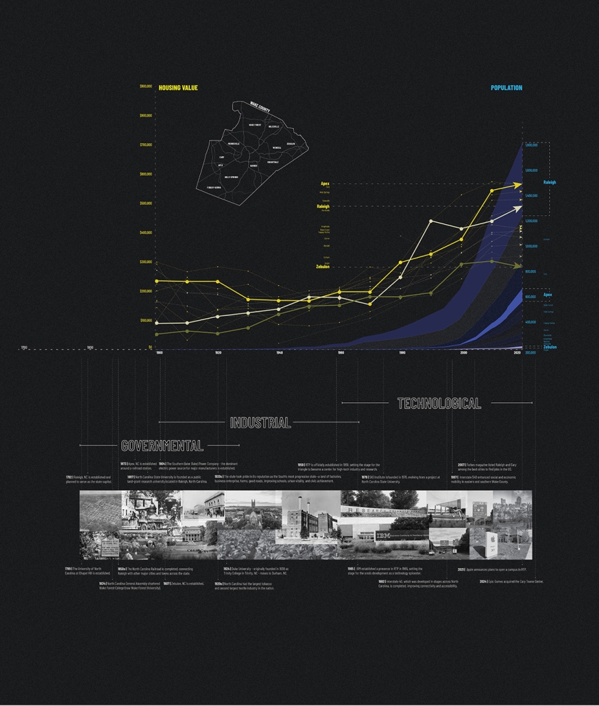
A History of Economic Disparities In Wake County NC (3)

This timeline charts how Wake County’s economic vibrancy stems from the distinct developmental patterns of its towns and the surrounding counties. Western Wake towns and cities have remained ahead of eastern towns due to the western-focused development toward the Research Triangle Park, Durham, and Chapel Hill. Average housing values are higher in western towns and cities of Wake County, and these are correlated with higher population counts and higher median income levels.

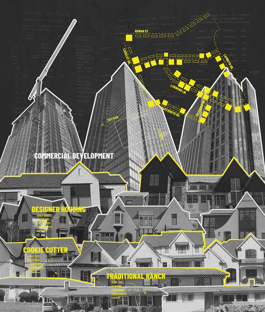
Old Roots, New Rises: Transitions of Architecture (4)

This investigative, on-the-ground mapping project delves into the architectural transformations in Raleigh’s Farrier Hills and Lakemont neighborhoods by documenting the evolution from traditional ranch-style homes to modern, multi-story residences, reflecting a complex interplay of tradition and modernization.”

This project was selected as a finalist for the APDU Data Storytelling National Award, AIA ASPIRE Regional Student Design Award, and NC State Research Image Award.

Instagram: @dilpickle01, @tanialeighallen, @rainrainqueen

Growth & Vulnerability by Gabrielle Schiltz, B. Arch ’24
North Carolina State University | Advisors: Sara Queen & Tania Allen

Across the US, we are witnessing a housing crisis catalyzed by a pandemic-related housing shortage and exaggerated by income inequality resulting in a disproportionate burden on the poor and non-homeowners. This visual essay examines historic and contemporary data to interrogate many of the complex factors that have contributed to the current state of housing in Raleigh, the Triangle, North Carolina, and the US. The primary aim of this research is to create more equitable, effective and innovative design and planning approaches to the future of housing and urban development writ large.

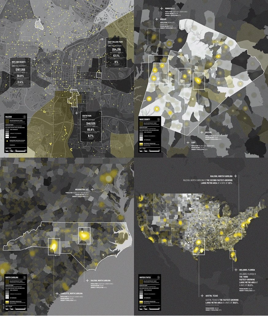
Growth & Vulnerability: Examining Development and Marginalized Groups (1)

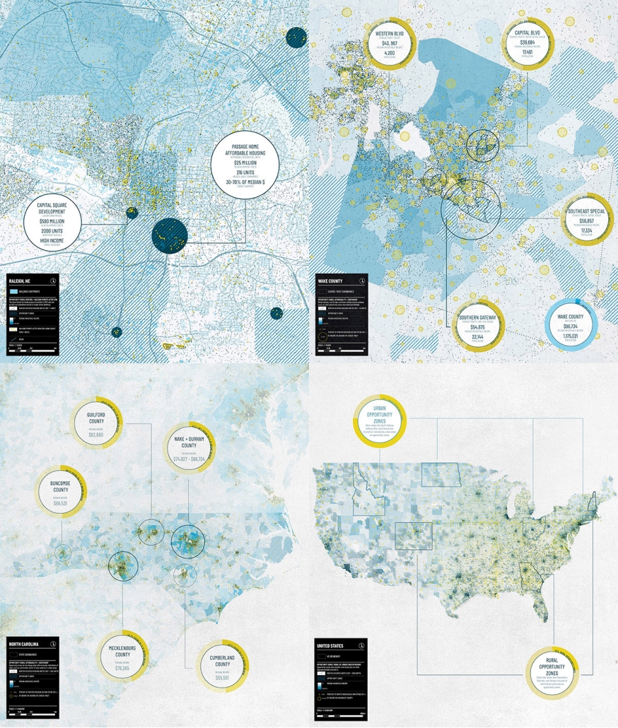
This map series explores the complex relationship between redevelopment and marginalized communities. The concentration of recent building permits and opportunity zones illustrates foreseeable development with loose correlative patterns between growth and marginalized populations.

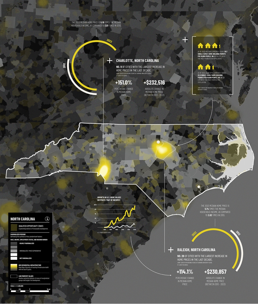
Growth & Vulnerability: The Disproportionate Rise of Housing Prices (2)

This map explores the potential correlation between residential development and marginalized demographics, questioning if historical patterns persist or are becoming increasingly obsolete. There are many factors that determine if a population is considered marginalized, prime factors articulated through this series include race, income, employment status, and housing burden.

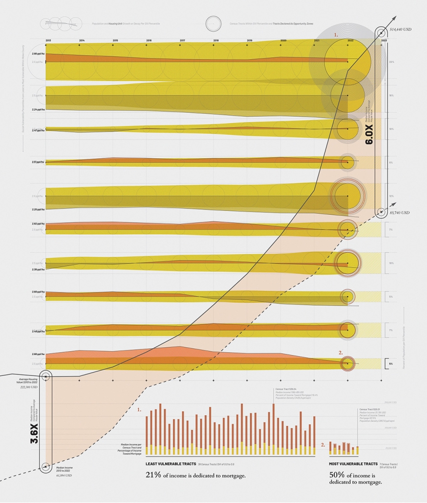
Growth & Vulnerability: A Study of Housing Flux Within Wake County (3)

This visualization explores the relationship between population density, housing unit density and population growth within socially vulnerable communities using the CDC’s Socioeconomic Vulnerability Index (SVI). The map categorizes Census Tracts per SVI percentile with the least vulnerable census tracts at the top and the most vulnerable tracks at the bottom. Each string articulates the population and housing unit growth or decline from left to right.

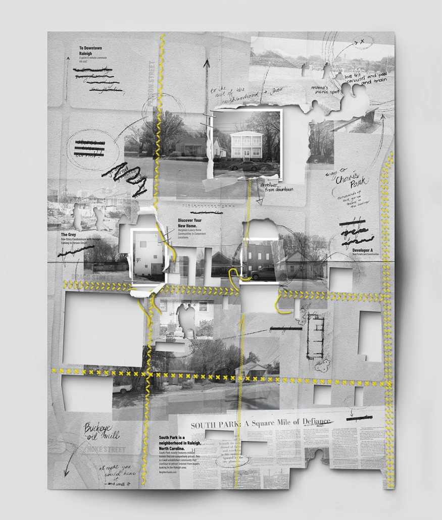
Growth & Vulnerability: Erasure of Neighborhood Identity: South Park (4)

This map offers a human-centric counter-narrative to the statistical analysis of redevelopment featured in earlier maps and considers: Who is represented within neighborhood data and how do their lives weave into the greater tapestry of the community? The map illustrates the in-progress erasure of South Park’s historically rooted identities due to contemporary redevelopment patterns.

This project was selected as a finalist for the APDU Data Storytelling National Award, AIA ASPIRE Regional Student Design Award, and NC State Research Image Award.

Instagram: @gabrielle.schiltz, @tanialeighallen, @rainrainqueen

Are Opportunity Zones Helping or Hurting? by Maggie Kroening, B. Arch ’24
North Carolina State University | Advisors: Sara Queen & Tania Allen

Across the US, we are witnessing a housing crisis catalyzed by a pandemic-related housing shortage and exaggerated by income inequality resulting in a disproportionate burden on the poor and non-homeowners. This visual essay examines historic and contemporary data to interrogate many of the complex factors that have contributed to the current state of housing in Raleigh, the Triangle, North Carolina, and the US. The primary aim of this research is to create more equitable, effective and innovative design and planning approaches to the future of housing and urban development writ large.

Examining Income and Rentership within OZs (1)

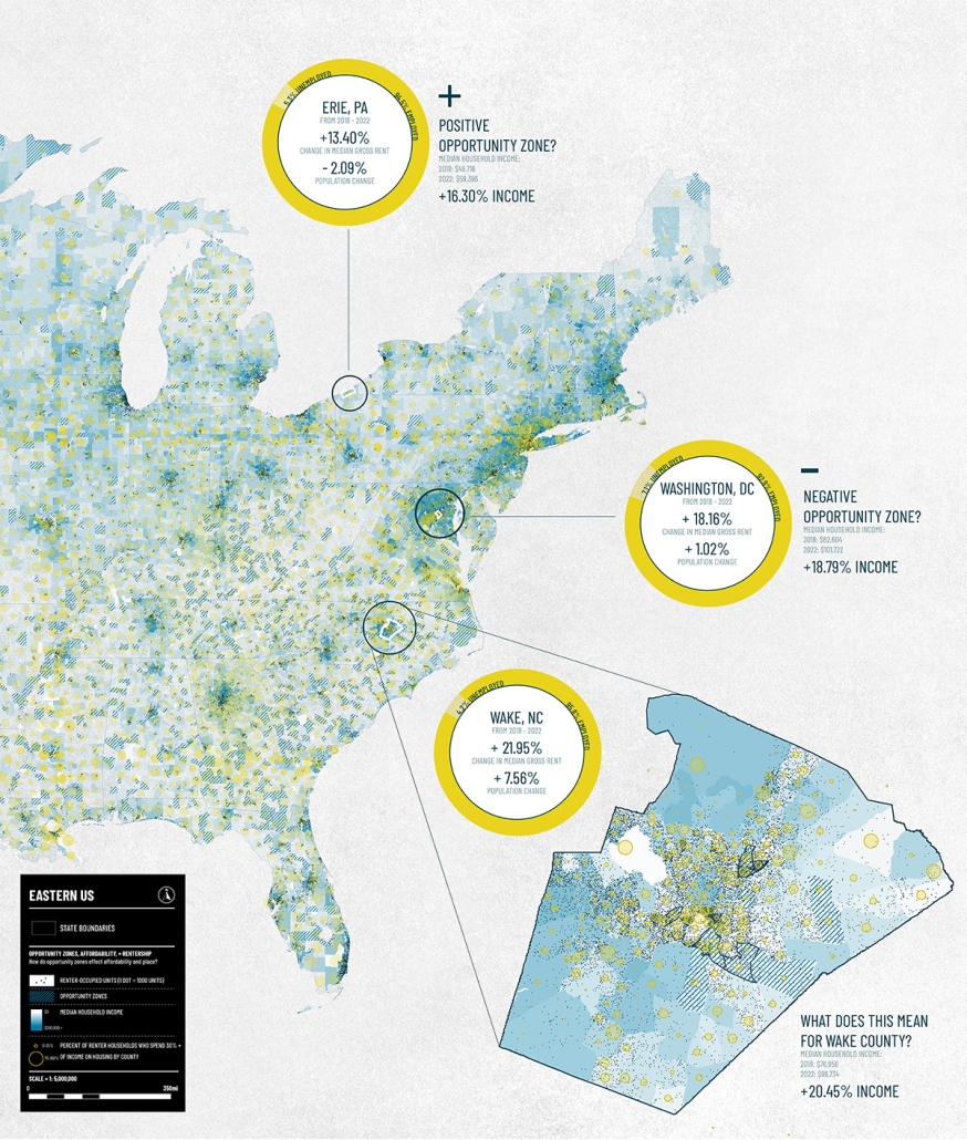
This map series looks at the impact of Opportunity Zone designations on neighborhood displacement and overall housing burden. Signed into law by the 2017 Tax Cuts and Jobs Act, Opportunity Zones (OZs) were originally launched as a place-based tax credit to encourage investment in impoverished communities, but have since faced a large degree of controversy.

Are Ozs Helping or Hurting? (2) 

This map features two contrasting cases, Erie, PA and Washington DC, exemplify the debate around OZs. US Treasury analysis reveals that 48% of zones do attract investment, but funds are often concentrated in isolated fractions of the whole zone. According to the NLIHC, targeted OZs often experience economic growth and renter displacement prior to investment. For Wake County, tracking OZ developments is crucial to examine who they serve and if they are contributing to equitable development.

Renter Cost Burden in OZs (3)

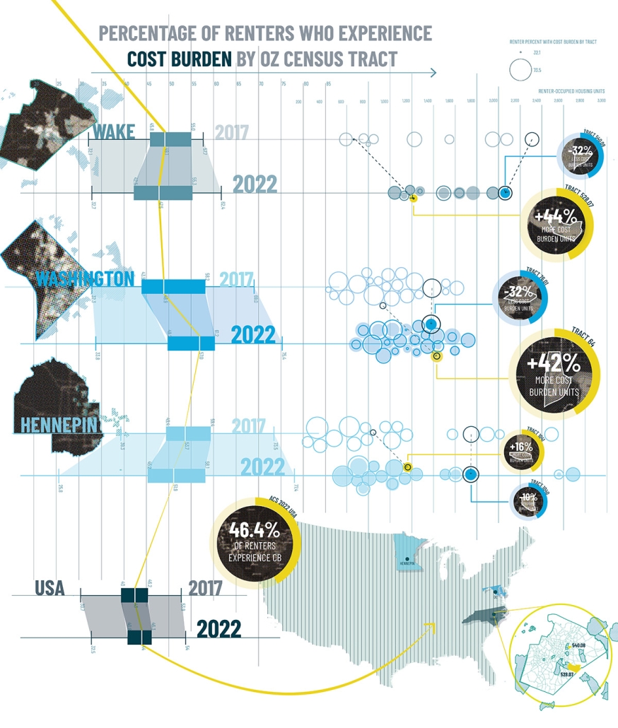
This map highlights change in rates of rent cost burden within OZs from three disparate countries, Wake (Raleigh), Washington DC, and Hennepin (Minneapolis), from 2017 to 2022 through box plots and beeswarm visualizations. The most extreme cases of either an increase or decrease of cost burden within each county are shown by tract.

Delineating the Fringe: OZs and Housing (4) 

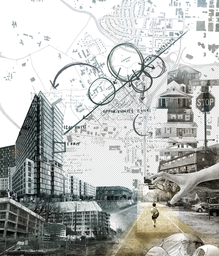
This map records observations of the Southern Gateway OZ along the Lake Wheeler corridor in Raleigh NC. Within a half mile three extremes of housing conditions were observed: new high-rise apartments, existing single-family homes, and people experiencing homelessness. This map raises complex questions concerning the impacts and opportunities of increased density and redevelopment fueled by OZs.

This project was selected as a finalist for the APDU Data Storytelling National Award, AIA ASPIRE Regional Student Design Award, and NC State Research Image Award.

Instagram: @maggie.k, @tanialeighallen, @rainrainqueen

Predatory Development by Lucas Stott, B. Arch ’24
North Carolina State University | Advisors: Sara Queen & Tania Allen

Across the US, we are witnessing a housing crisis catalyzed by a pandemic-related housing shortage and exaggerated by income inequality resulting in a disproportionate burden on the poor and non-homeowners. This visual essay examines historic and contemporary data to interrogate many of the complex factors that have contributed to the current state of housing in Raleigh, the Triangle, North Carolina, and the US. The primary aim of this research is to create more equitable, effective and innovative design and planning approaches to the future of housing and urban development writ large.

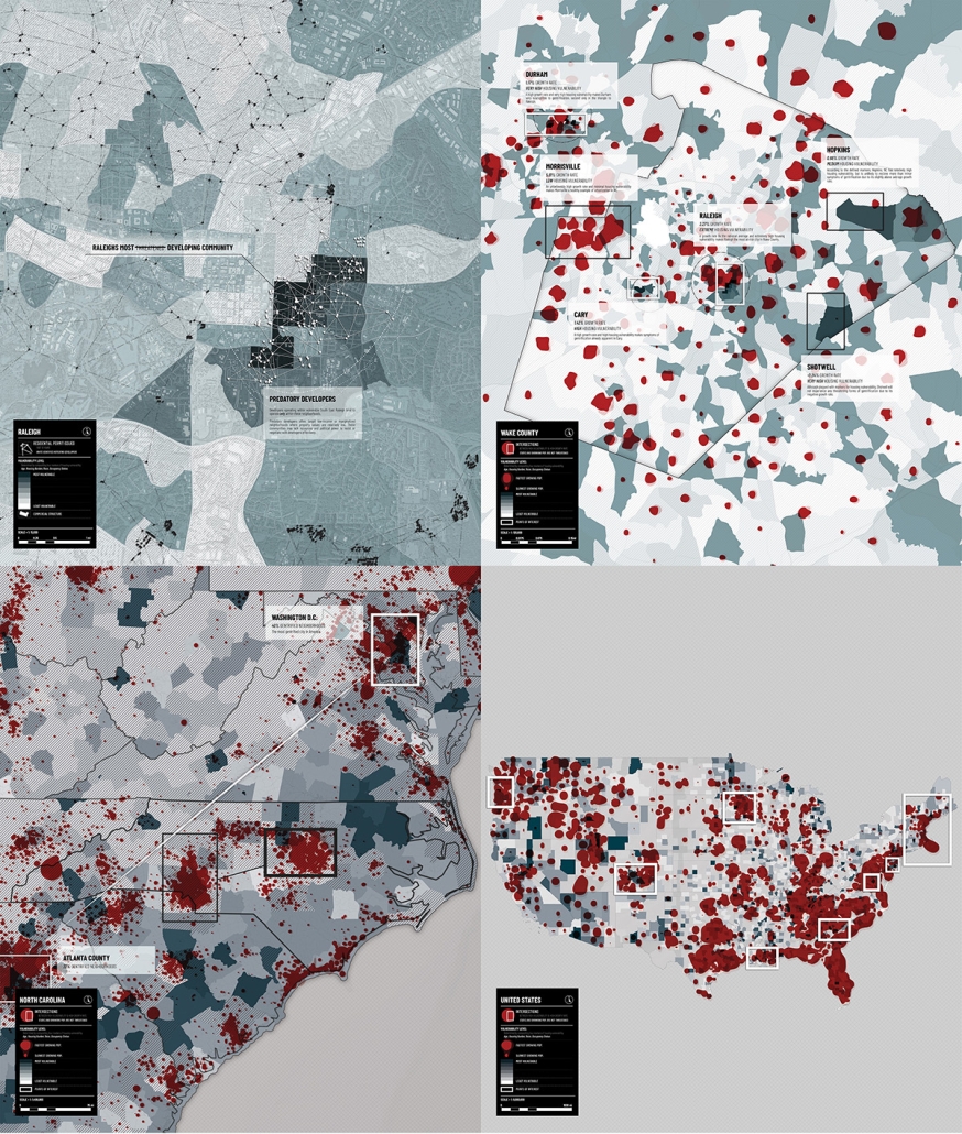
What Makes a Neighborhood Vulnerable? (1)

This map series illustrates markers for housing vulnerability (race, housing burden, age, and occupancy status) to identify tracts as more/less vulnerable. These measures of vulnerability are overlaid with measures of population growth and the areas of overlap suggest the neighborhoods most vulnerable to the threats of gentrification.

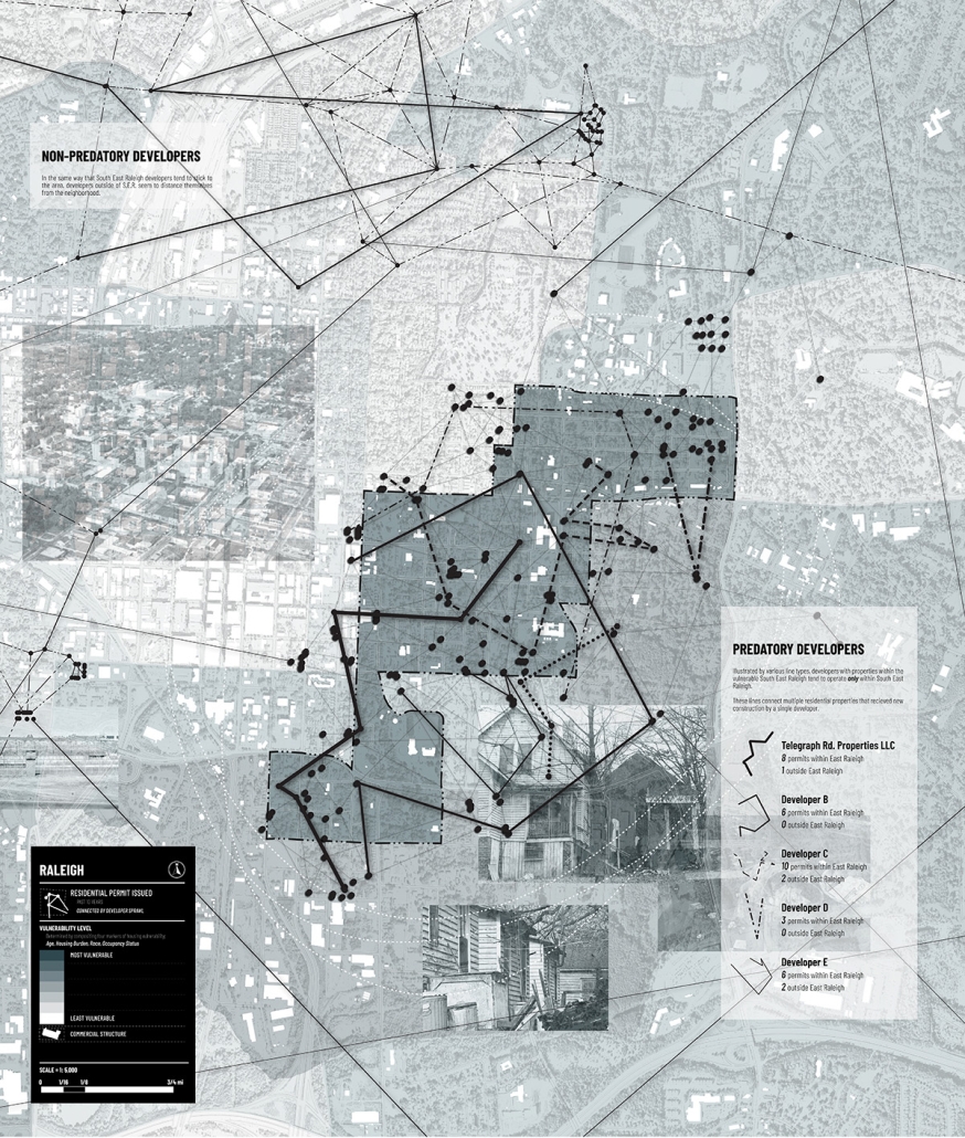
Predatory Development (2)

This map visualized patterns of redevelopment in Southeast Raleigh which has historically had low-income residents and under-valued properties. By plotting building permit data, we see a distinct pattern of developers active solely within Southeast Raleigh versus developers that avoid it completely.

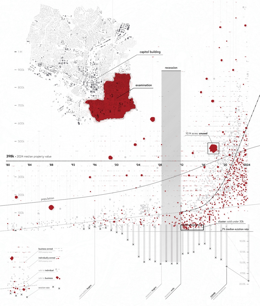
Speculative Real Estate and Community Vitality (3)

This graphic aims to raise questions about the ethics of modern-day, speculative property sales. Southeast Raleigh, a region with high housing vulnerability, has seen drastic changes in the ownership and popularity of its land. Over time it transformed from an affordable, black neighborhood into a threatened historic district torn apart by redevelopment, rising housing costs, and speculative real estate.

Urban Squeeze: The Weight of Gentrification (4)

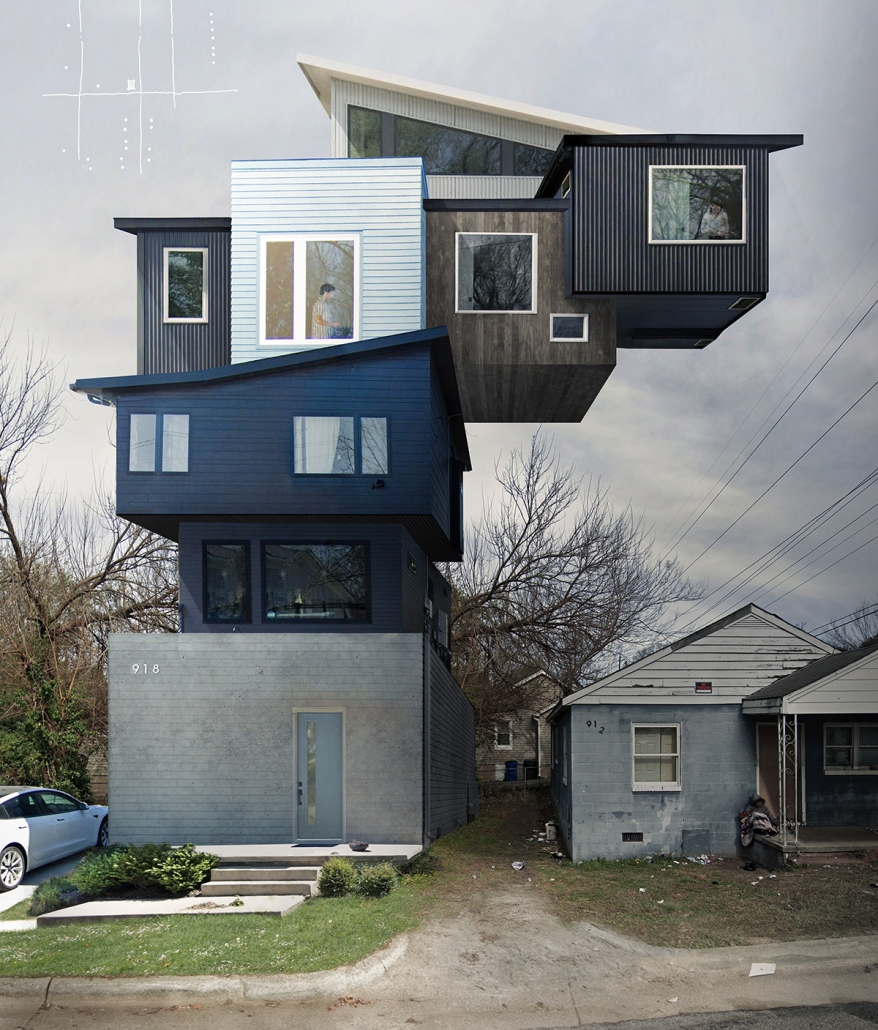
Walking through the South Park neighborhoods reveals a shift from shotgun houses and net-less basketball hoops to two-story contemporary houses flanked by Teslas and neon playgrounds. At this map’s core is a weather-worn, dilapidated house—a relic of South Park’s past and a poignant symbol of the challenges faced by its residents. Street photographs of recently constructed housing developments, all within 500 feet, are meticulously collaged to convey the experience of ongoing social suffocation and displacement.

This project was selected as a finalist for the APDU Data Storytelling National Award, AIA ASPIRE Regional Student Design Award, and NC State Research Image Award.

Instagram: @tanialeighallen, @rainrainqueen

Live, Laugh Learn: Affordable Housing in Honolulu by Marco Zhou, B. Arch ’24
California State Polytechnic University, Pomona | Advisor: Pablo La Roche

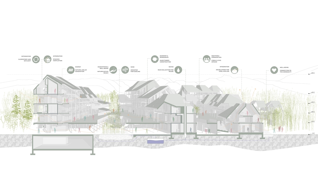
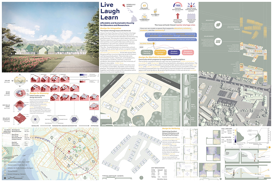
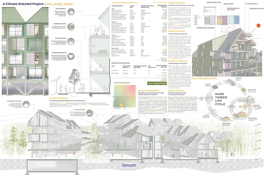
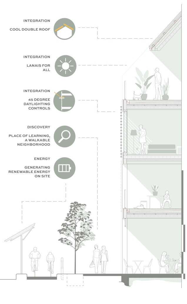
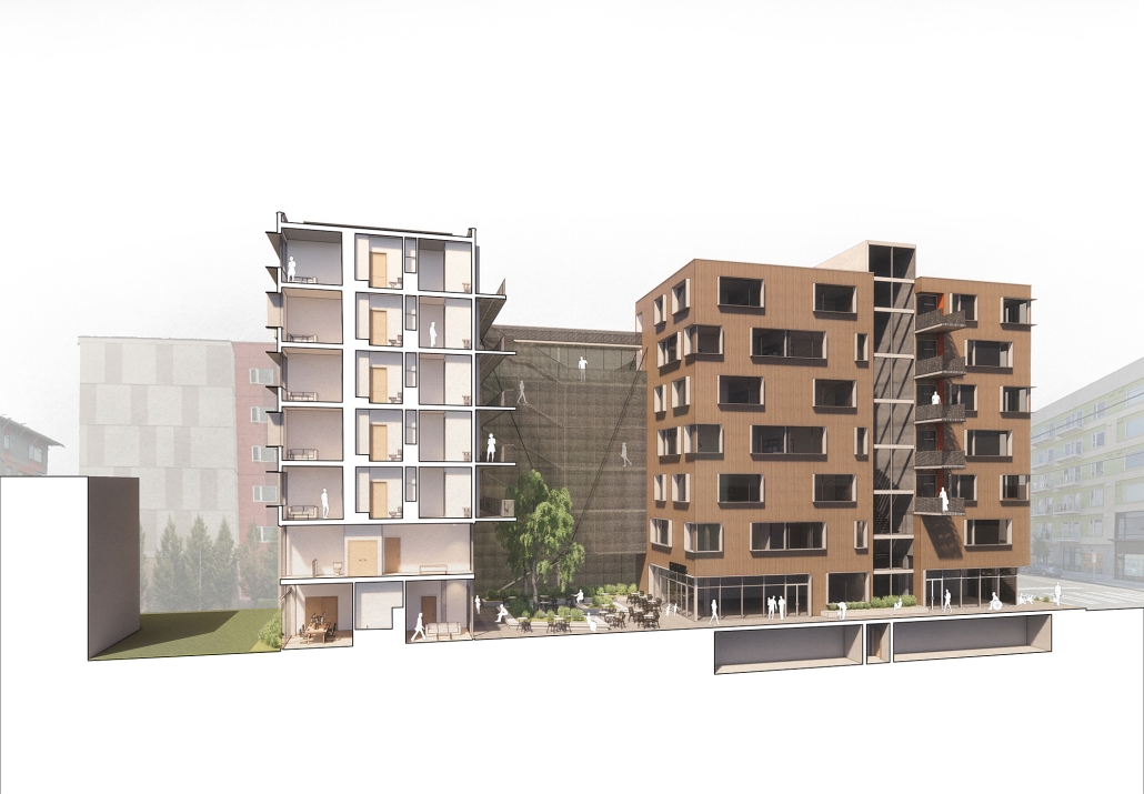
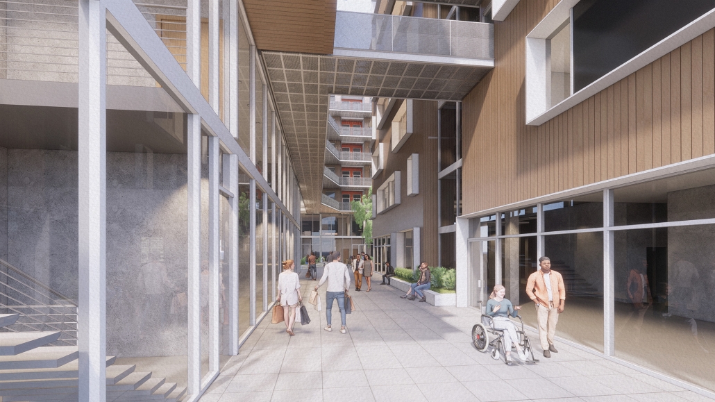
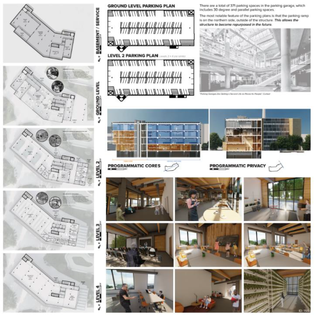
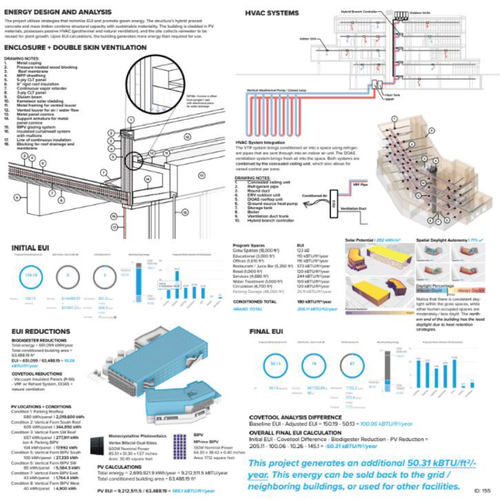
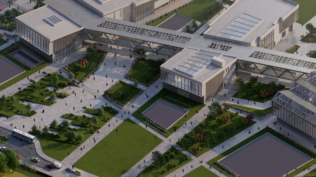
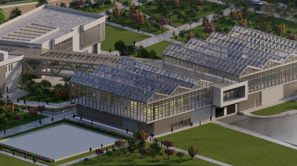
Live Laugh Learn is a sustainable affordable housing project in Honolulu to provide housing for educators and researchers. Due to the high cost of living in Hawaii, there are poor retention rates for teachers, and schools rely on emergency hires. This project, located between an elementary, middle, and high school, provides an option to alleviate this issue. There are 120 units, and the ground floor fosters well-being and education. The project also aligns with the University of Hawaii’s core value, Aloha “Aina. The project aims to create a social hub that harmonizes surrounding amenities and infrastructure, promoting biodiversity in a dense urban area. AIA’s COTE framework for design excellence was integrated into the design. Energy modeling and carbon calculations were an integral part of the design process from the beginning. 

Instagram: @marcozhou_, @pmlaroche

Interested in being featured in next year’s showcase? Stay tuned for updates this summer!

2024 Study Architecture Student Showcase - Part XV

Part XV of the 2024 Study Architecture Student Showcase highlights various intersections of the natural and built environments. The featured projects provide design solutions that address various environmental elements and ecosystems. Scroll down to learn more!
Lake Meredith Aquatic Research Institute by Carlos Cepeda Gomez, B.S. in Architecture ‘24
Washington University in St. Louis | Advisor: Zahra Safaverdi

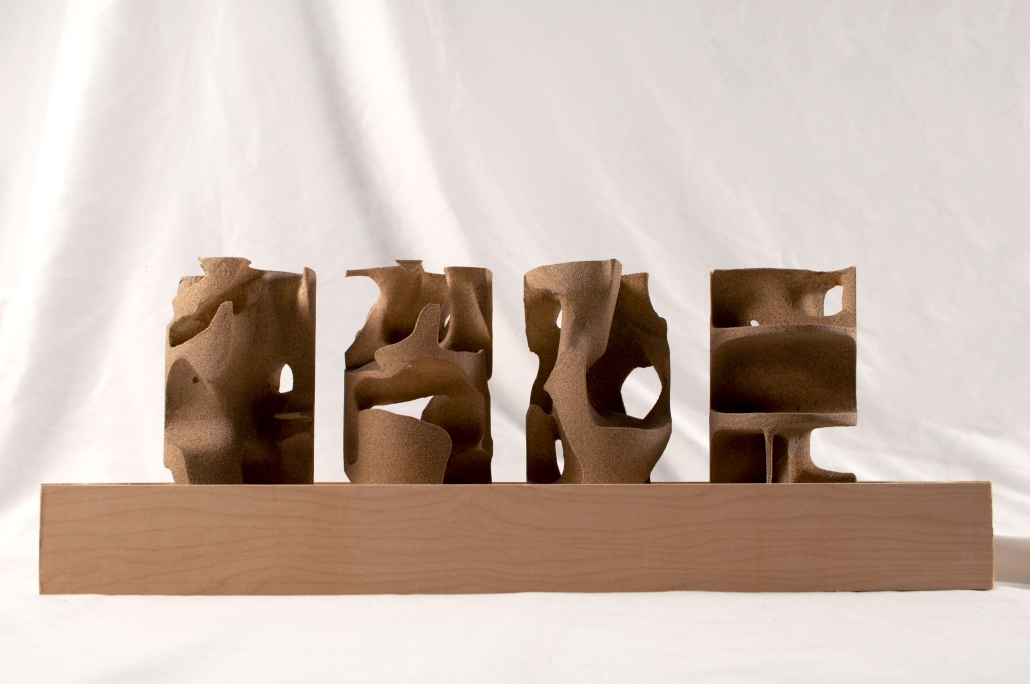
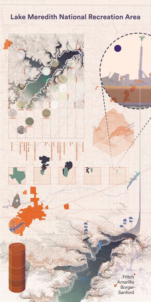
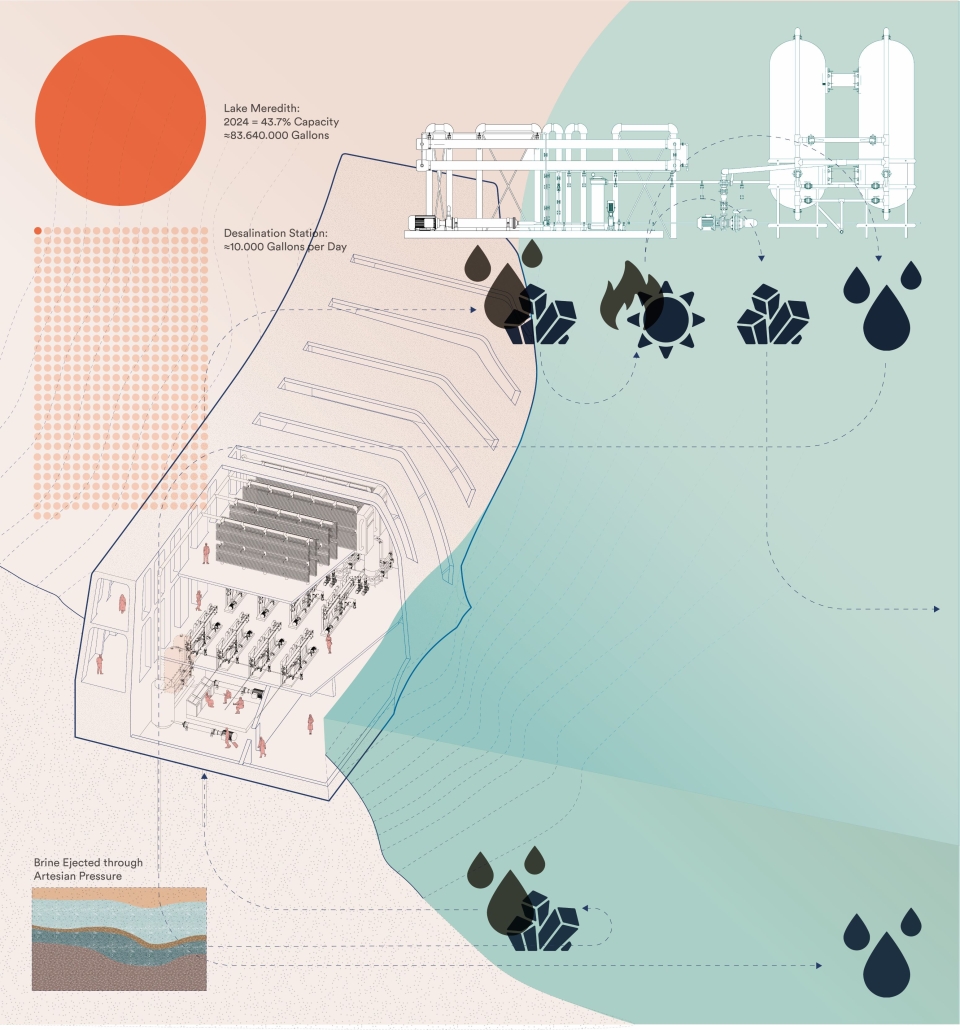
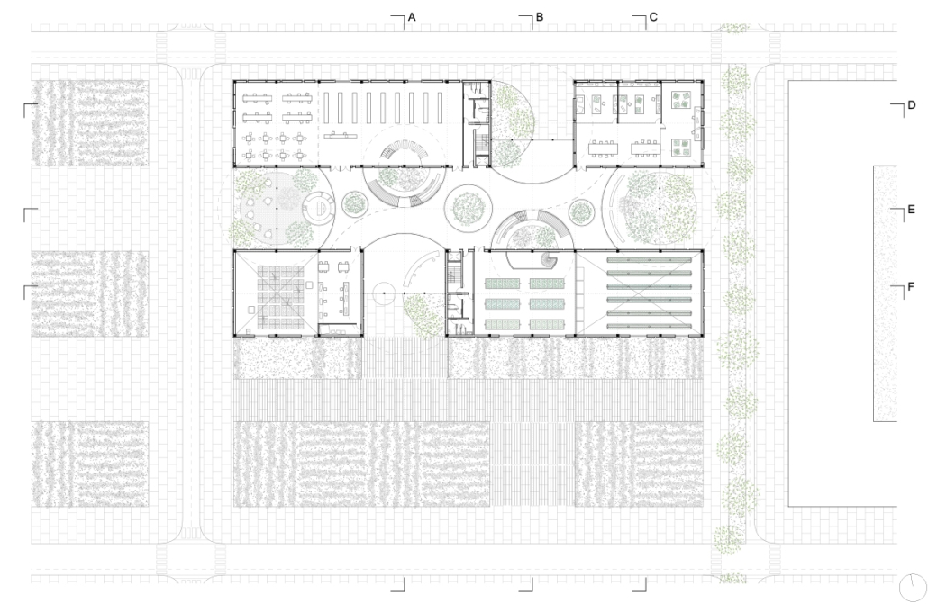
Lake Meredith Aquatic Research Institute is a center that investigates water management, desalination, and local biodiversity in a man-made reservoir near Amarillo, in the Texas Panhandle. The lake contends with geological challenges from the Ogallala aquifer, Permian salt basin, and climate change. These features have caused diffusion points across the American arid regions, where the aquifer erodes the salt basin, forming brine pockets that then percolate into the water system through artesian pressure.

Salinification, lax water regulations, desertification efforts, and climate change effects have made the water reliance on the lake unreliable. During the emergency 2010-2014 drought, the lake dropped from 105 feet to a record low of 25 feet.

A diverse team of biologists, engineers, geologists, ecologists, and other specialists reside and collaborate at the institute. They engage local communities to educate them about the research conducted on-site while interacting with each other and the lake. The institute’s focus, systems, and research directions are decided sociocratically ensuring inclusivity, effective governance, and equity.

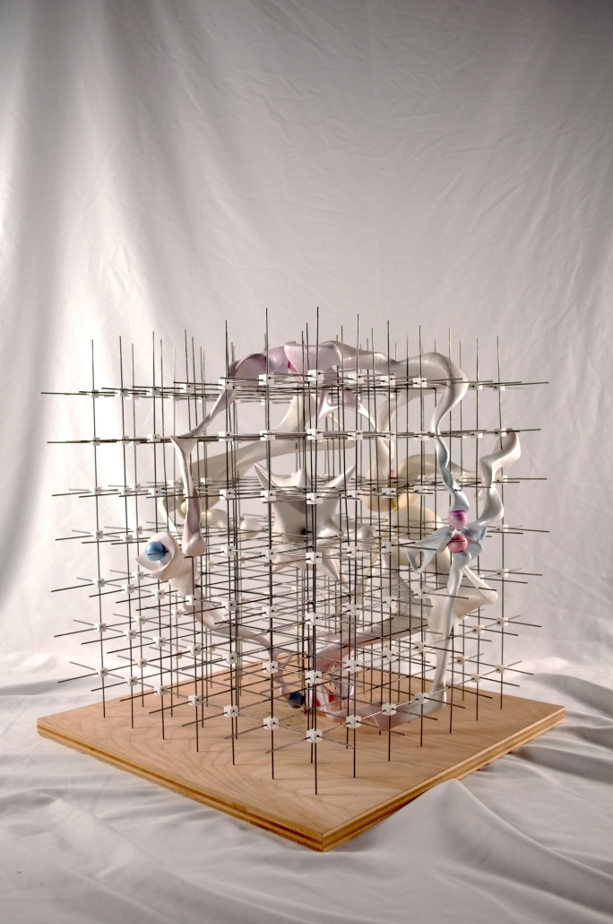
The Institute’s center around water, geology, and erosion was determined via an importance matrix—using six data sets affecting the lake’s surroundings: Weather, Salinity, Human Factors, Biodiversity, Water Levels, and Geology. The data sets and intersections were translated into a three-dimensional spider chart study. The concluding “blobs” created through data analysis were used through Boolean operations to develop an architectural language.

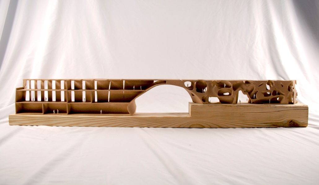
The building reflects its function, interior programming, and residents’ ethos, resulting in a blend of efficient, desalination, and scientific areas that develop research to protect the reservoir’s ecology. Its geological, cavernous structures diverge from contemporary architecture, allowing scientists to make eco-political statements on humanity’s abusive relationship with nature and advocating for dismantling systems of eco-exploitation and resource mismanagement. They address environmental catastrophes and innovative architecture and reconceptualize governance systems. The Institute’s community and purpose channel the scientists’ energy into activism, policy-making, and technological development, rather than self-radicalization, within the context of post-colonial and capitalistic frameworks.

This study focuses on water, sedimentation, and erosion, utilizing locally sourced materials to address local issues, enhance the local environment, and redefine the relationship between humans, nature, and architecture promoting intersectionalism between justice, equity, and environment.

Stó:lō Relationalities: Exploring Infrastructures of Climate Adaptation along the Fraser River by Wilson Tian Zhi Jiang, M. Arch ’24
Carleton UniversityAdvisor: Jake Chakasim

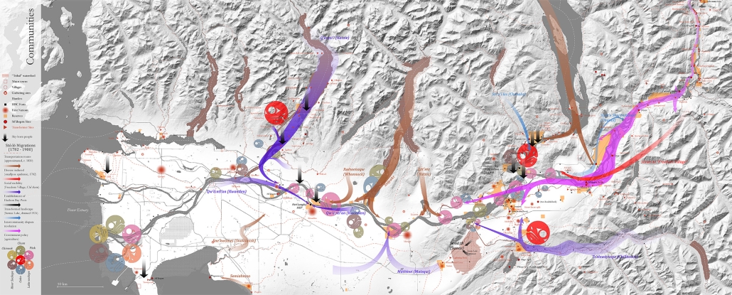
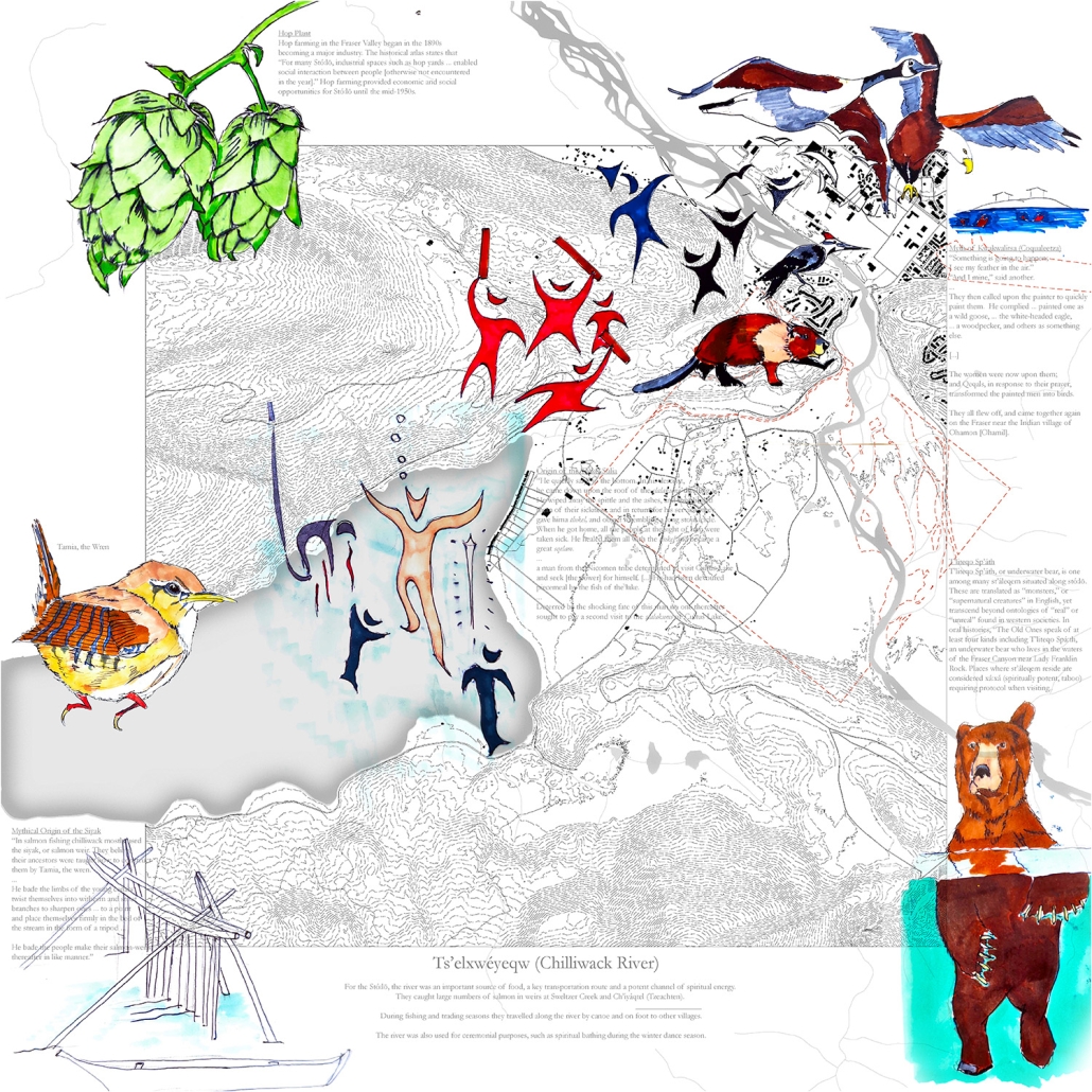
This thesis confronts the issue of climate-induced flooding along Stó:lō, or the Fraser River in British Columbia. In November of 2021, the Sumas Prairie near Chilliwack flooded, creating what the agricultural minister Lana Popham described as the “largest agricultural disaster in BC.”  Many instances of flooding predate 2021, notably in 1894 and 1948, more recorded in Dirk Septer’s 2007 report Flooding and Landslide Events Southern British 1808-2006, and as old as 12,000 years ago. A conventional modern response to flooding is to build infrastructures like dykes that preserve the economic function of the land, perpetuating a colonial relationship to land dependent on technical, extractive processes which overlook existing cultural connections essential to climate adaptation. For its First Nations, Stó:lō has always been a formidable force, an interconnected ecosystem over 1300 kilometres long and home to migrating salmon for 9,500 years. Land sovereignty, defined through Indigenous cultural practices and ecologies, becomes a framework for approaching climate adaptation and decolonization, built on marginalized narratives from Indigenous and non-indigenous communities. The methodology follows three phases – encountering, entangling, and engaging – of indigeneity from a Chinese-Canadian perspective.

Encountering Stó:lō – Mapping exercises from the scale of the river to regional story maps. Macroscopic drawings document themes of climate, community, and infrastructure. Story maps of  ‘touch-down points’ document oral histories and anecdotes on architecture, infrastructure, and migrant labour.

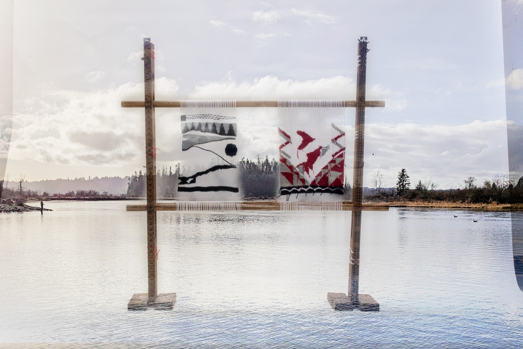
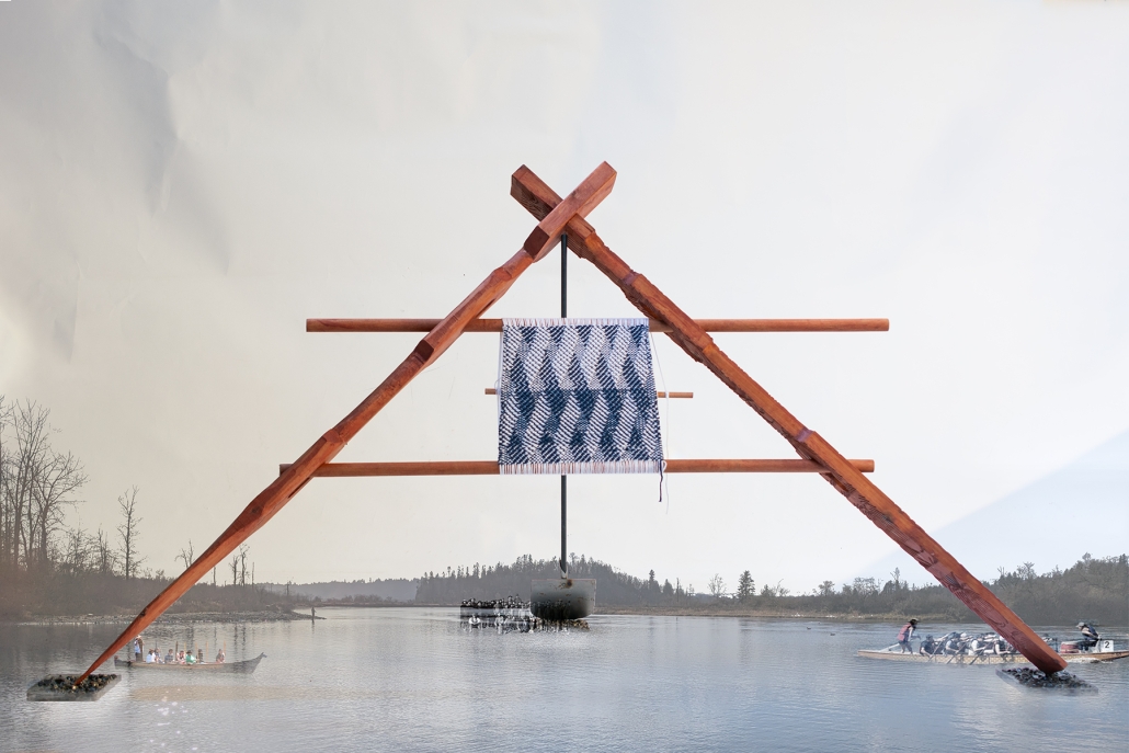
Entangling Stó:lō – Explorations of embodied knowledge of Stó:lō by making, weaving, and interpreting. Initialized with a cedar basket-making workshop in Seattle, Washington, followed by weaving exercises on a custom-built Salish loom. This section concludes with a ‘Weirloom’ apparatus that interprets Coast Salish and Chinese Canadian history through craft.

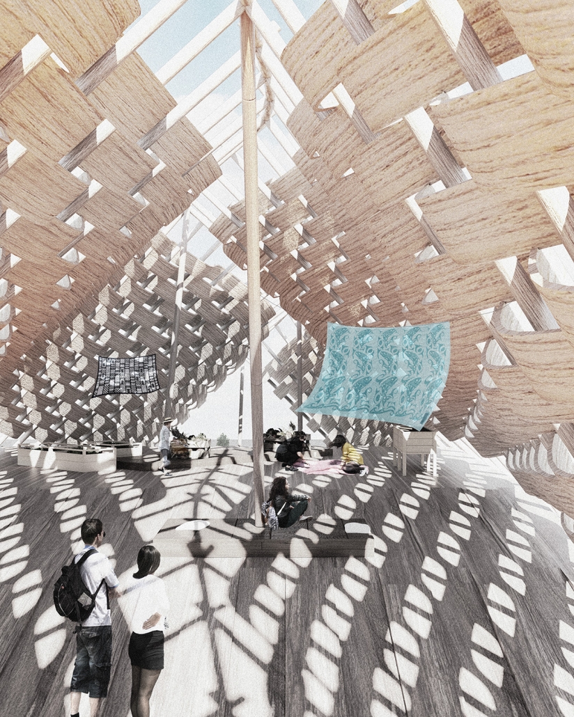
Engaging Stó:lō – Design of a socio-ecological infrastructure over a creek near the Musqueam Cultural Center in Musqueam territory. Its program builds on the shared history of two marginalized groups on Musqueam-Chinese farms, synthesizing earlier research. The resulting structure combines indigenous basketry with an underlying beam-woven structure common to traditional Chinese bridges with a continuous space for exhibits and resting spaces, reminding users of entangled histories of place, cultural connections to water, and a fluid relationship to water and climate change.

This project won Carleton University’s 2024 OAA Guild Medal and was nominated for the Canadian Architect Student Award of Excellence.

Instagram: @wilson.tz.jiang, @jakechakasim

On the Edge: A Climate Adaptive Park for Battleship NC Memorial by Josh Gogan, Maggie Kroening & Stella Wang, M. Arch & B. Arch ‘24
North Carolina State University | Advisors: Andrew Fox & David Hill

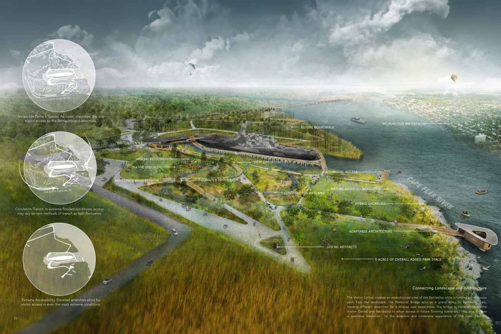
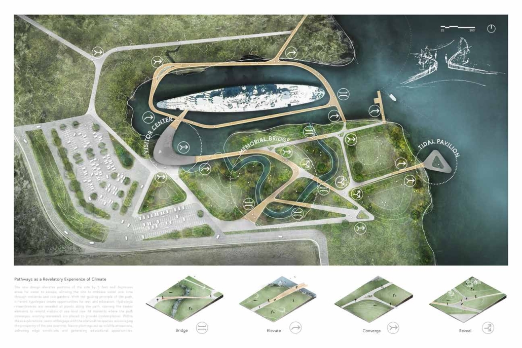
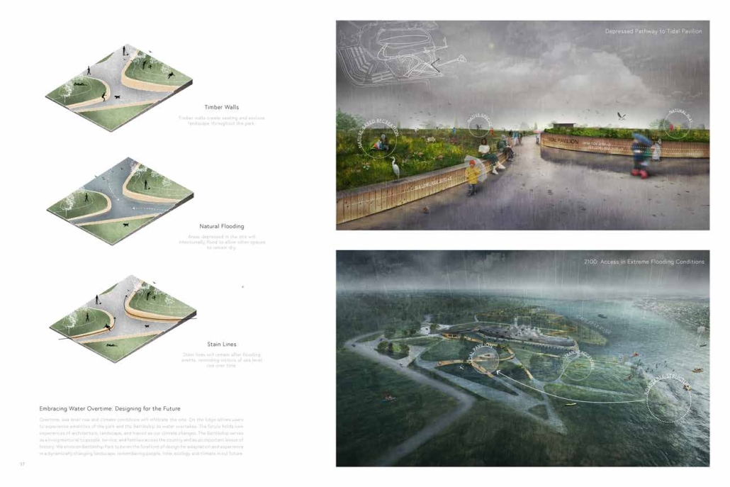
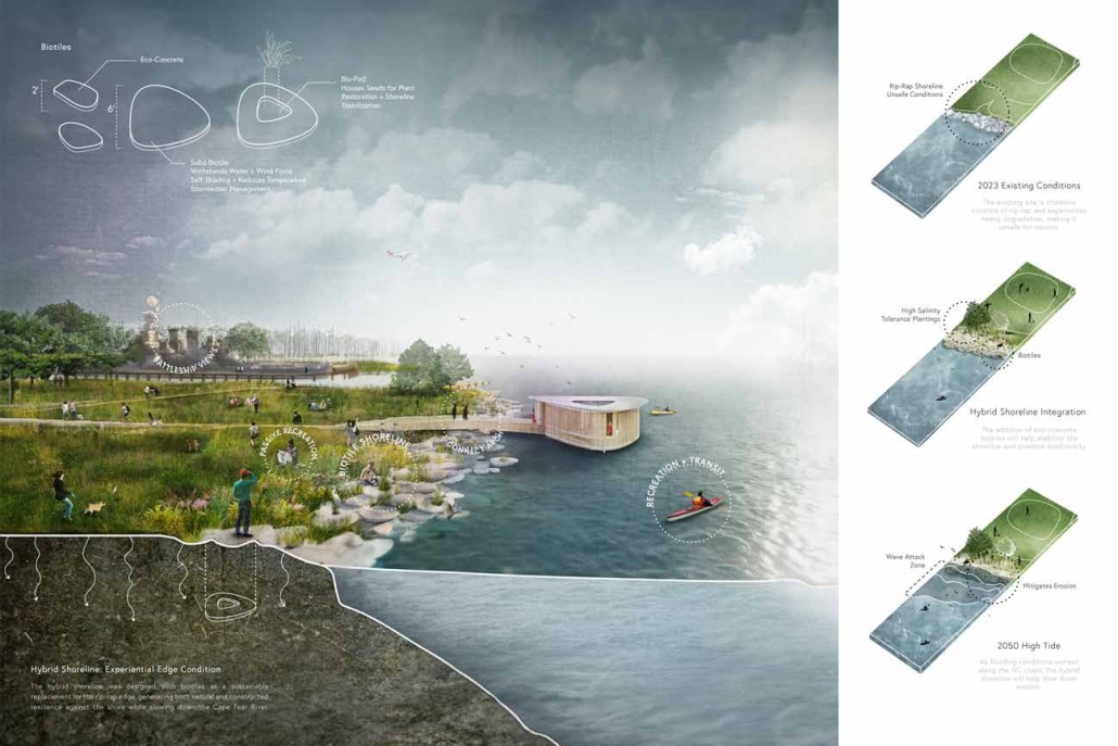
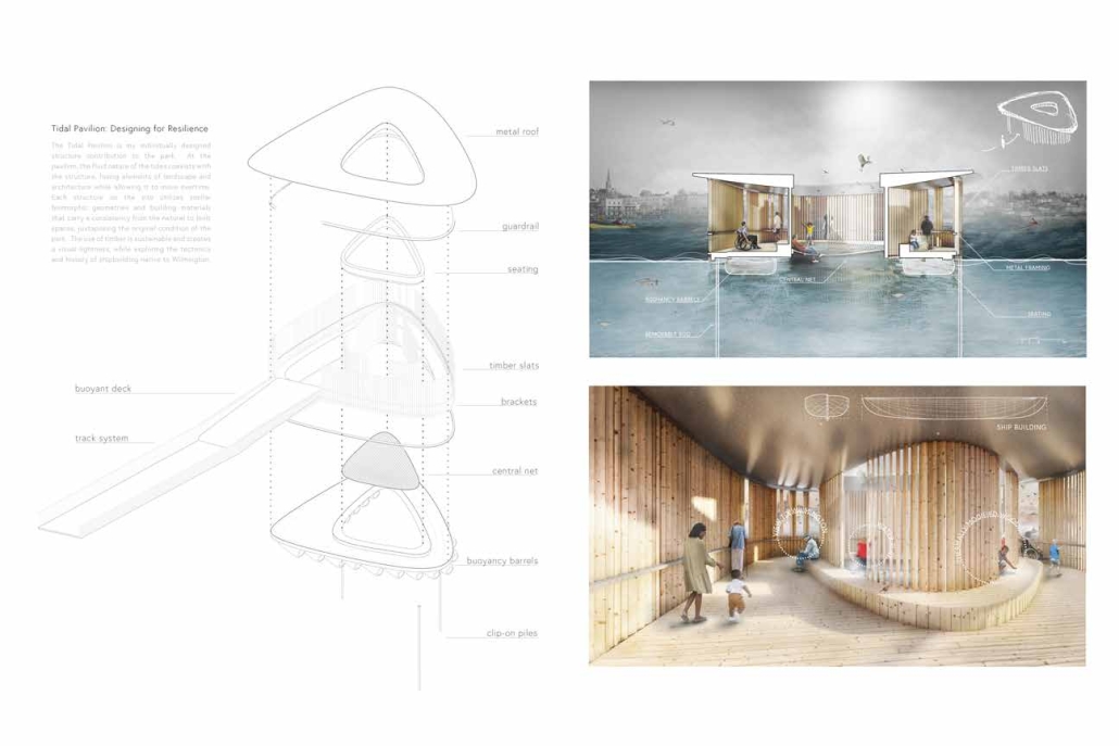
On the Edge proposes a redesign for the parklands surrounding the Battleship North Carolina. The reimagined site celebrates a challenging narrative of place that reveals and highlights multifaceted histories while embracing infiltrating water. The new park transcends physical composition, serving as a dynamic memorial space connecting people, time, ecology, and climate through the goals of integration, adaptability, preservation, and restoration. The design proposes numerous site-specific community amenities, including a visitor center, a moveable tidal pavilion, a memorial bridge, and a hybrid shoreline. The result is a destination park that adapts to water as the climate and site shift, allowing the memorial to withstand the test of time.

Battleship Park in Wilmington, NC presents a contrast between the natural and built environment. Through our experience and analysis of the site, we asked ourselves as designers how this could adapt to consider people, time, ecology, and climate more cohesively for the greater community of Eagles Island. On the Edge explores Battleship Park as a space of education through experiences of integration, adaptation, preservation, and restoration. The site’s adjacency to the USS NC and views to Wilmington highlight the need to convert the current parking lot into five additional acres of park space. The new design elevates portions of the site by five feet and depresses areas for water to escape, allowing the site to embrace water over time with the construction of wetlands and rain gardens. Hydrologic remembrances are revealed at points along the path, staining the timber elements to remind visitors of sea level rise. At moments where the path converges, existing memorials are placed to provide contemplation. Within these explorations, users will engage with the site’s native species; encouraging the prosperity of the site as it continues to change. Native plantings act as wildlife attractions, softening edge conditions and generating educational opportunities. 

Over time, sea level rise and climate conditions will infiltrate the site. On the Edge allows users to experience the amenities of the park and the Battleship as water overtakes. 

This project won the 2023 National ASLA Award of Excellence in Student Collaboration, the 2024 North Carolina ASLA Student Award of Excellence in General Design, and the 2023 AIA Aspire Student Design Award. 

Instagram: @kroening.3dm, @davidhillarch, @stellawang_2 

High Seas, Low Lands: When Water Creates Spaces by Aya Youssef, B. Arch ’24
American University of Beirut | Advisor: Trevor Patt

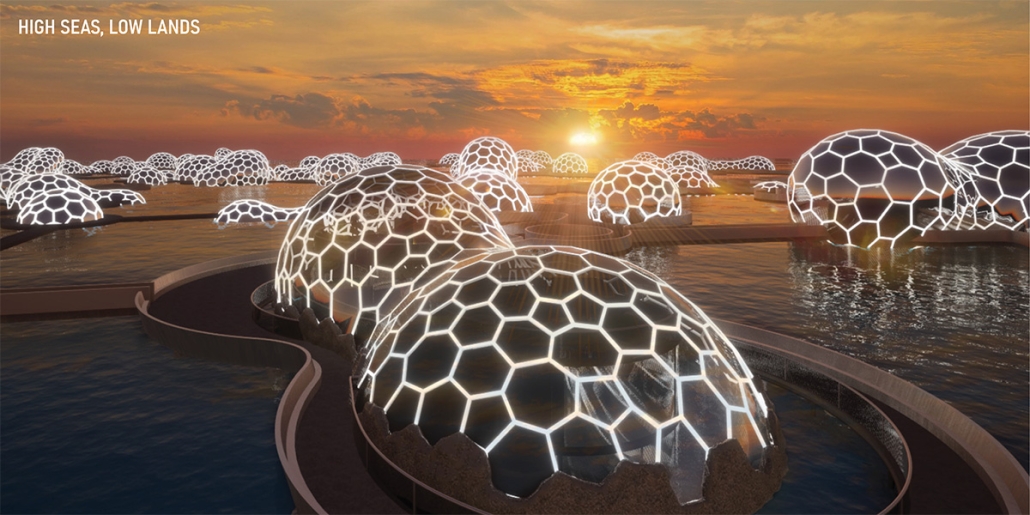
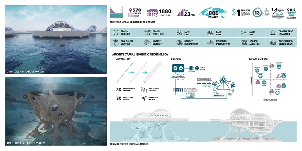
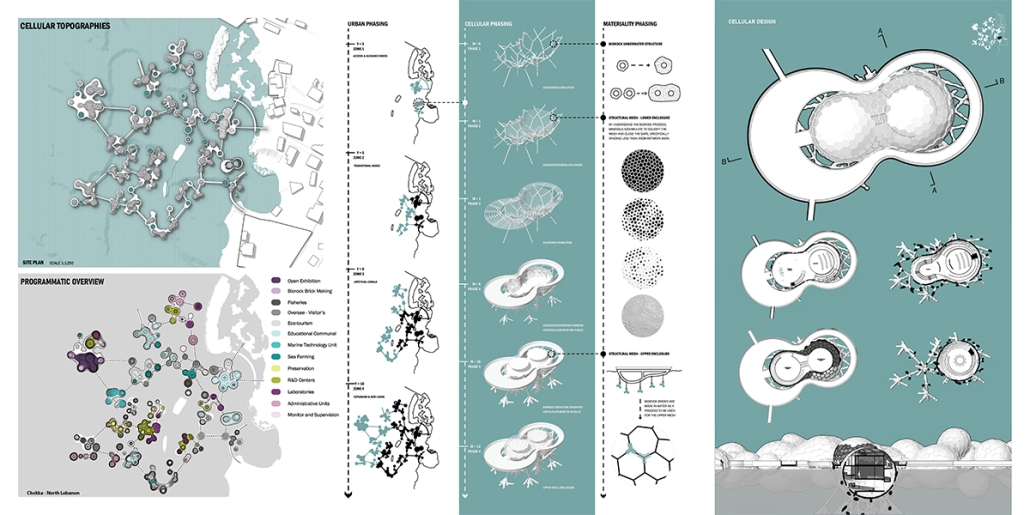
Understanding the relationship between architecture and climate change necessitates a detailed scientific comprehension of their causality. Collaborating with the National Geographic Society, this initiative explores how architecture can mitigate climate change impacts through innovative building practices. Central to this approach is the integration of biorock technology, a process that forms solidified building materials underwater using mineral accretion. This technique not only produces materials with a zero carbon footprint but also harnesses the ocean as a novel construction medium.

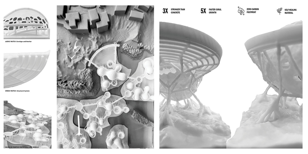
Biorock technology leverages natural electrochemical processes to precipitate minerals from seawater, creating strong, durable materials akin to limestone. This environmentally friendly method significantly reduces carbon emissions traditionally associated with concrete and steel production. Furthermore, the biorock structures support marine ecosystems, promoting coral growth and enhancing biodiversity.

The design process is inherently adaptive, taking into account site-specific environmental and geographic conditions. This allows for procedural iterations, ensuring each project is tailored to its unique context. The result is architecture that harmonizes with its surroundings, minimizing ecological disruption and maximizing sustainability.

At its core, this approach is both planet and human-centered, emphasizing the importance of ecological balance and human well-being. By utilizing the sea as a construction medium, this initiative opens up new possibilities for sustainable architecture that not only reduces carbon footprints but also contributes positively to marine environments. This paradigm shift in building design signifies a promising step towards addressing climate change, showcasing how innovative architectural practices can lead to sustainable and resilient built environments.

This project was recognized as the Best Degree Project of 2023/2024.

Instagram: @ard_aub

BREAKWATER – Breaking the Cycle by Adrian Mora, M. Arch ’24
University of Maryland, College Park | Advisors: Julie Gabrielli, Brian Kelly & Marcus Cross

A significant portion of the world’s population is concentrated along coastlines. Climate change has produced hazardous environmental conditions that threaten coastal populations, including many poor, vulnerable communities. The built and natural environment within this diverse boundary zone must be redeveloped as a self-resilient system that can protect its inhabitants from climate-induced hazards. 

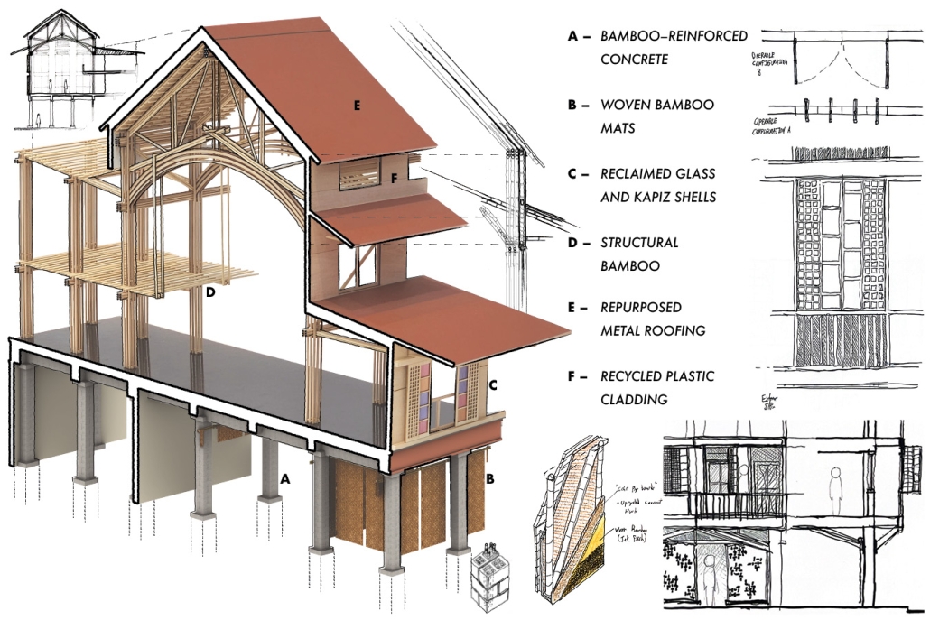
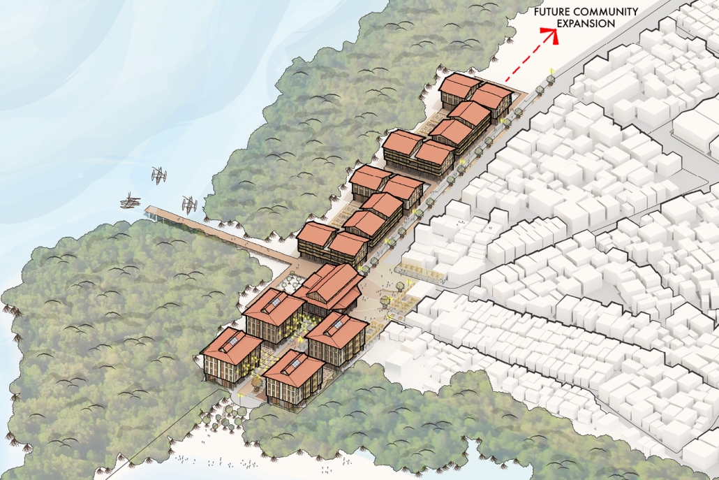
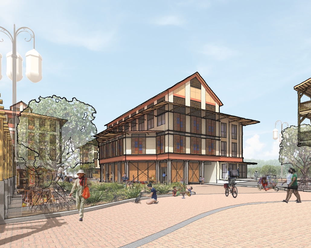
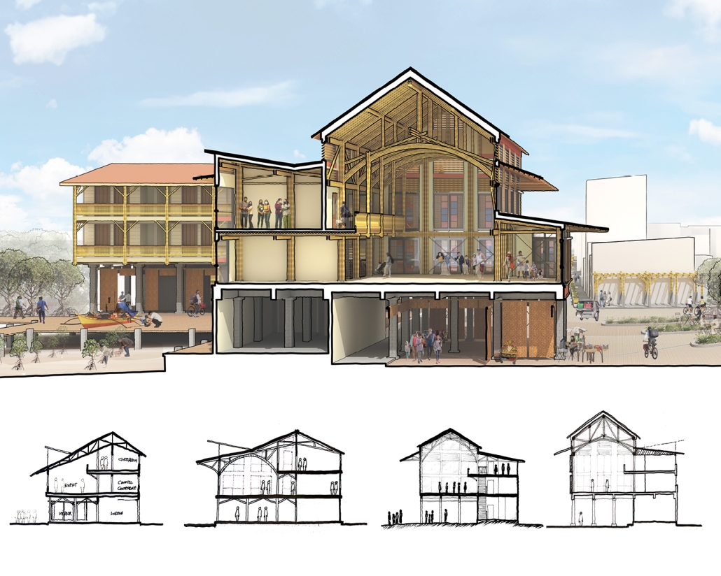
This project acts as a testbed for the ecological urban renewal of the Baseco Compound, a high-density urban neighborhood located on an artificial island within Manila Bay. An underutilized lot adjacent to the island’s beach and a small mangrove nursery has been transformed into a series of urban spaces defined by three distinct modules inspired by vernacular stilt housing. The modules also feature traditional and experimental construction techniques being pioneered in the Philippines, including structural bamboo, recycled plastic cladding and bamboo-reinforced concrete. Two residential modules, the Bahay Patayo and the Bahay Kublihan, explore different configurations of two-bedroom units that offer varied levels of density. The Kapwa Community Center module will serve as the new focal point for the neighborhood, providing multi-functional amenity spaces for public use and shelter during emergencies. 

The renewal of the built environment will be coupled with the restoration of the natural mangrove forests that previously occupied Manila Bay. The new buffer zone will also create an adaptable living barrier that will mitigate the impact of storms and flooding on the community and the rest of the Baseco Compound. The proposal will provide amenities that promote activities to support the neighborhood’s self-resilience and environmentalism within the urban context. Establishing a critical connection between new residents and the emerging grove will encourage active stewardship of the local environment.

This project won the UMD Architecture Thesis Award.

Instagram: @amora.art.photos, @umdmappschool

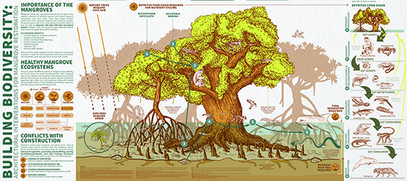
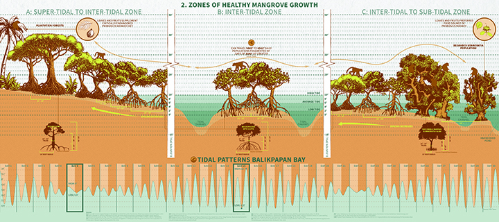
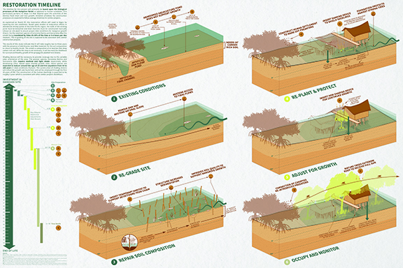
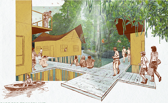
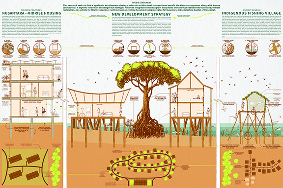
Building Biodiversity: Architectural Interventions for Mangrove Restoration and Community Engagement by Emily Bigelow, M. Arch ’24
Lawrence Technological University | Advisor: Scott Shall

Biodiverse ecosystems play a critical role in maintaining the health of the world. They help to combat climate change, prevent natural disasters, and mitigate the spread of diseases among other benefits. Mangrove ecosystems are biodiverse habitats that provide more important benefits including carbon sequestration, water filtration, and coastal erosion mitigation.

However, these habitats are frequently threatened by human development and construction practices that prioritize speed and profit over sustainability. Current conservation strategies, which involve regional-scale coexistence, struggle to address this issue because the demand for more human settlements remains higher than the demand for wildlife preservation. As more ecosystems are compromised by urban landscapes, the regional balance between the two shifts in favor of humans at the expense of the environment.

These problems are worsened by the imposition of building strategies that are foreign to a climate region. This practice not only reduces occupant comfort and increases energy demands, but also disrupts natural processes like the flow of water and predation patterns. Vernacular architecture, on the other hand, has an intimate relationship with the surrounding environment and has been adapted to provide comfort within the given conditions. These practices can provide insider knowledge of the local climate and ecosystem to produce new developments that aid in restorative projects rather than harming them.

This thesis seeks to find a symbiotic development strategy, wherein architectural interventions benefit biodiverse ecosystems along with human constituents. It explores innovative and indigenous strategies for urban integration with mangrove ecosystems which reduce habitat destruction and promote restoration. This project recommends a transformative strategy for urban development that makes use of indigenous building techniques and ecological principles to guarantee a symbiotic coexistence of mangrove ecosystems and human infrastructure.

This project won the CoAD Chairs Award, 2024. 

Instagram: @emilybigelow_designs, @scott_shall

Disrupting the Global Supply Chain in Architecture – A Hyper-local Approach to the Built Environment by Frangiscos Hinoporos, M. Arch ’24
Carleton University | Advisor: Sheryl Boyle

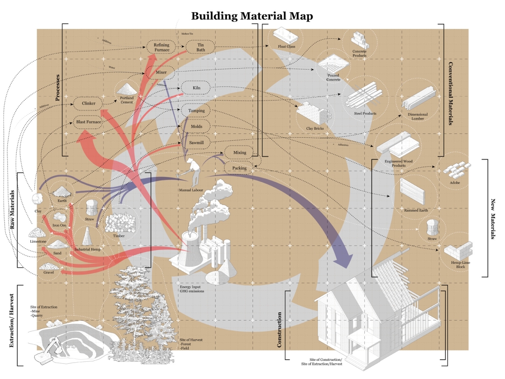
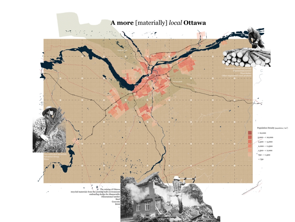
The building industry has come to rely heavily on the global supply chain with materials such as concrete, glass and steel becoming ubiquitous. From manufacture to construction, these materials adversely contribute to climate change. This thesis embraces a circular economy and uses data and design to inform how a hyper-local materials ecosystem for construction could be achieved locally; proposing how, over the next century, steps towards circularity can be achieved in Ottawa. By establishing hyper-local supply chains that only use materials local to the region, the goal of this thesis is for Ottawa to become minimally reliant on the global supply chain. Local materials in this case are defined as materials extracted from the Ottawa area and ones extracted from existing built structures. Through experimentation, prototyping, design, and research this thesis explores concepts and presents a design proposal that enables Ottawa’s future to become unshackled from the global supply chain.

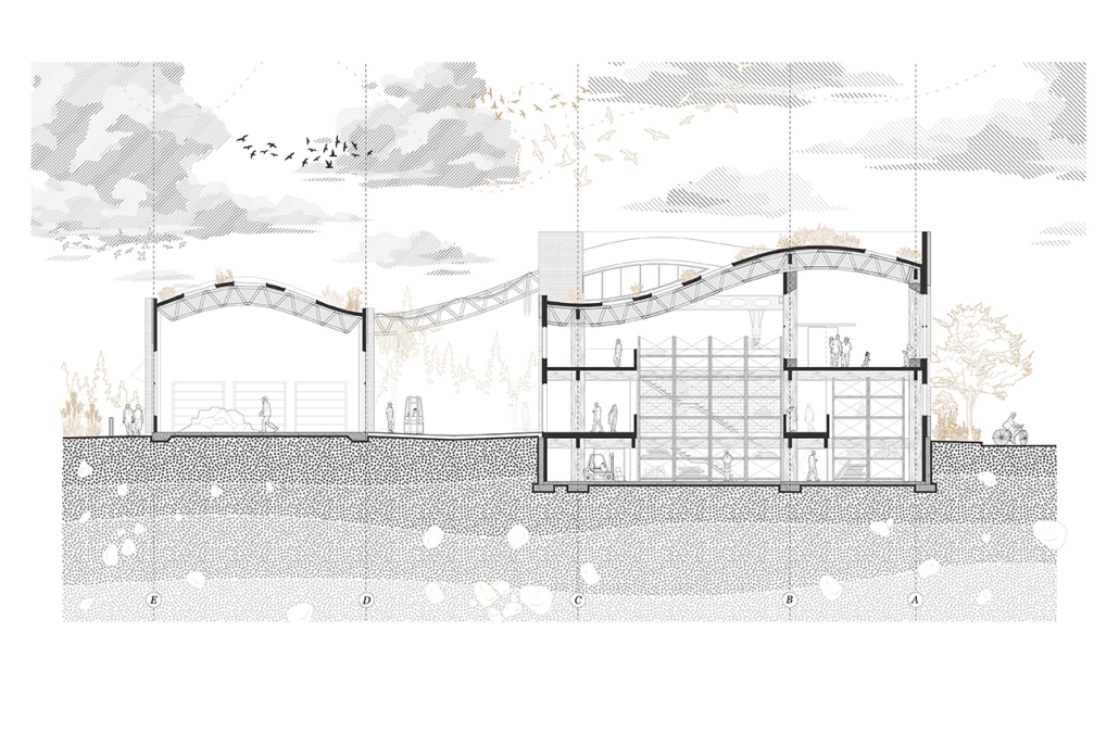
This thesis is separated into three distinct parts. Part I envisions a Regenerative Building Center that helps facilitate the move away from the Global Supply Chain. Situated on the footprint of a soon-to-be-demolished public works building in Ottawa, the design utilizes the existing foundation as well as other building components to create a center that espouses the ideas that this thesis stands for, bio-based local materials, radical reuse, design for disassembly and more.

Part II explores materials, locality, and supply chains, going in-depth on broader global scales as well as focusing on Ottawa. In this part, a rough account of potential materials diverted from landfill in the Ottawa area is taken, and local availability is assessed.

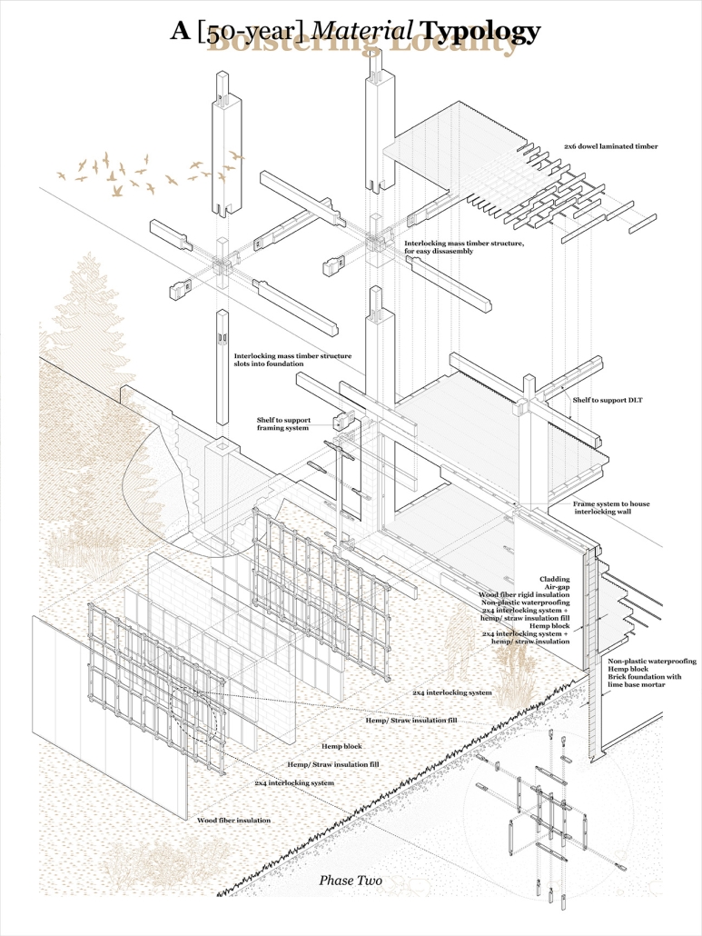
The last part, Part III imagines speculative futures, in the form of 3 distinct typologies each one 25, 50, and 100 years into the future. Here a future that is gradually less and less reliant on the Global Supply Chain is imagined, to the point where minimal reliance is required and Ottawa’s architectural ecosystem is fully circular and self-sufficient.

This project won the Maxwell Taylor Prize, through Carleton University’s Azrieli School of Architecture and Urbanism. It was also awarded the CAGBC Scholarship for Sustainable Design and Research, through the RAIC Foundation

Instagram: @frankhinoporos, @csaltarchitecture, @carleton_architecture

Aquatic Bio-Park: Harmonizing Public Space and Water Treatment by Andrew Hertz, M. Arch ’24
New York Institute of Technology | Advisors: Marcella Del Signore & Evan Shieh

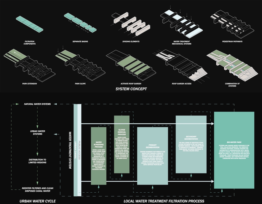
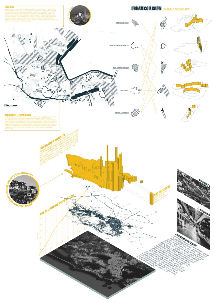
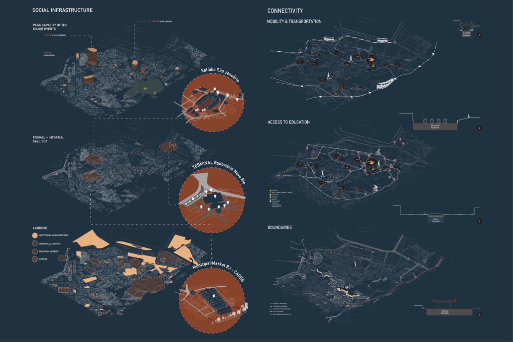
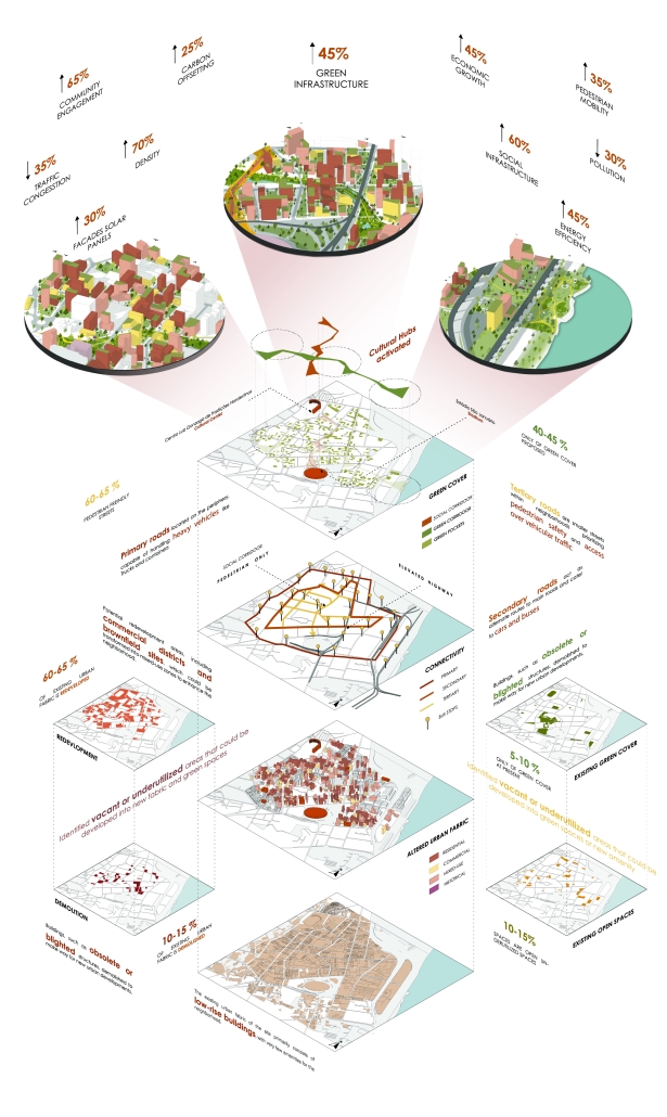
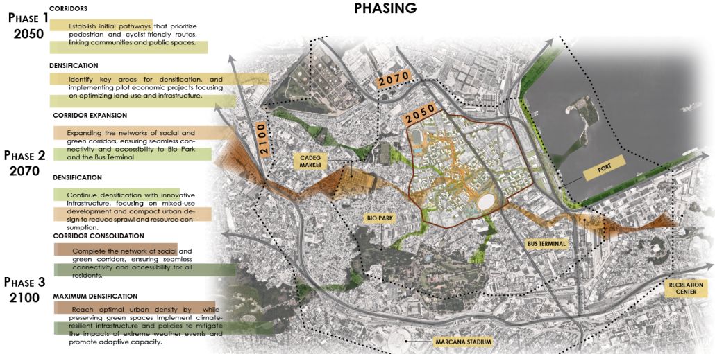
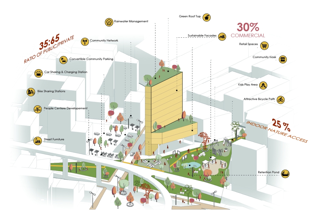
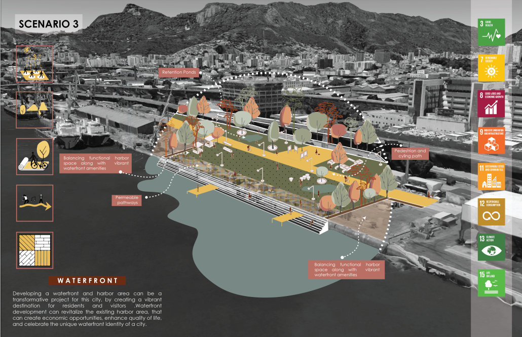
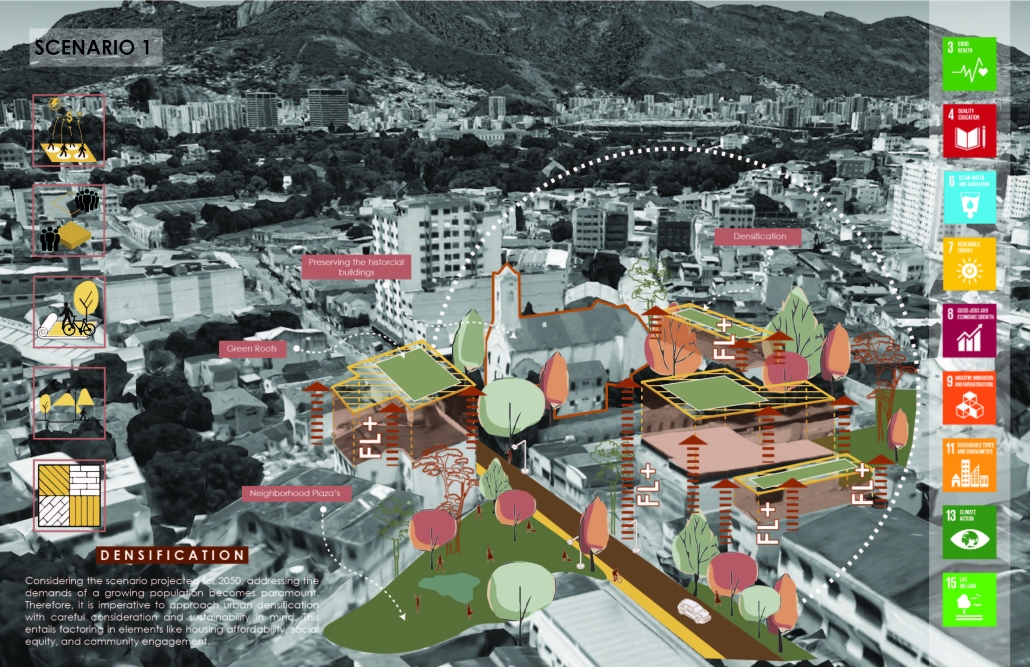
The relationship between water and the built environment continues to challenge designers. Water, although an obstacle in design, is a defining element among many urban environments; it influences ecology, building typography, social equity, social gathering and economy. Sao Cristovao of Rio de Janeiro, Brazil is no exception. 

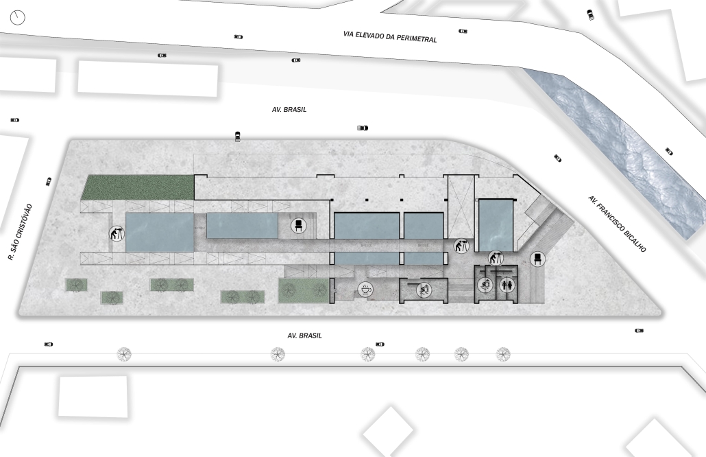
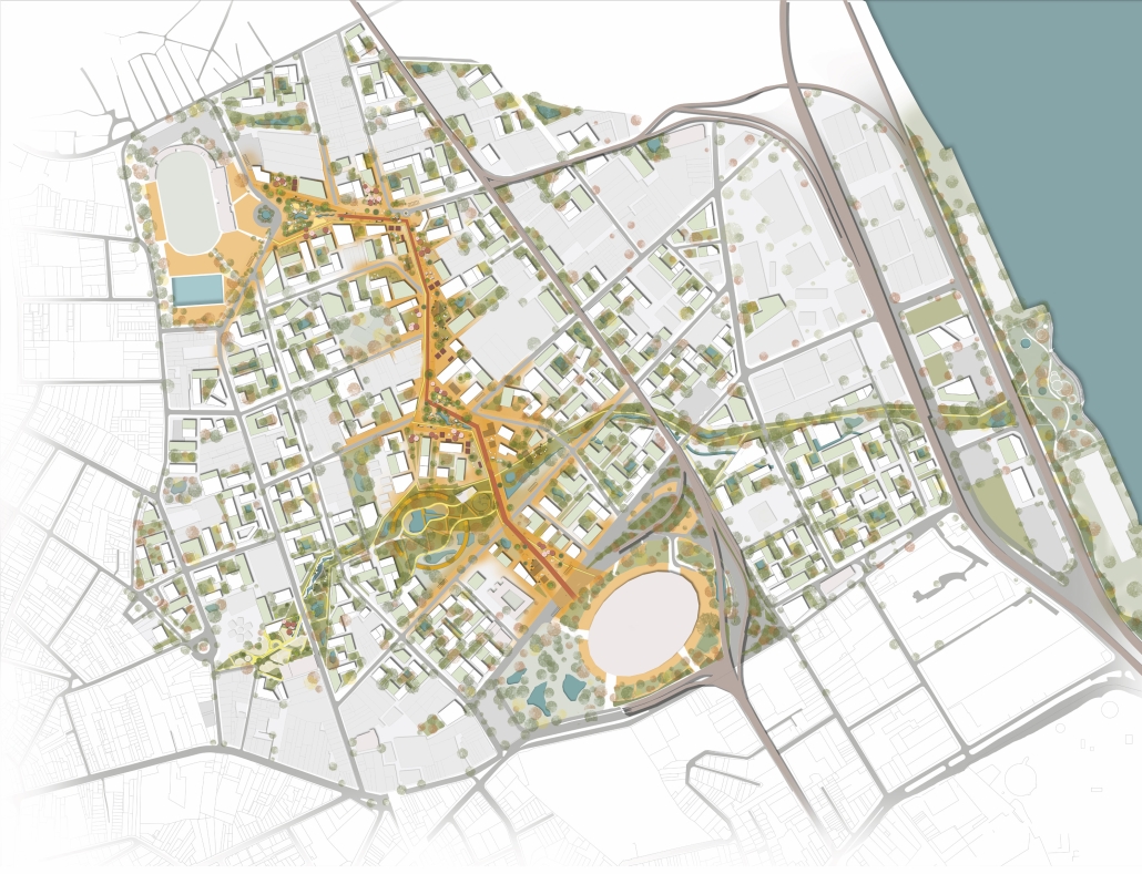
The Aquatic Bio-Park is designed to serve the community of Sao Cristovao. Rivers emanating from the mountains to the west merge with the city’s urban systems and canals and out to the Guanabara Bay to the east. The canals carve through the urban fabric, often running parallel to major roads, highways, and places of gathering and commercialism. While rich in culture and industry, Sao Cristovao’s inequities, access to urban systems and green space burden the community and environment.  

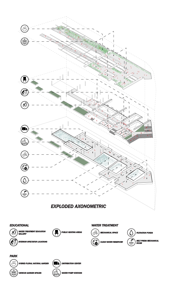
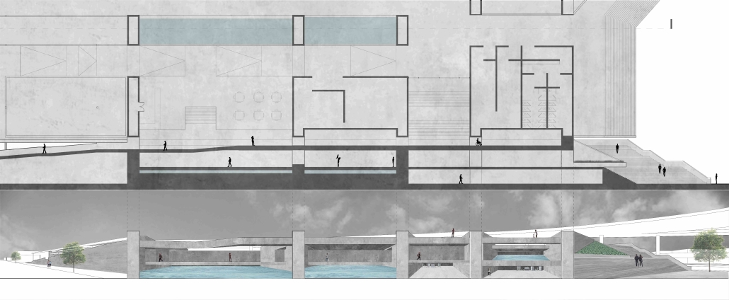
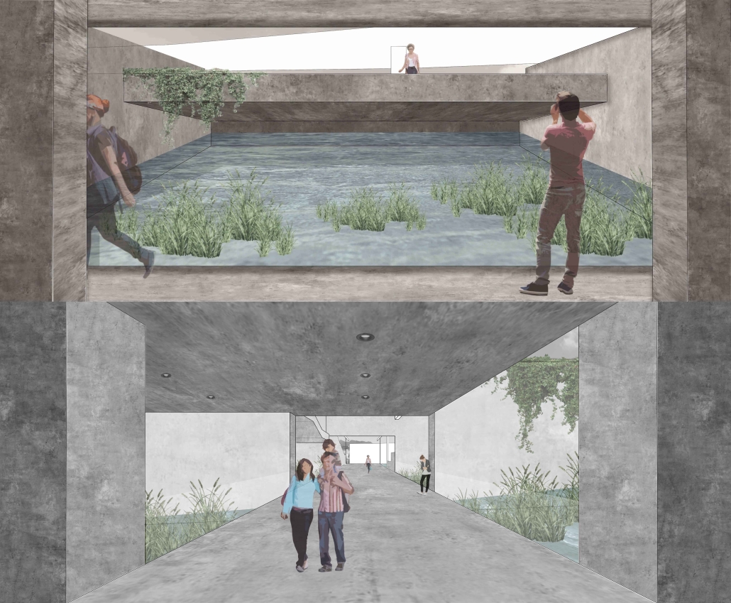
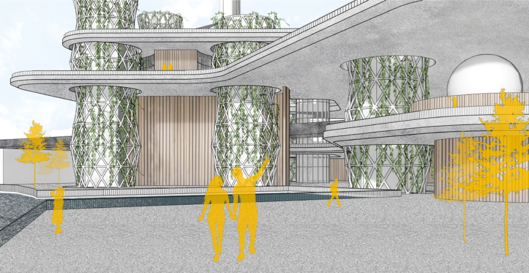
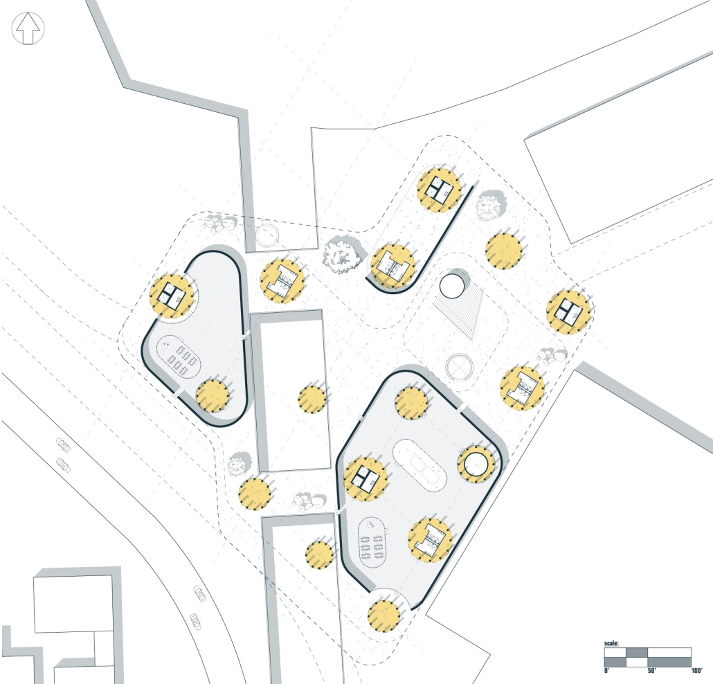
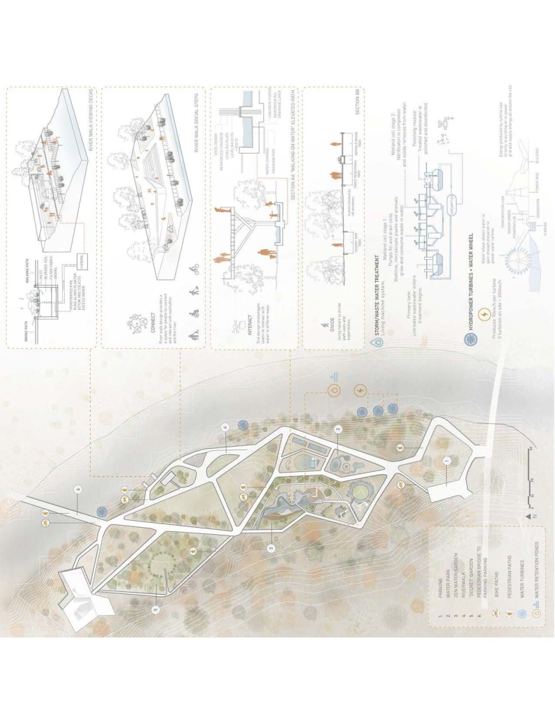
The bio-park addresses the challenges of inequity, access to water, purification of water bodies, urban heat, and so on. While confronting these issues, the bio-park also celebrates the local culture, ecology, and the utility of water. Using three different grounds: the lowest ground treats the canal water, which is channeled into the site, and purified through simulated marshlands through multiple filtration stages. The highest ground provides the public with open space, vegetation supported by the processed water, and visual connections to the filtration ponds below. Lastly, the middle ground merges the public space with water treatment. Bridging across the ponds creates a physical connection and understanding of the processes of filtration. At the destination of all grounds, whether water treatment, park or spectacle, they unify. At this point of celebration, the results of the journey are on full display: flourishing vegetation, purified water, and a place to gather, observe and learn. These grounds taper off into the urban landscape extending public space into the site. 

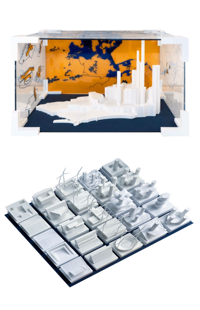
Throughout Sao Cristovao, there are numerous canals and implementation opportunities. Different canals carrying varying quantities of water can adjust the scale of each bio-park, as required. Servicing multiple areas throughout the region would theoretically reduce the urban heat concentration, provide public space and clean water, all while celebrating the culture and ecology of the local community. 

Instagram: @marcelladelsi, @ev07

Building Resilience: Innovative Architectural and Planning Strategies for Ecological Restoration in Qinghai’s Deserted Landscapes by Bochuan Zheng, B. Arch ’24
Rhode Island School of Design | Advisors: Junko Yamamoto & Leeland McPhail

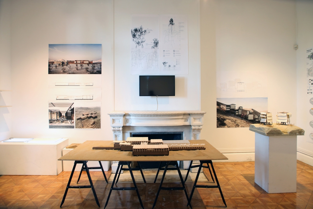
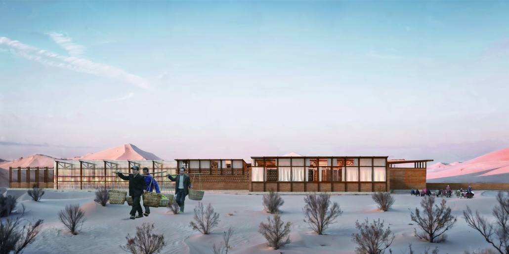
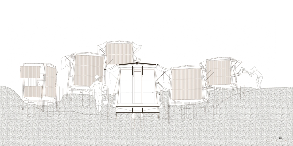
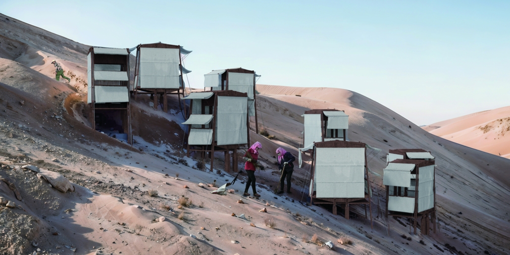
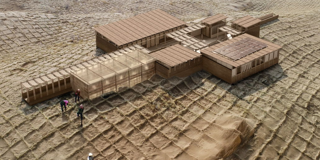
This thesis explores the interplay between architectural innovation and planning strategies for ecological restoration in Qinghai, China, a high-altitude grassland region severely impacted by desertification. The area, primarily dependent on herding, faces challenges from overgrazing, over-cultivation, and sparse rainfall, which threaten the livelihoods of pastoralists and lead to conflicts over resources like land and water. The study proposes integrated architectural and planning approaches focused on sustainable land management and resilient infrastructure development to mitigate these threats and ensure stable, sustainable habitats for local communities. Particularly, the research emphasizes cultivating two resilient plant species, Saxaul (Haloxylon ammodendron) and Cistanche Deserticola, which are well-suited to harsh climates. It details how tailored architectural solutions enhance planting efficiency and safety, accelerating ecological restoration and improving community living conditions. The findings provide a blueprint for addressing similar environmental challenges globally, demonstrating that merging ecological science with architectural and planning ingenuity is crucial for enhancing community resilience and socio-economic development and mitigating the impacts of desertification and climate change.

This project was recognized as a Thesis Award Nominee.

Instagram: @innerpeacechuan, @junkoyamamoto_, @risdarch

Stay tuned for the final installment, Part XVI!
2024 Study Architecture Student Showcase - Part XII

Now more than ever, sustainability is a top concern in architecture as we continue to witness the impacts of climate change. Part XII of the 2024 Study Architecture Student Showcase features projects that promote sustainable, eco-friendly practices.

From design solutions to reduce the production of harmful greenhouse gases to innovative use of green technologies such as rainwater harvesting, solar cells, etc), this showcase presents various strategies to address sustainability concerns. The featured projects seek to support not only humankind but the flora and fauna that share the planet as well. The award-winning designs also emphasize the importance of community preservation, integration, and education.

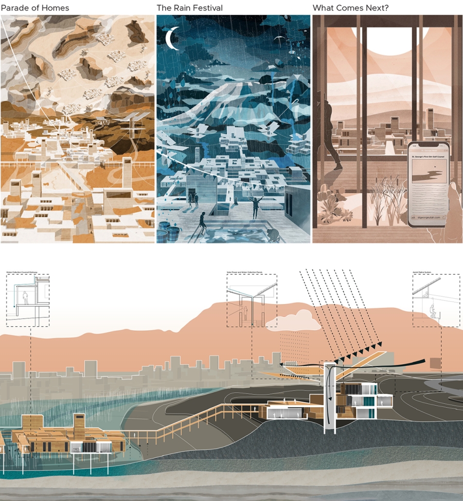
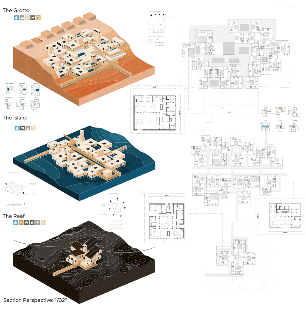
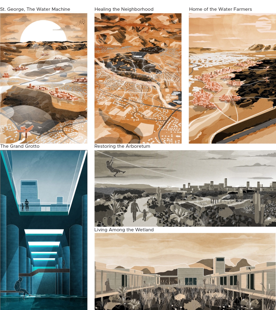
Spirit of Water, Empire of Sun Designing for Desert Living by Nate Dansie, BS in Architecture ‘24
University of Virginia | Advisor: Mona El Khafif

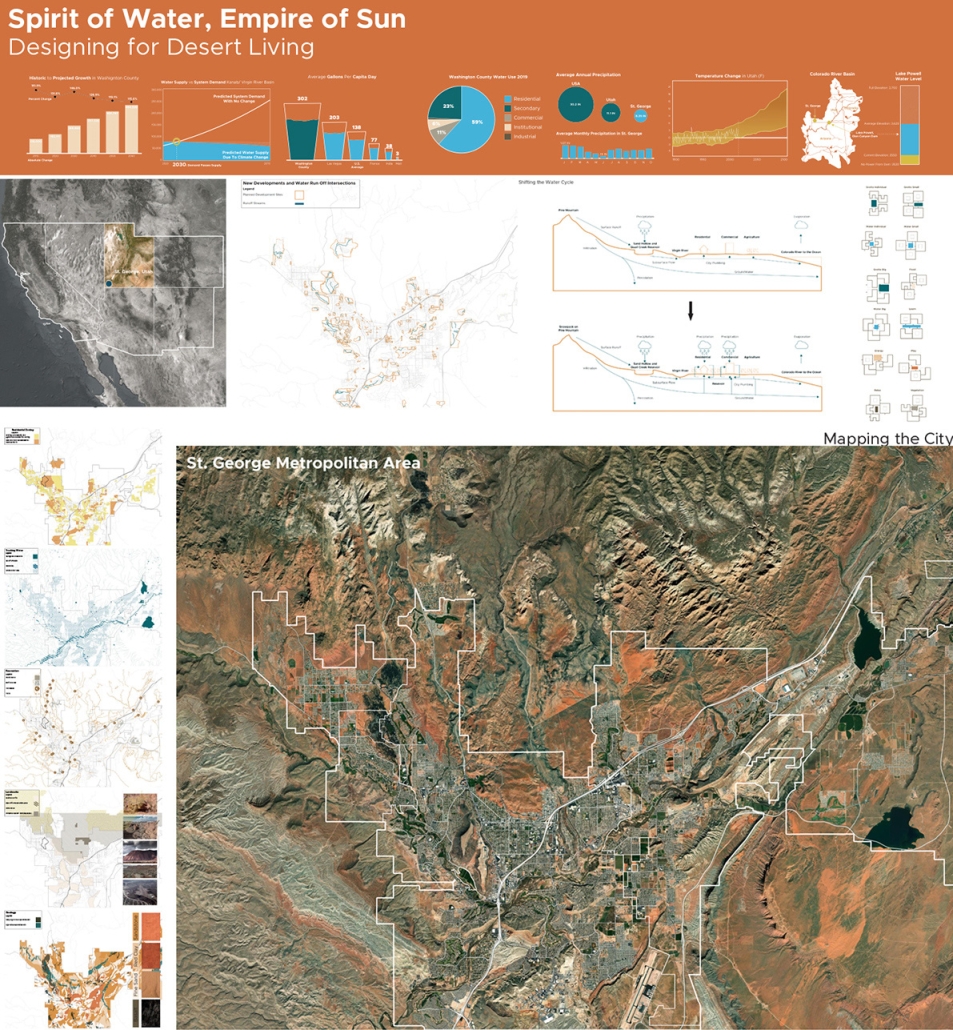
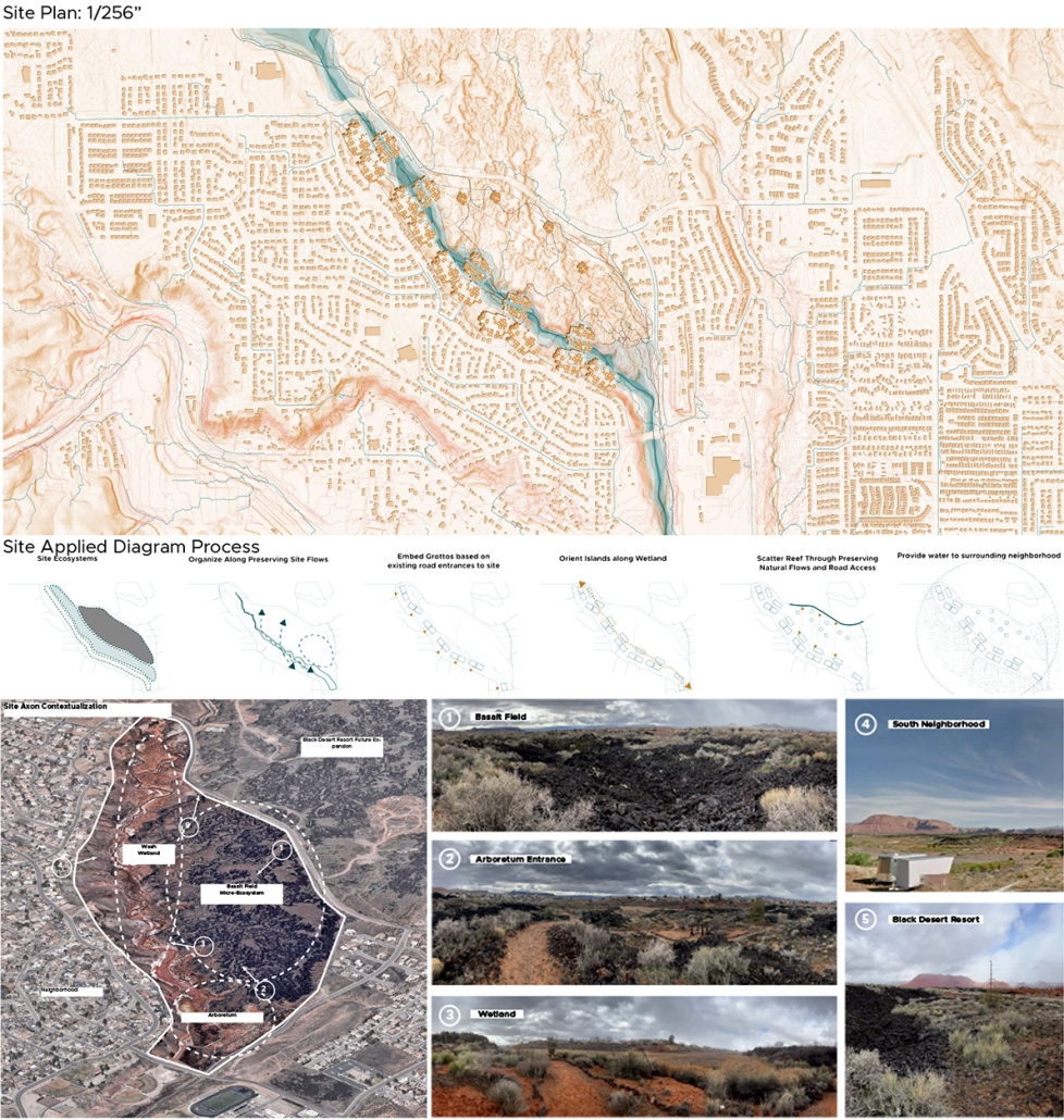
Historically, the Southwest [of the] United States has been defined as a place of rampant westward expansion by American citizens in one of the most iconic landscapes on this planet. Accelerated by the COVID-19 pandemic, the Southwest has gone through a renewal of rapid growth, where the landscape of mountains and sand has transformed from monuments of nature to backdrops for newly planned communities. 

Through a society driven by individual and economic success, these large development projects in growing towns are made as cheaply and quickly as possible. This becomes a plastic city in a landscape that is losing its identity as it continues to fill with more and more people. In hand with this increasing population, the Southwest is facing some of the most prominent climate change effects in the world. From rising temperatures, spreading desertification, and uncontrollable wildfire, to the most severe drought in the last 1,200 years, the future of desert living will be defined by how we adapt to climate change’s outcomes. This unsustainable growth of capital-driven small-town populations in juxtaposition to the increasing effects of climate change provides a dangerous future that we are heading towards. The city of St. George, Utah typifies these conditions and serves as the site for this thesis proposal. Known as one of the fastest-growing metro areas in the United States, it is dealing with one of the most severe water crises- with the demand for water expected to pass the supply by the year 2030.

The story of this town needs to shift from a one-directional water system into a cyclical and sustainable metabolism that addresses all scales of design. The proposed solution comes through a duality of increasing the water supply through a new master-planned housing typology at the community scale, and a sociological shift in our relationship with water through the architectural and individual scale to conserve what we have. We must reinvent how we live in a place to accommodate sustainable urban growth and amplify the original identity and ecology of the desert landscape.

This project was recognized as the Best Project of the 2023 Thesis Cohort.

Instagram: @natedansie.design, @aschool_uva

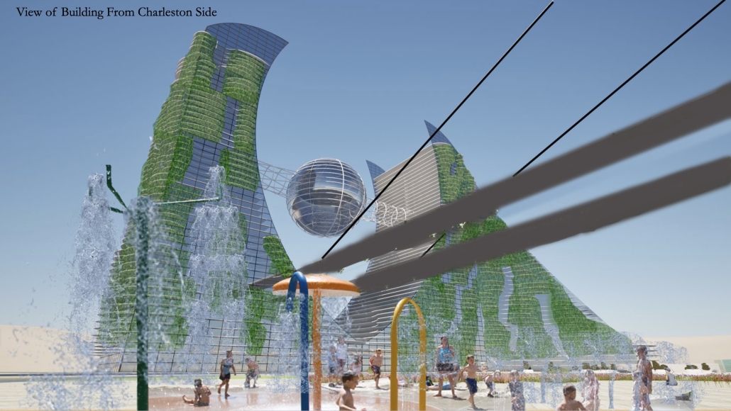
Skyscraper/ Megastructure Design Studio by Ko Harmes, B. Arch ’24
Endicott College | Advisor: Robert Augustine

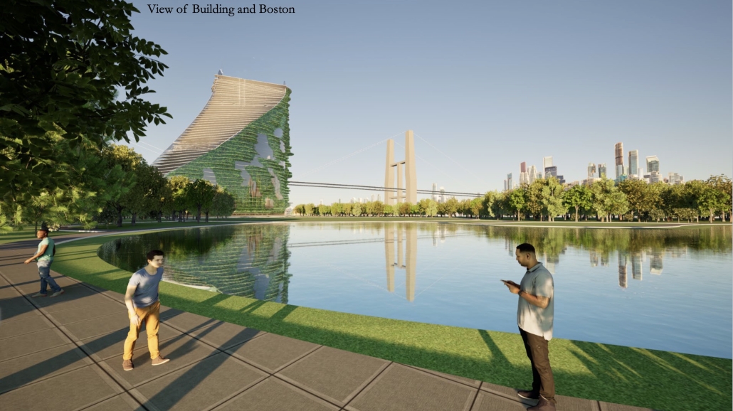
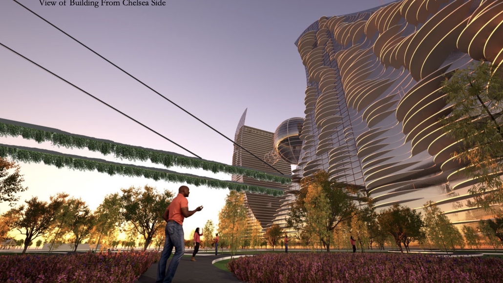
Concept Brief: Eco-Portal to a Sustainable Future in the City of Boston

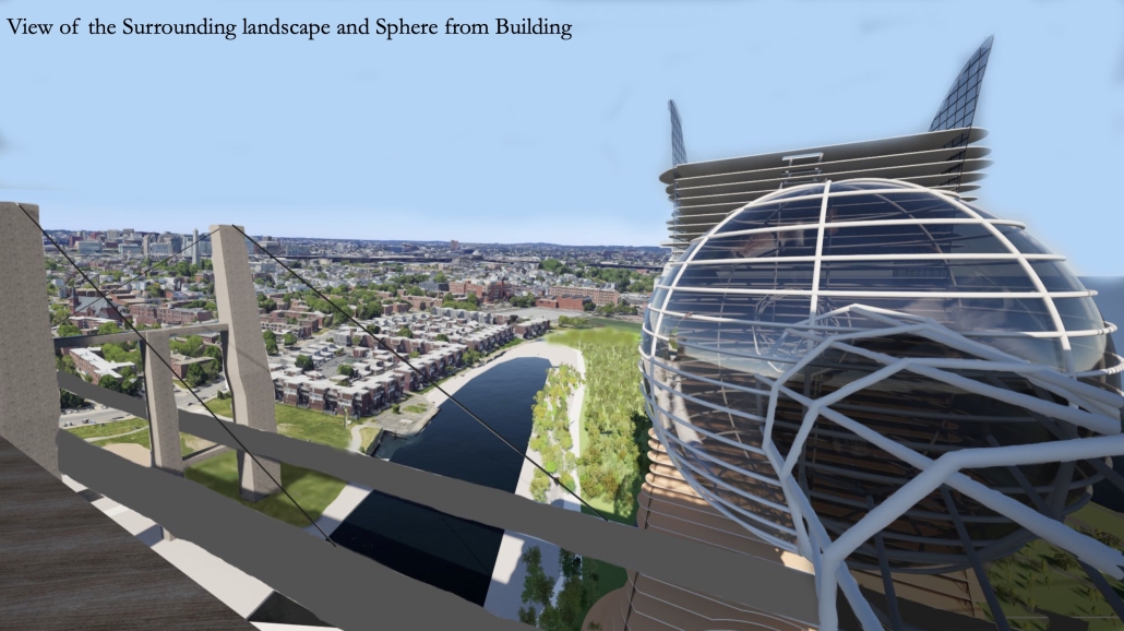
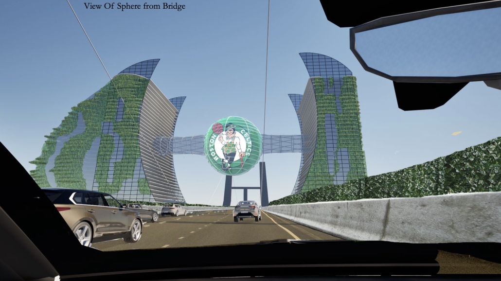
Located on a waterfront site, near the Charlestown Naval Yard, this advanced Mega Structure / Skyscraper / “Eco-Ark” serves as an inspiration for a sustainable, green future.

These two, organic-shaped, net zero towers, serve as stewards of the environment, featuring living green roofs and balconies that mitigate urban heat island effects. Special features include large, multi-story green-walled atriums, rainwater harvesting systems, and thin solar cell glass windows that generate over 25% of the power used by the facilities.

Built, in part, from the recycled remnants of the adjacent Tobin Bridge, currently slated for demolition, these organic-shaped towers celebrate advancements in environmentally responsive, sustainable, green technologies. 

The Site: One of potentially the most important landmark sites along Boston’s harborfront, the existing site can currently be described as mostly “a parking lot”… a hardscape/ industrial wasteland. The proposal re-establishs an eco-system that re-introduces nature back into this brittle area that once was home to native species of plants like the Sugar Maple, Eastern White Pine, Highbush Blueberry and Woodland Sunflower also helping re-introduce wildlife and pollinators back into the ecosystem.

Program: Mixed-use apartments, shopping malls, hospitality/ hotel space and a large informational eco-sphere / sky bridge, suspended between the two towers provide a green sky garden and a digital communication outer sphere. 

Structure

A mega core with an outrigger framing system, similar to that used in the construction of the Burj Khalifa, currently the tallest skyscraper standing today. The mega core system requires larger cross sections in addition to a shear wall that is part of a composite core or reinforced concrete. This allows for the system to have no column or shear walls on the outer perimeter because the mega core can resist all the vertical and lateral loads.

Facilitating Extrastructure by Reilly Walker, M. Arch ‘24
University of Toronto | Advisor: Jeannie Kim

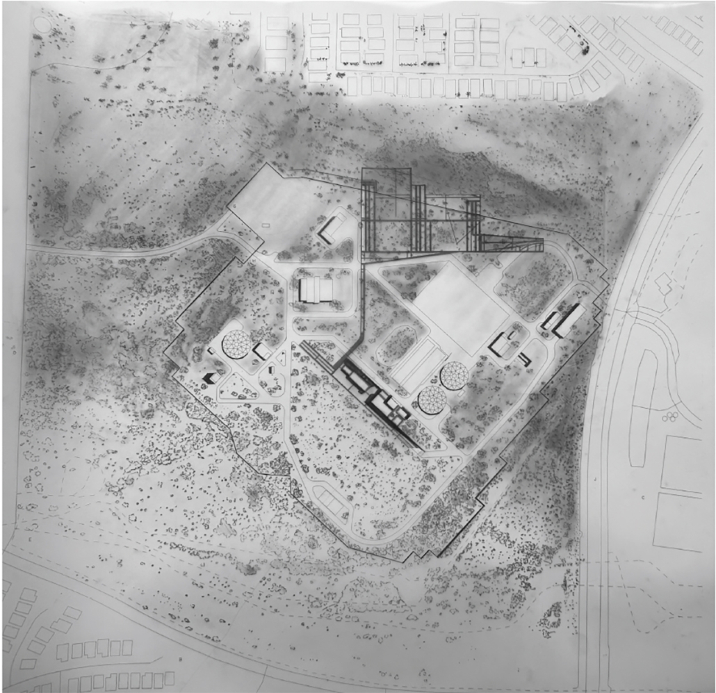
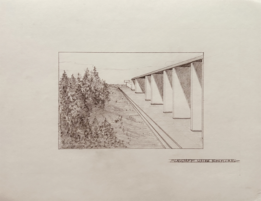
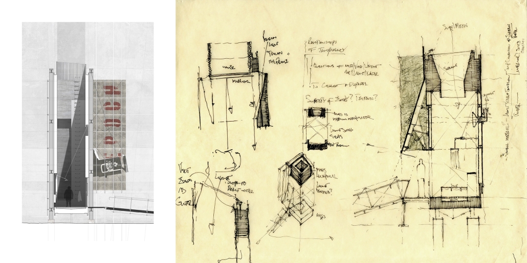
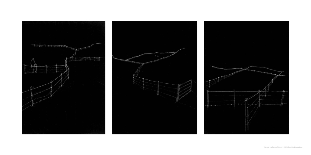
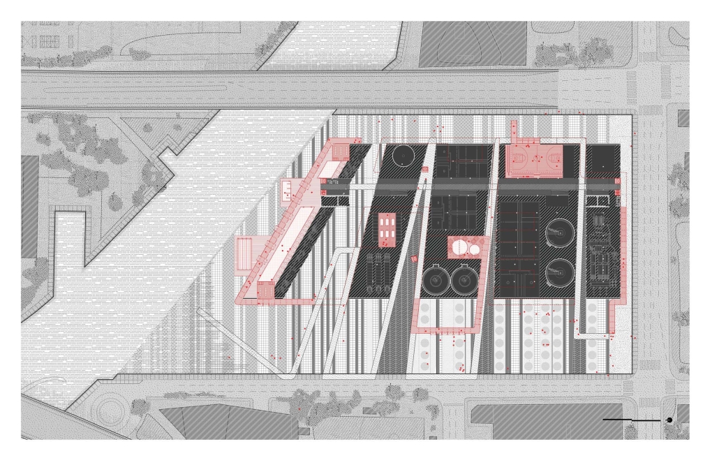
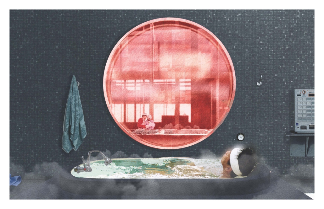
Amidst a megadrought, Arizona has announced water-saving plans that include direct potable reuse: upgrading municipal wastewater treatment facilities to produce effluent suitable for processing into drinking water. In this high-risk decision, how can these new additions create spaces that are interwoven with the communities they serve? This thesis focuses upon the fenceline as the experiential threshold of these typically off-limits facilities: interlacing fence and building to provide new vantage points; manipulating border and landscape to provide new visual access; and transforming the boundary into an infrastructure of maintenance and care.
Instagram: @reindustrial

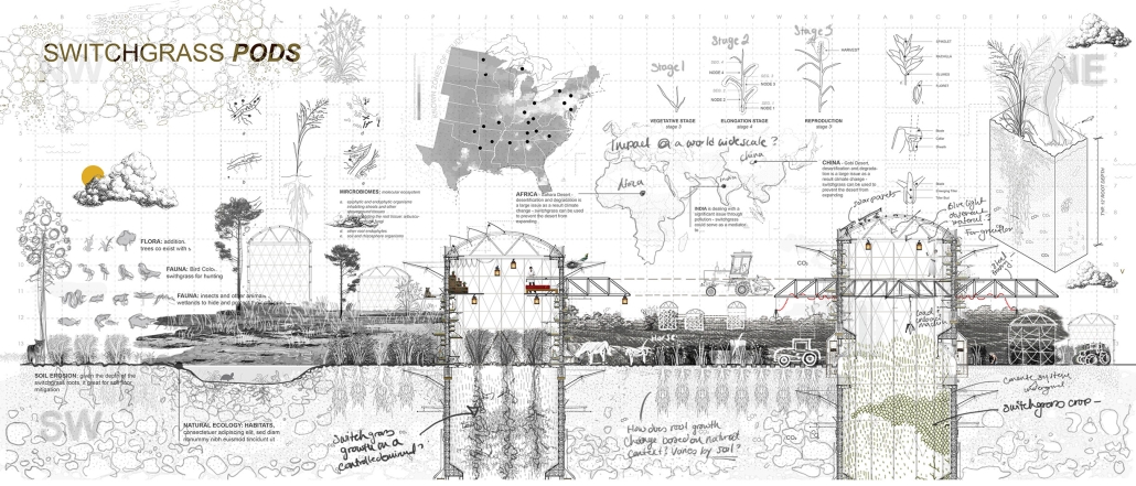
Village of the Levy: Switchgrass by  Brenda R. Castillo, B. Arch ’24
University of Houston | Advisor: Roya Plauche

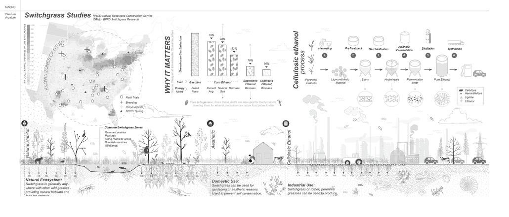
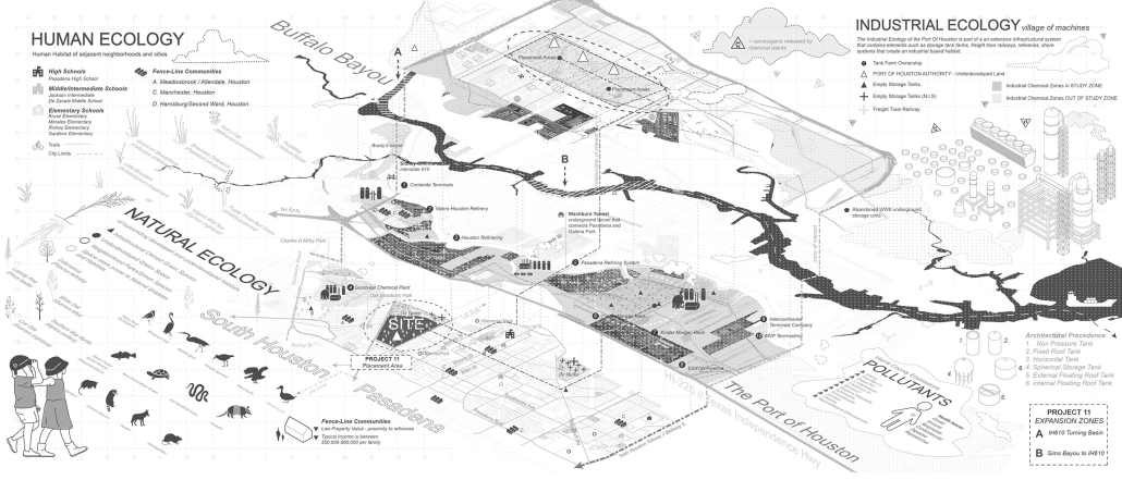
“The Village of the Levy” is a visionary project dedicated to nurturing and caring for the Earth by creating a machine composed of natural systems and ecosystems that fulfill environmental, architectural, and cultural roles. This project centers around switchgrass, a perennial grass with incredible potential for improving soil health, flood control, and carbon sequestration. Through detailed micro and macro studies, the project explores the morphology, structure, and growth of switchgrass and its suitability for producing cellulosic ethanol, an eco-friendly alternative to traditional ethanol sources.

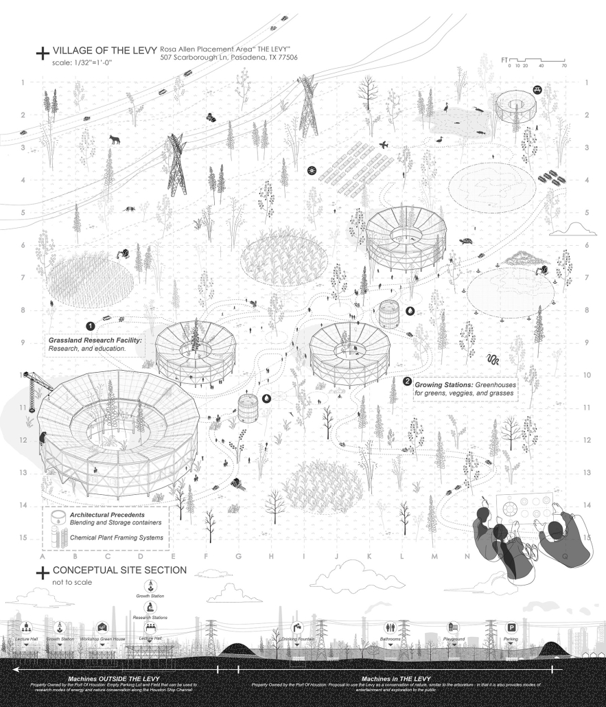
The project conceptualizes “Switchgrass Pods,” establishing a village of programmed framed systems within one of the many placement areas proposed by Project 9 on the Houston Ship Channel. These systems protest against the existing refinery infrastructure along Buffalo Bayou, highlighting the need for sustainable practices. The site integrates human, natural, and industrial ecology, by programmatically offering a research and nature center for the adjacent communities. 

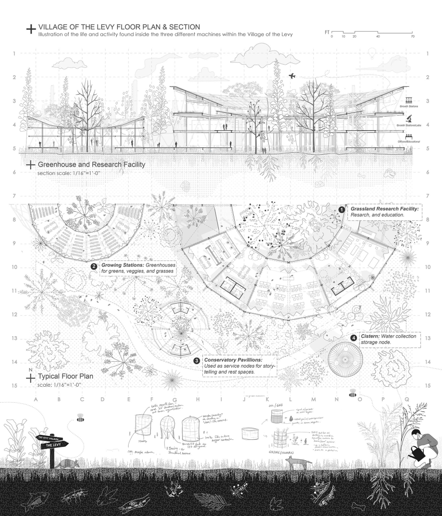
The project includes potential site planning and urban/architectural responses, culminating in detailed floor plans, sections, and isometric views of the “machines.” “The Village of the Levy” aims to create a system between nature and urban development, demonstrating the potential for ecological innovation in addressing environmental challenges.

This project won the Super Jury First Place prize.

Instagram: @brcarq, @rocio.arq, @royaplauche

ReGen Hall by Lexi Hudson, Saba Abdolshahi, Michael Alada, Dariya Fallon, Catherine Graubard, Marcell Hajmuhammad, Qin He, Ruiqi Huang, Zane Johnson & Sarah Rosseau, MSSD (Sustainable Design) / M. Arch / B. Arch / Chemical Engineering / Mechanical Engineering ’24
University of Texas at Austin | Advisor: Michael Garrison

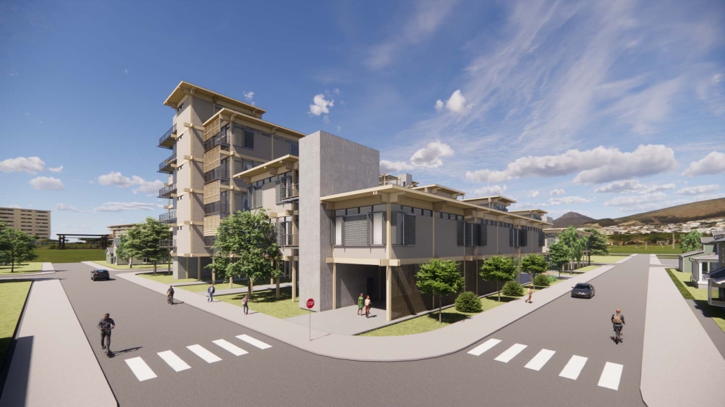
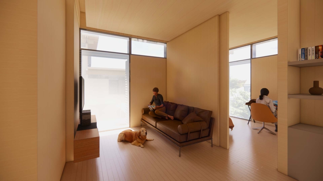
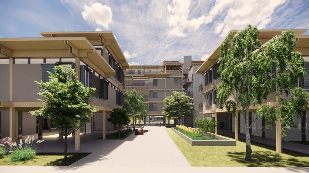
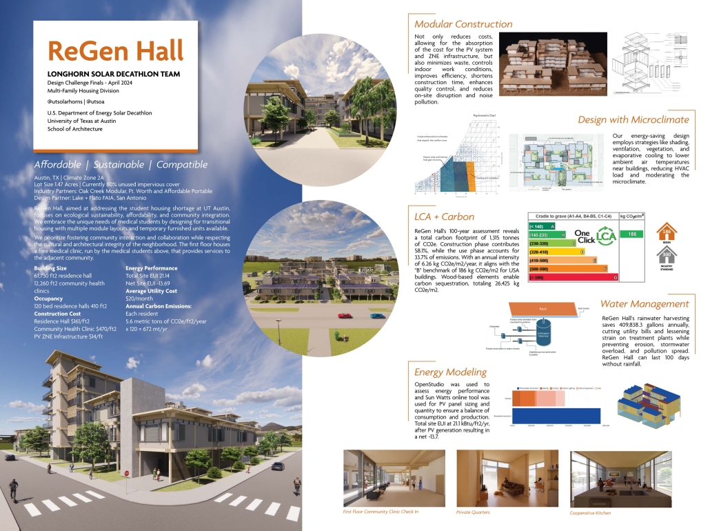
Addressing the pressing need for student housing at UT, ReGen Hall integrates ecological sustainability and affordability while meeting the housing requirements of Dell Medical students and the adjacent neighborhood. Positioned at a unique edge between Austin’s East Campus and the historic Blackland neighborhood, ReGen Hall prioritizes health through its design, program, materials, and environmental considerations. The design promotes collaborative living, encouraging community interaction and adaptability through interconnected spaces.

The design features seven courtyards, providing medical students with outdoor access and spaces for respite. Optimal cross-ventilation is ensured through thoughtful window placement and modular design, enhancing air quality within residences and communal areas. To accommodate varying schedules, bedrooms are equipped with rolling exterior shading systems for daylight control, while sound insulation was considered to ensure residents’ sleep quality. 

Sustainable practices are integral, incorporating Passive House level insulation as well as a photovoltaic system on the roof and western facade to achieve net zero operational energy. ReGen Hall exemplifies a holistic approach to sustainable architecture through both design and engineering.

Further enriching community engagement, the ground floor hosts a free clinic staffed by medical residents, offering essential services to the historically underserved Blackland neighborhood. The project’s modular construction reduces costs, absorbing the upfront cost of high-performance insulation and photovoltaics. Designed with consideration for neighborhood scale, the building steps in height from two stories along the neighborhood side to six stories facing the university, responding to community feedback for enhanced integration and preservation of local character.

This project was a 2024 Solar Decathlon Design Challenge Finalist. 

Instagram: @utsolarhorns, @utsoa

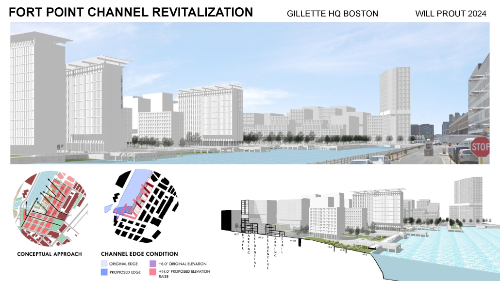
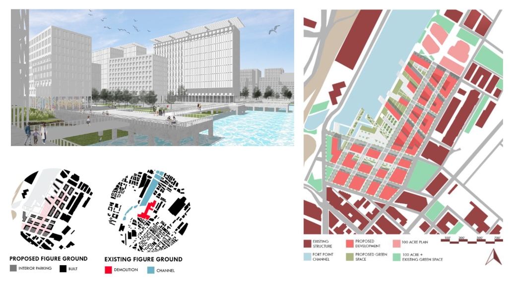
Fort Point Channel: Gillette Site by William Prout, BS in Architecture ’24
Roger Williams University | Advisor: Edgar Adams

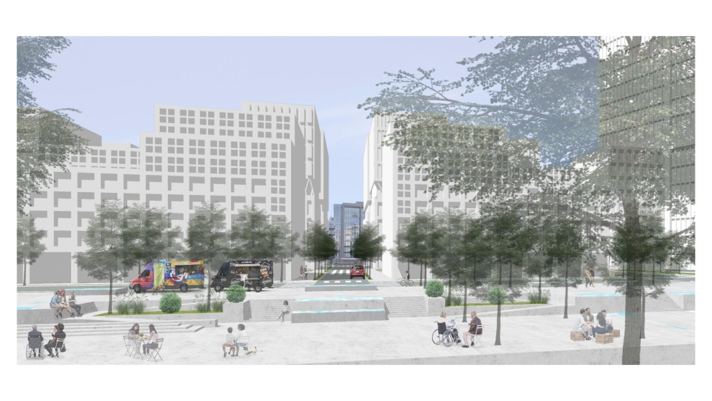
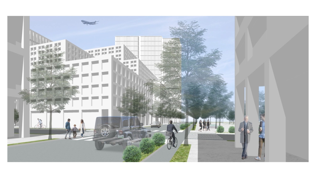
The planned movement of manufacturing facilities from Gillette’s Boston headquarters to a remote site provides a unique opportunity to explore the potential of this crucial site as an exploration of the issues of sustainable density and coastal resilience. The site is a vulnerable pathway for the flooding of the Fort Point Neighborhood and a crucial link between the Seaport and South Boston.

Suburban Symbiosis: Balancing Ecology and Economics in Suburban Development by Diego Courtney, M. Arch ’24
Lawrence Technological University | Advisor: Scott Shall

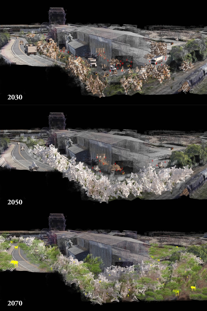
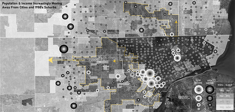
Following World War II, a mass exodus from cities to suburbs necessitated new building patterns that prioritized economics and speed over environmental considerations, changing landscapes and having a negative influence on ecosystems. This growth, which we now know as sprawl, combined with profit-driven motives, has led to an emphasis on quick, low-cost construction methods like stick framing, which frequently ignore the impact on the local environment and result in significant waste. In the profit-driven model, the residential development process begins with street layout, then lot/parcel maximization, with ecological and landscaping considerations as afterthoughts. This foregrounds the concerns of the car over the environment, prompting developers to sterilize the environment, resulting in fragmented habitats and homogeneous ecosystems that are detrimental to regional biodiversity. 

The consequences of this uncontained sprawl, which are already significant, will be exposed by the inevitable natural disasters, which are anticipated to become more frequent as a result of climate change. The current suburban development pattern is flawed, outdated, and unprepared for these environmental changes which we must contend with as architects.

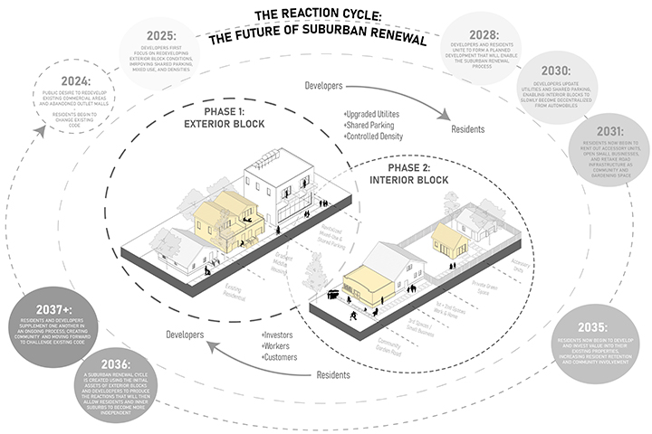
To investigate this concern, this thesis will investigate an alternative development pattern, tested within the parameters of a neighborhood located within the rapidly sprawling city of Austin, Texas. This development strategy is intended to balance economic needs with environmental sustainability, with the goal of establishing a widely adopted, US-based model that corresponds with current economic proformas while regenerating and preserving the surrounding ecology. This thesis aims to address the concerns of both profit and the environment by attempting to achieve symbiosis with the environment at the suburban scale using the Living Building Challenge.

Instagram: @diego_courtney, @scott_shall

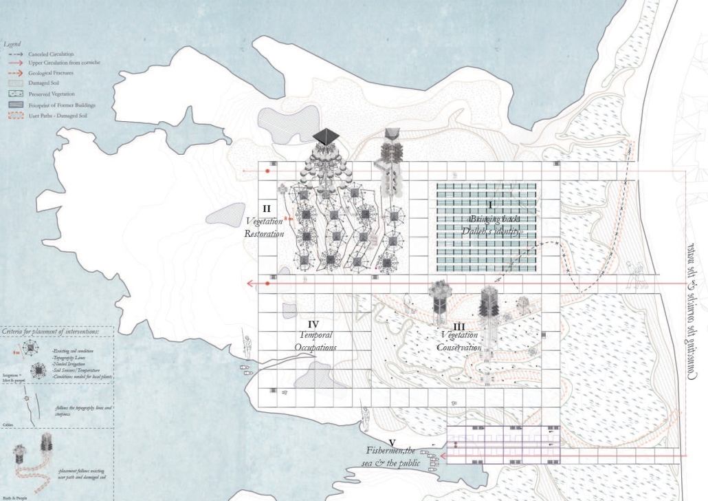
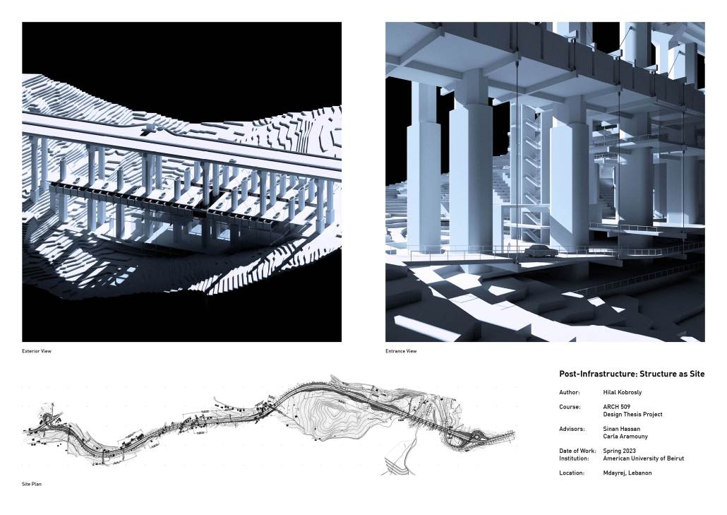
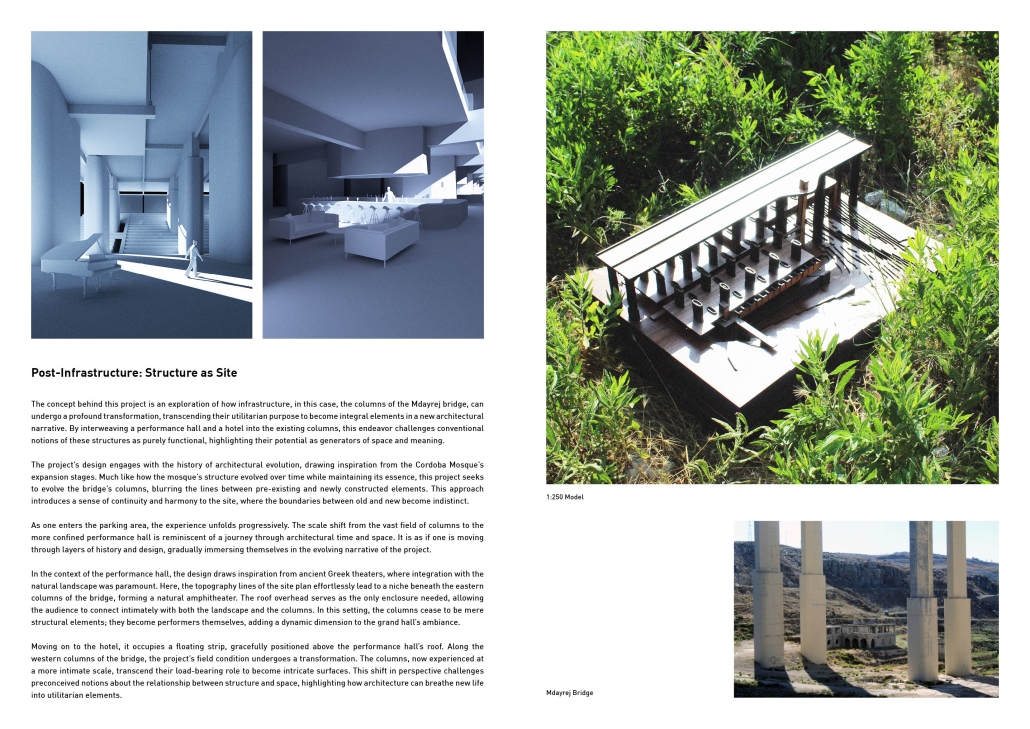
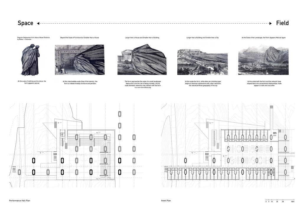
Choreography of Topography: Dalieh’s Calibrated Auto-Datum & E-co Interplay by Doria Doubal, B. Arch ’24
American University of Beirut | Advisors: Dr. Howayda Al-Harithy & Sinan Hassan

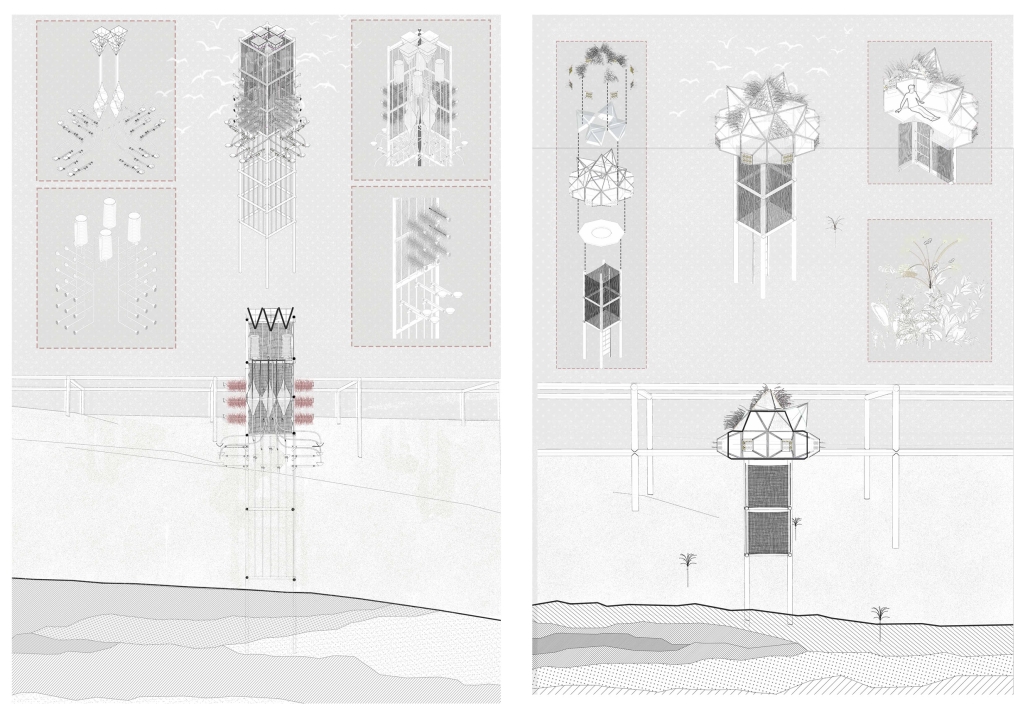
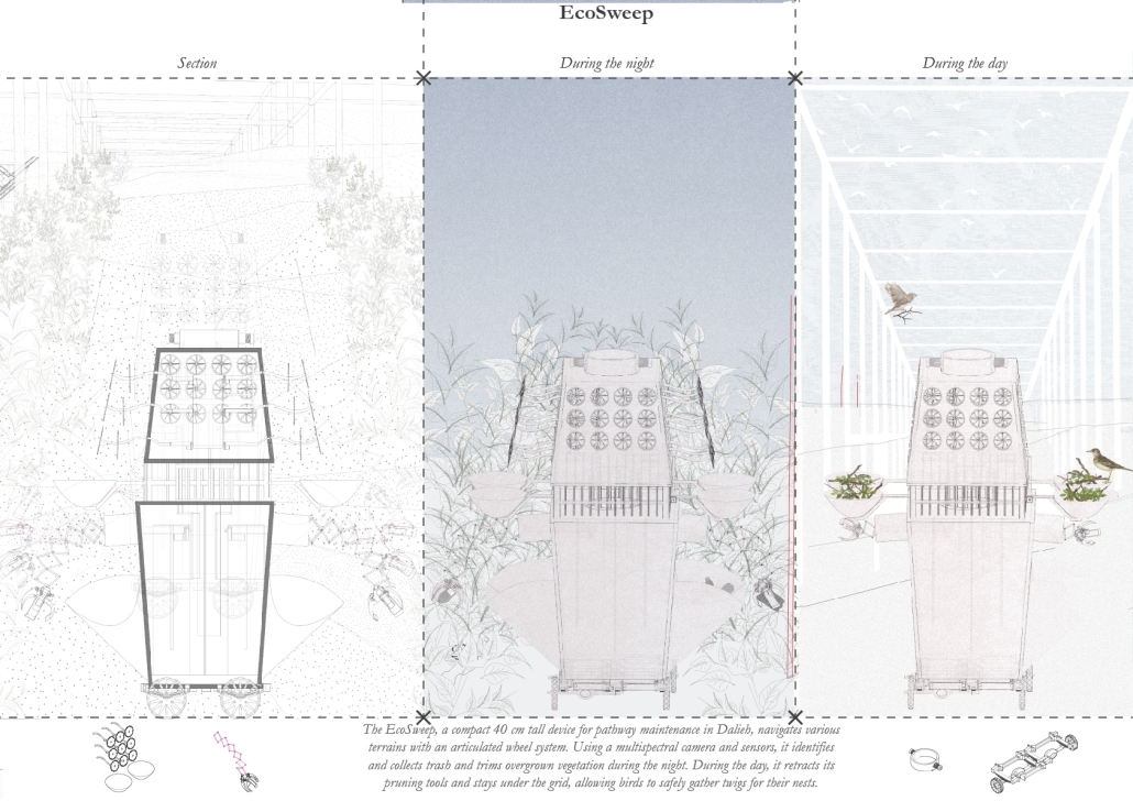
“Choreography of Topography: Dalieh’s Calibrated Auto-Datum & E-co Interplay” redefines the concept of ground by exploring its philosophical and spatial dimensions. Ground is not just a physical foundation but a dynamic entity influenced by the interaction of natural and artificial forces. This thesis examines Dalieh, a site in Beirut known for its historical significance as a vineyard, characterized by perpetual transformation.

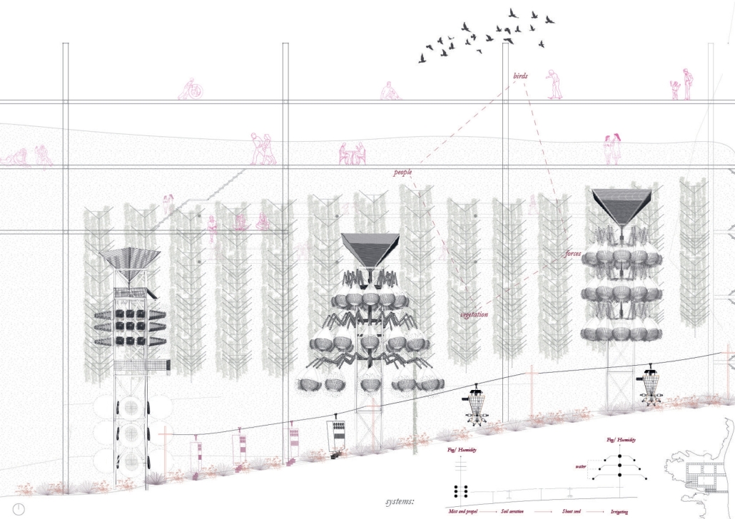
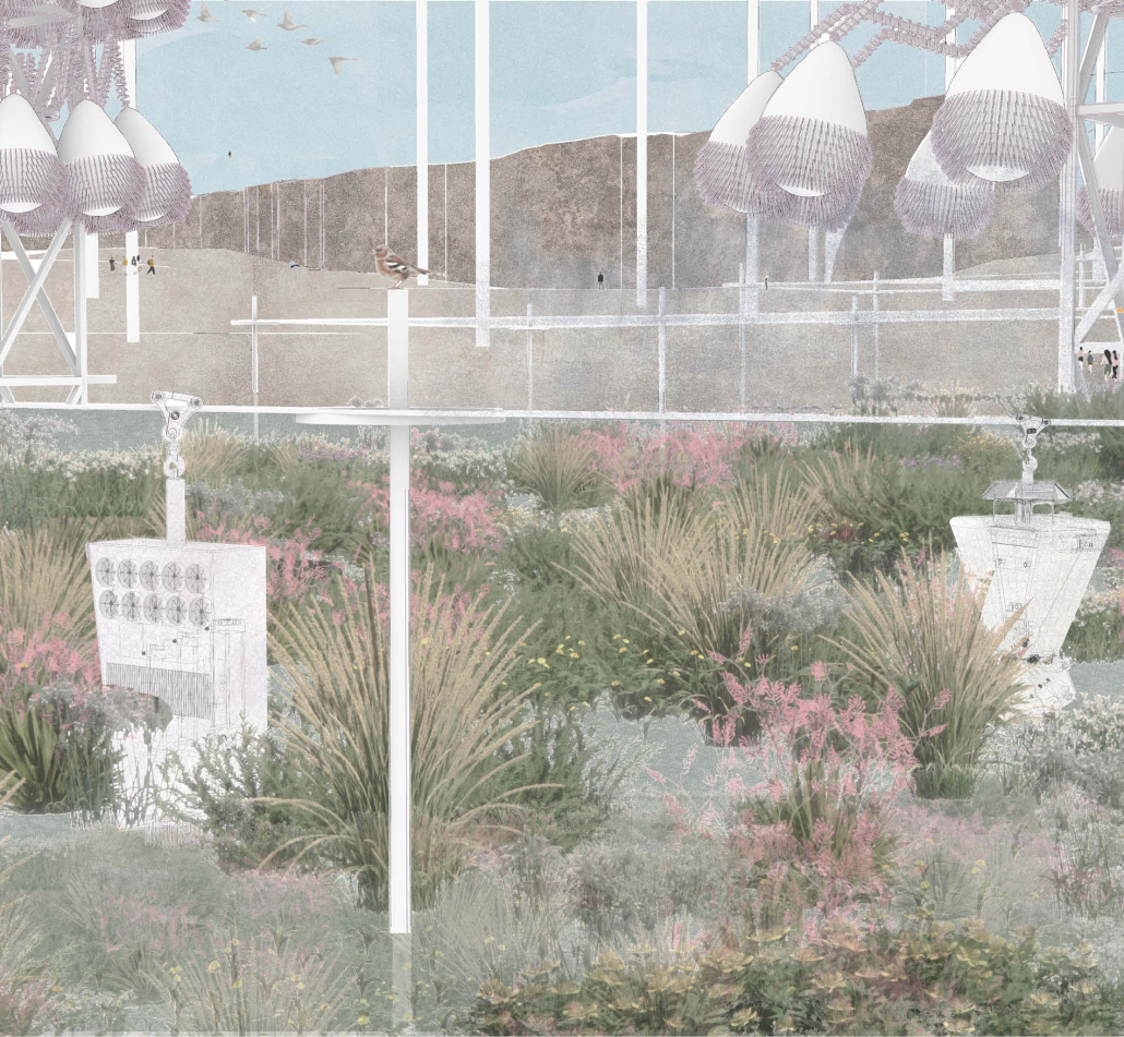
The architecture harnesses humidity for irrigation, uses solar and wind energy to generate movement, and incorporates systems that expand, contract, inflate, and deflate in response to environmental conditions.

Central to this approach are the metaphors of the pergola and fishnet, reflecting Dalieh’s identity and the daily lives of local fishermen. The interventions are connected physically and conceptually by a temporal grid put throughout the site that interacts with the ground, people, and birds. Key interventions include:

  1. Reintegrating Lost Identity: Revitalizing the site by planting a vineyard and restoring Dalieh’s historical significance as a “vineyard” in Arabic.
  2. Vegetation Restoration: Addressing areas ruined by construction, this intervention includes:
  • Mist & Propel: Harvests atmospheric moisture to cool the air and disperse seeds.
  • Eco-Kinetic Soil Revive: Uses kinetic mechanisms to aerate the soil and inject nutrients.
  • Seed Shooter: Disperses native seeds to promote biodiversity.
  • AquaBloom Irrigator: Collects fog moisture for irrigation.

These systems regenerate the soil and enhance flora and fauna for public use.

  1. Vegetation Conservation: Attracting birds and providing feeding and shelter areas, ensuring ecological balance and integrating human interaction through designed seating spaces.
  2. Fishermen Strip: Supporting the primary users of the site, this area creates a fluid connection between the corniche and the water, facilitating economic activities by day and transforming into cultural spaces by night.
  3. Temporal Grid: A flexible structure throughout the site, used by the public for various activities depending on the season, festivals, weather, and time of day.

This project embraces the temporality and ephemerality of Dalieh, creating an ever-evolving architecture that responds to the rhythms of nature and human activity. It reimagines ground as a multilayered, dynamic entity, fostering a harmonious interplay between the environment and its users.

This project was the 3rd Place Winner of the Areen Projects Awards for Excellence in Architecture.

Instagram: @ard_aub

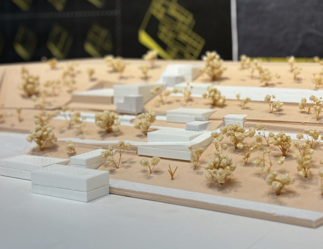
From Waste to Wealth: Food and Community Nexus by Fatema Dula & Rachel Aronbayev, M. Arch ’24
New York Institute of Technology | Advisors: Marcela Del Signore & Evan Shieh

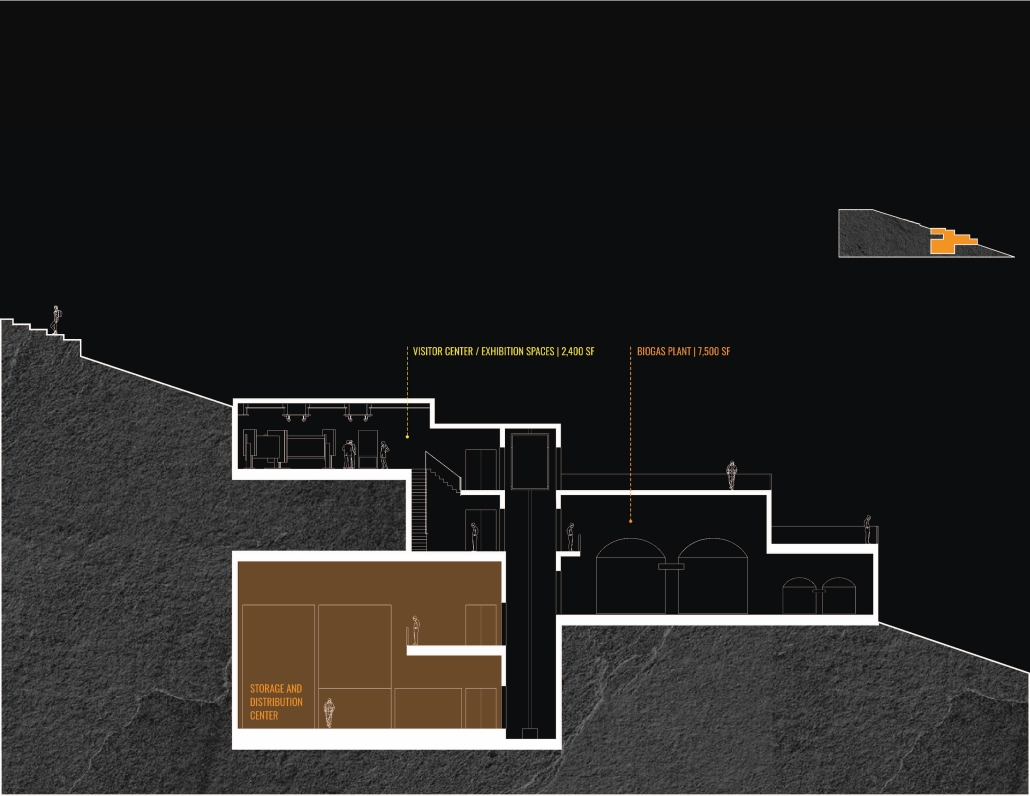
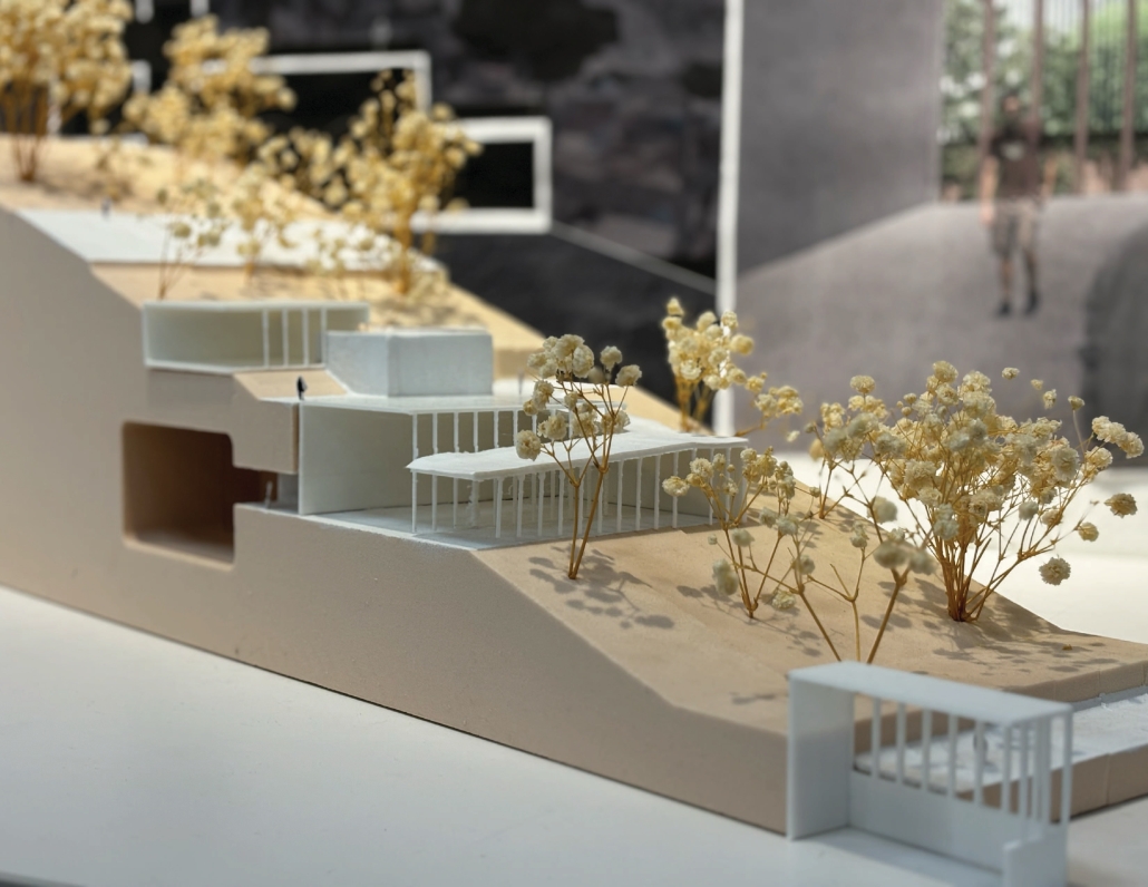
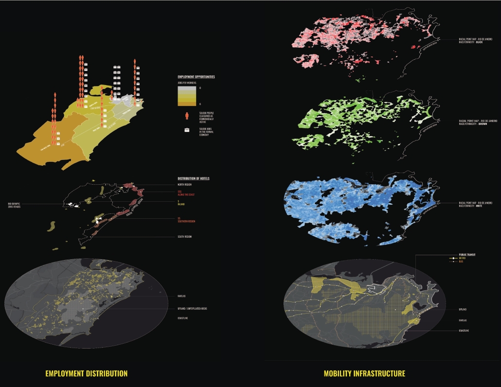
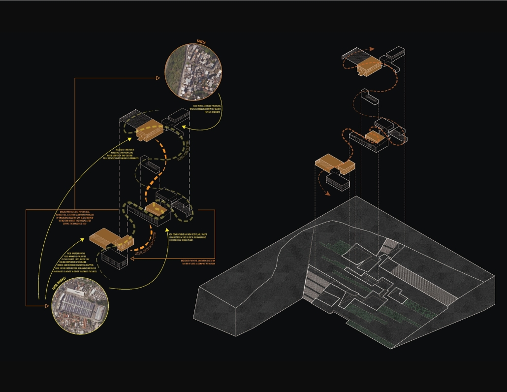
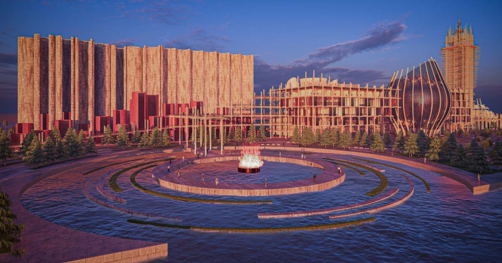
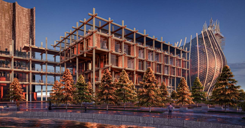
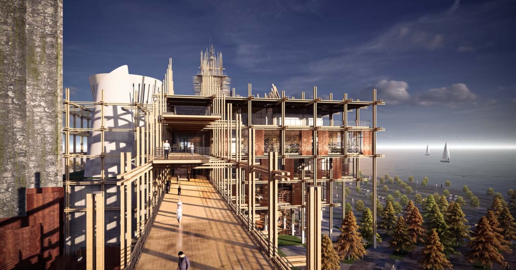
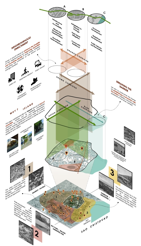
The food waste processing facility is strategically designed to bridge both the literal and metaphorical divide between the hilltop favela residents in São Cristóvão, and the bustling food market below, a critical cultural hub. Situated on a hill, the facility not only connects these separate communities but also aims to serve as a vital nexus, enhancing interactions and mutual benefits between the informal settlements and the market. The facility is envisioned as a symbol of unity, sustainability, and progress, bringing together diverse groups for a common purpose.

The building is structured into three clusters, each dedicated to a specific treatment type: Composting, Anaerobic Digestion, and Recycling. Within each cluster, there are three distinct areas: a waste zone for processing, a communal area for collaborative activities, and a recreational space for leisure and relaxation. The design of these clusters ensures that the facility is not just a processing plant but a community center that encourages participation, education, and engagement in sustainable practices.

The three clusters are linked by a versatile circulation path that ranges from fully outdoor to semi-outdoor and indoor segments, enabling traversal from the hilltop down to the food market level. This path is designed to be accessible and inviting, with shaded walkways, benches, and educational signage about waste management and environmental stewardship. It serves as a continuous thread weaving through the facility, fostering a sense of connection and flow.

In addition to its primary function of waste processing, the facility is intended to host workshops, community meetings, and educational programs focused on sustainability. It aims to empower residents with the knowledge and tools to reduce waste, recycle more effectively, and participate in a circular economy. Through these initiatives, the facility aspires to create a more resilient and interconnected community.

Instagram: @fatty_2109, @marcelladelsi, @ev07

Natural Reflection: Reducing the Environmental Impact of Architecture through Biomimetic Design by Keenan Doricent, B. Arch ’24
Kennesaw State University | Advisor: Robin Puttock

The use of biomimetic design can be used to develop construction techniques and integrated building systems that reduce the increased amount of operational and embodied energy consumed by contemporary approaches to building. Factors like material production, site preparation, and equipment use are just a few examples of contributors to the amount of embodied energy consumed by a structure before it is even completed, while active building systems consume energy throughout the life of an occupied building. Because of greenhouse gasses, the long-term effects of historical and current architectural and infrastructural strategies have had a detrimental effect on the climate. The forest, desert, tundra, mountain, and aquatic biomes are all home to countless types of plant and animal life that adapted to their respective surroundings to become a part of the natural cycles that occur within any given area. This thesis project strives to study plants and animals that occupy and interact with the environment in order to reduce energy consumption and the ecological footprint of typical buildings.

This project was a finalist for the ARCC King Student Medal Award.

Instagram: @thenumber1fun, @xkdesign1

Powering Equality: Teaching Clean Energy on Multiple Grounds by Sabrina Innamorato, M. Arch ’24
New York Institute of Technology | Advisors: Marcella Del Signore & Evan Shieh

Due to the complex nature of the São Cristóvão neighborhood, in-depth research and an understanding of the mounting spatial and social issues were paramount prior to the development of an urban intervention for the city. Resiliency and vulnerability at the urban and human scale were analyzed through three interconnected lenses: social/cultural, environmental/ecological, and infrastructural/networked.

The proposal looks to develop public, peaceful nodes that operate on “urban collision” sites by hybridizing clean energy infrastructure with social programs. The proposal transforms former “pass-through” sites into places that are productive and social.

The concept is to allow the site context to inform an organizational armature. Building near the coast requires an attitude about not just having multiple floors of a building, but also about offsetting multiple ground planes. A diagrid column system acts not only as the main structure but also creates light wells and, at times, is occupied by supporting programs like egress cores or plumbing chases. There are a series of small pavilions for 5 clean energy systems: Geothermal, Hydro, Biogas, Wind, and Solar. The systems function on the site and the pavilions include teaching space to inform community members and stakeholders about the operation and importance of clean energy, while the space between is a public park. Ultimately the project is an infrastructural playscape.

Through a series of teaching pavilions, observable clean energy infrastructure, and public green space, the architecture provides a physical ground for knowledge building, where community members can become ambassadors for spatial and social change in São Cristóvão and beyond. The project looks to acknowledge and adapt to the already irreversible effects of climate change by offsetting and creating multiple grounds that anticipate and accept sea level rise, and simultaneously address the importance of mitigating future climate change. The park is a prototype for a larger strategy that can begin to bridge social and spatial divides and heal communities at an urban scale, by teaching clean energy on multiple grounds.

The project was presented at NYCxDesign 2024 Student Showcase at F.I.T., and the cartographic model was exhibited at Salone del Mobile in Milan, Italy, along with the Gold Certificate of Excellence in Design and the ARCC King Medal.

Instagram: @sabrinainnamorato, @si_archidesign, @marcelladelsi, @ev07

UrbanSymbio by Bharat Satish & Nicholas Reid, M. Arch ’24
New York Institute of Technology | Advisors: Marcella Del Signore & Evan Shieh

The UrbanSymbio can be viewed as a self-sustaining and carbon-neutral organism that coexists harmoniously with its surrounding urban environment, promoting energy circularity in São Cristóvão. Its growth is guided by the cellular automation algorithm, which mimics natural processes of organic growth and adaptation, ensuring a sustainable and efficient use of resources. Like living organisms that evolve in response to their environment, this kit of parts expands and transforms itself based on the changing needs of its inhabitants and the available space within the urban fabric.

Its modular and flexible nature allows it to seamlessly infill and occupy underutilized or vacant spaces, repurposing and revitalizing them without causing significant demolition or displacement. This minimizes waste and maximizes the use of existing resources. The system’s self-organizing capabilities and sensitivity to changes within itself and its surroundings enable it to grow sustainably by utilizing renewable energy sources and implementing circular processes that minimize resource consumption and carbon footprint. Its adaptive nature ensures that as the city evolves, the system can continuously reconfigure itself to optimize energy efficiency and resource utilization, avoiding the creation of obsolete or redundant structures that contribute to urban blight and environmental degradation. This system could act as a prototype that could be implemented in any city worldwide.

Instagram: @0ero_persepctive, @unruly.don_, @marcelladelsi, @ev07

Dataism Motion Exhibition Center by Begimai Baibachaeva, B. Arch ’24
Boston Architectural College | Advisors: David Eccleston & Robert Gillig

Location: 40 Commercial St, Portland, ME 04101 

Project: Exhibition Center

Site Description: Portland is a center of connectivity, equity, sustainability, and authenticity. Portland’s Eastern Waterfront is one of the primary economic hubs that serve as a center for travel, fishing, commerce, and shipping. Thus, it’s essential to continue supporting the waterfront in a rapidly changing world. The concept of the project is to revive Portland’s waterfront while celebrating its heritage and innovation. 

Considering that our site is a center of various activities, my vision was to create a seamless connection between the distinct boundaries of land and water, particularly through the exhibition hall experience, visually at the heart of the building. But also mimicking the freedom and fluidity of water, envisioning a scenario where these two natural elements (land and water) coexist harmoniously. The approach included providing people with access to water through strategic landscape design.
Concept: The architectural thesis envisions a dynamic synthesis of Umberto Boccioni’s “Development of a Bottle in Space” and the progressive essence of artificial intelligence, merging seemingly disparate concepts through the lens of time and motion. Set in Portland, Maine, the design employs curves in both the facade and interior spaces, integrating intelligent program design and enhancing the user experience. The primary structure, a space frame, supports the organic design, while a cylindrical curtain wall pays homage to Boccioni’s sculpture, marrying the rhythmic dance of form with the seamless interconnectivity of data.

This project received Commendations: Bachelor’s Degree Project in Architecture and the Edwin T. Steffian Centennial Award: Bachelor’s Degree Project in Architecture.

Instagram: @begimay_b_, @thebacboston

Walking with Gentle Giants by Manshi Manojkumar Parikh, M. Arch ’24
Boston Architectural College | Advisor: Ralph Jackson, FAIA

Humans have long sought to dominate and exploit every corner of the planet. As civilization advances, coexistence with other species becomes increasingly dystopian thought. Humans have harmed the environment and imposed our presence on the voiceless, including the majestic Asiatic elephants, who face abuse and exploitation, with some populations nearing extinction. Elephants act as ecosystem architects, playing a vital role as keystone species in creating forests and maintaining biodiversity. The endangerment of these critical species signals a potential loss of other interconnected species, jeopardizing nature’s essential services. Preserving nature and developing strategies to adapt to climate change is crucial for the survival of endangered species. Caring for animals and plants is about safeguarding the Earth’s natural caretakers. 

At the beginning of the last century, the world had 100,000 Asian elephants. Over the past three generations, their population has dwindled by at least 50 percent. India is home to more than 50 percent of the elephant population. Habitat reduction, fragmentation, commercial poaching, and the illegal trade of live elephants drive these nomadic creatures to near extinction. In December 2022, India reported the loss of almost 500 elephants due to electrocution, train collisions, poaching, and poisoning. This data underscores the challenges of protecting elephants, with most deaths in West Bengal caused by train collisions between 2012 and 2017. Since 2018, 379 elephants died from electrocution, 80 from train accidents, 40 from poaching, and 25 from poisoning. 

The aim [of this thesis] is to create a safe haven for these gentle giants, protecting them and the environment that makes our planet unique. A holistic design approach can bridge our worlds, fostering understanding and shared living. Through architecture, we can create a space where humanity’s impact shifts from exploitation to harmonious coexistence. This thesis explores solutions for conserving Asiatic elephants in the West Bengal region of India focusing on one of the elephant corridors situated between the Apalchand forest and the Gorumara Wildlife Sanctuary, by designing a facility that serves as a refuge for elephants in need, inspiring, educating, and providing a research base for conservation. The goal is to enhance the well-being of these gentle giants with a holistic approach, creating a coexisting environment. This sanctuary aims to go beyond traditional conservation models, reviving the migration corridor and positively impacting both humans and elephants. 

This project received the M. Arch Thesis Commends.

Bio-Encapsulation by Justin Wolkenstein-Giuliano & Crystal Hope Giard, B. Arch ’24
Syracuse University | Advisors: Britt Eversole & Julie Larsen

Harmful freshwater and saltwater algae blooms, which are caused by phosphorous and nitrate from agricultural and wastewater runoff mixing with increasingly warm waters, constitute a widespread environmental crisis. As a response, architecture must develop environmentally responsible construction and innovate with novel materials. We propose that, in navigating ongoing ecological degradation from harmful algae blooms, we can develop a unique design language and material expression that captures problematic substances and redirects them toward literally constructive ends. 

Our design research explores the bio-material robotic fabrication possibilities that might arise from intervening in the environmental cycle of agricultural production, runoff, and algae growth. To give form to the formless and explore the aesthetics of the toxic, we built a prototype 3D algae printer that extracts algae from the environment and, using a proprietary admixture that we developed, redirects it to build novel architectural assemblies. Agricultural industries use a hydrogel called sodium polyacrylate to mitigate liquid runoff. When combined with liquid, this dry powder will absorb and expand, creating a gel. Our 3D printer makes use of existing sodium polyacrylate and existing toxic algae; when combined and then applied to sand mold formworks and allowed to cure, the algae hardens into three-dimensional forms and thin folded and warped surfaces. 

Our design research operates at a 1:1 scale, rather than analogs or models. In terms of size, we have managed to produce large-format components, approaching 3’-0” in length. However, the system, chemical combinations, and logic of manufacturing can scale up. The system we have created will serve to index a degrading ecology but also offer the possibility of creating a new cycle of pollution remediation and growth: one where design is not a solution to the toxicity of our world, but rather an opportunity to collaborate with toxins, resulting in a new formal language of bio-encapsulation.

Instagram: @syr_arch, @jmlarsen, @g_britt_eversole, @justinwg64

Saltscapes: Architectural Systems for Salt Reuse by Peiyu Luo & Shengxuan Yu, B. Arch ’24
Syracuse University | Advisors: Britt Eversole & Julie Larsen

Our design research investigates the many scales—local, regional, and continental—of the material and environmental economy of salt. Salt is both a naturally occurring and manmade substance that is entangled with the human environment. Salt is in and on our bodies and food. It is found in masonry, stucco, mortar, and cement. It is an essential substance in countless industries. Its most harmful application, however, is the massive amount of salt deployed on roads and highways during the winter to melt snow and prevent ice buildup. High concentrations of road salt circulate through the environment, leaching into the watershed where it harms plants and animals, especially amphibians.

Our project speculates on the role of architecture, infrastructure, and design in remediating the ongoing problem of salinization caused by road salt usage in the United States’s transportation infrastructure system. The salt used for wintertime road treatment is either extracted from mining or formed from the natural crystallization of salt flats. The enormous quantity of road salt used in the United States taps into a complex shipping network that moves salt around the Nation and even imports salt from multiple countries. Throughout the northeastern states, storage facilities for keeping and spreading the salt serve as the local nodes of this network, which underlines the architectural and infrastructural possibilities for intervening in this economy.

After visualizing the global and regional economies of salt, as well as the ways in which it reenters and pollutes local environments, we explored the possibility of building infrastructural interventions that would capture runoff and crystalize the road salt, making visible the enormous quantities of an otherwise invisible substance. We imagine occupying the medians of interstate freeways, where we would rebuild the architectural infrastructure of salt distribution and, more importantly, capture runoff and construct saltwater habitats. We explored different crystallization methods as well as substrates for the constructions, ultimately settling on engineered timber tetrapod units that could be structurally stacked or linked in predetermined geometric configurations, or piled and accumulated to create structures that rely on friction for their structural stability. Salt would accrue on the units and collect underneath them, while saltwater plant species would flourish and animals would take over other areas as habitats. However, given climate change, we project that the need for road salt will decrease as snowfall in the Northeast declines. Our project therefore has a lifespan of 50 to 100 years, by which time the wood units will decay, and the medians can return to being non-saline environments.

Lastly, we explored visualization strategies—using both physical and digital modeling—to represent the constantly forming and unforming state of the matter in construction. During the summer, the assemblies would largely be devoid of salt, whereas during the winter the medians would become saline environments, requiring us to develop particle-based drawing and modeling strategies that represent material and environmental change over time. Our final model assemblages and architecture drawings were created as a means of epitomizing all our research on salt, providing a detailed visualization connecting all the research information we found on road salt usage, and picturing a design response to our research subject.

This project won the Dean’s Citation for Excellence in Design.

Instagram: @syr_arch, @jmlarsen, @g_britt_eversole, @cass_peiyu

Stay tuned for Part XIII!

2024 Study Architecture Student Showcase - Part IV

Infrastructure is the central theme covered in Part IV of the 2024 Study Architecture Student Showcase. Defined as “the facilities and systems that serve a community,” infrastructure can range from public transportation to roadways.

Today’s featured projects look at existing infrastructure and use design solutions to improve conditions. Examples include creating opportunities for connection between surrounding areas, reimaging exclusionary foundations to support upward mobility, developing comprehensive building codes, and promoting sustainability.

Suburbia As the Anti-Society: Why We Need a Suburban Architectural Rebellion by Megan Kaminski, M. Arch ‘24
Lawrence Technological University | Advisor: Scott Shall

There needs to be a Suburban Rebellion in architecture. Suburbs were originally built for a white middle class and continue to be built for a white middle class, even as suburbs begin to change and evolve socioeconomically. The conditions of which are a prevailing continuation of a dependency on automobiles, zoning, and infrastructure that becomes dangerous limitations as the flow of suburban sprawl moves income and investment farther and farther away, causing an equal sprawl of suburban decay in its wake.

Existing suburbs should be reimagined by reusing decaying or underused conditions by the community, in spite of harmful regulations that have been institutionalized since the 1950s, to rewrite them.

To investigate this, I propose to design a methodology for how future suburbs can be designed by people/the community as well as detailing how existing conditions can be reused in order to achieve this.

Instagram: @scott_shall

Post-Infrastructure: Structure as Site by Hilal Kobrosly, B. Arch ’24
American University of Beirut | Advisors: Carla Aramouny & Sinan Hassan

The concept behind this project is an exploration of how infrastructure, in this case, the columns of the Mdayrej bridge, can undergo a profound transformation, transcending their utilitarian purpose to become integral elements in a new architectural narrative. By interweaving a performance hall and a hotel into the existing columns, this endeavor challenges conventional notions of these structures as purely functional, highlighting their potential as generators of space and meaning.

The project’s design engages with the history of architectural evolution, drawing inspiration from the Cordoba Mosque’s expansion stages. Much like how the mosque’s structure evolved over time while maintaining its essence, this project seeks to evolve the bridge’s columns, blurring the lines between pre-existing and newly constructed elements. This approach introduces a sense of continuity and harmony to the site, where the boundaries between old and new become indistinct.

As one enters the parking area, the experience unfolds progressively. The scale shift from the vast field of columns to the more confined performance hall is reminiscent of a journey through architectural time and space. It is as if one is moving through layers of history and design, gradually immersing themselves in the evolving narrative of the project.

In the context of the performance hall, the design draws inspiration from ancient Greek theaters, where integration with the natural landscape was paramount. Here, the topography lines of the site plan effortlessly lead to a niche beneath the eastern columns of the bridge, forming a natural amphitheater. 

The roof overhead serves as the only enclosure needed, allowing the audience to connect intimately with both the landscape and the columns. In this setting, the columns cease to be mere structural elements; they become performers themselves, adding a dynamic dimension to the grand hall’s ambiance.

Moving on to the hotel, it occupies a floating strip, gracefully positioned above the performance hall’s roof. Along the western columns of the bridge, the project’s field condition undergoes a transformation. 

The columns, now experienced at a more intimate scale, transcend their load-bearing role to become intricate surfaces. This shift in perspective challenges preconceived notions about the relationship between structure and space, highlighting how architecture can breathe new life into utilitarian elements.

Instagram: @ard_aub

Turnpike Beef by Ray Wincko, M. Arch ‘24
University of Florida | Advisors: Charlie Hailey & Bradley Walters

Turnpike Beef is a design project that synthesizes the inherent relationships amongst underlying infrastructural systems, the subliminal qualities of the banal, and a bucolic Floridian landscape. Florida is notorious for fantastical manufactured environments like the neon nightmares of Miami or the fabricated magical kingdoms of Orlando. Turnpike Beef suggests that the systems of infrastructure that stitch these urban centers hold a more accurate perspective of what this landscape beholds. Arguably the most overlooked component of infrastructure that, in its absence and introduction, has contributed to the development of Florida is the fence.

Through the analysis and invigoration of the fence, Turnpike Beef aims to envision how “fence” as an architectural tool can catalyze and shift the manner in which citizens perceive and interact with infrastructure, banal space, and the in-between of the Florida landscape. Once the idea of the fence surpasses its normally understood role of line and boundary, it acquires a greater set of roles as a spatial mediator, raconteur, and witness to the environment. The fence is most often interacted with while traversing between destinations at high speeds which demands a regional scale of response. Along with a regional response, a more impactful aspect of infrastructural interaction is that in a time of intimate and reflective pause or rather, rest.

In search of tying narrative and conditional threads between infrastructural landscape and seemingly regular program, this study proposes a set of interventions that utilize the “fence” as a tool for synthesizing and charging spatial, political, and cultural relationships. The intervention, programmatically, is a reinterpretation of a contemporary staple of American travel, the rest stop. A  generally disregarded, temporal experience along our routes, the rest stops of Florida’s state highway system are designed to operate as efficient exchanges of north and south-bound travelers with little regard for its infrastructural context or the often-enriched historical landscape that surrounds them. Through ceremonial defecation, boiled peanuts, trucker showers, and billboard propaganda, this project connects the individual with infrastructural traces and the forgotten celebration of the subsided program.

Instagram: @charlie.hailey, @r_winky

Central EJE de Movilidad Turística Tequisquiapan by Axel Josua Nogales Bernal, B. Arch ’24
Universidad Anáhuac Querétaro | Advisor: Jorge Javier

This project was born as an integral mobility strategy for the state of Querétaro, as well as from the need to connect the city of Tequisquiapan with the rest of the magical towns in the region.

The proposal is inserted in the periphery of the urban area, in order to integrate different local transports and make it easier to move around.

The building, a structural integration of uniform columns that link the large concrete roof through subtle arches, divides the public part from the private part, expanding the uses, in order to have internal plazas and open spaces and thus achieve a great amplitude for the transit and boarding of the bus users.

This project won the 2024 AIA Triangle Student Design Award.

Instagram: @axelnogales, @ajnb_arq, @arqwave, @arquitectura_anahuac

Exclusionary Infrastructure & Displacement: A Study on Architectural Mobility by Elisa Castañeda & Luke Murray, B. Arch ’24
Mississippi State University | Advisors: Jassen Callender, David Perkes, Mark Vaughan & Aaron White

Jackson, Mississippi, is a unique place, the capital of the most low-income state in the Nation, the Blackest major city in the United States per capita, and a city whose history is translated through its infrastructure and built landscape. While the implementation of policies and regulations are directly in view as forms of disenfranchisement in marginalized communities, public infrastructure, urban planning, and the built environment are not often recognized as forms of regulation. The placement of highways, railroads, walls, and more, have had profound effects on the organization of different racial demographic groups within the city of Jackson – these patterns are still pervasive today.

The above implicates exclusionary infrastructure, defined here as the placement and construction of built works that hinder accessibility between communities, resulting in systemic disinvestment and social plight. 

This proposal aims to examine how these factors – and their historical, social, and political contexts – have resulted in inequity at multiple scales. And furthermore, leverage that research to better understand how architecture can be a form of liberation rather than control in a city and a state that fails to reconcile under the weight of its own history.

What follows, is our research and conclusions on how architectural design skills can be used to illustrate how we might begin to break down exclusionary infrastructure and create collective autonomies over spaces that may seem divisive. To argue that physical divides can become points for connection. 

Through this analysis, we were able to identify what public infrastructure in the built environment had the most negative impacts within the Jackson community. Out of this came the Illinois Central Railroad as the site for a theoretical design intervention. In many instances, the track represents a literal earthen wall through the city that separates lower-income black communities from more fluent white-centric communities. The mission of the design intervention is to provide spaces to connect, while also contributing to social mobility among local stakeholders. This brought about a new re-imagining and reinvention of how we perceive train tracks as an occupyable space. One with broad reach and the ability to adjust to changing needs, both in programming and location.

This project won the CDFL Capstone Studio Travel Award.

Instagram: @elisa_castaneda, @chimichurrimurray, @jassencallender

Emerging Connections: Renetworking Formal and Informal Public Space by Hoi Ting Chan & Nicole Giella, M. Arch ’24
New York Institute of Technology | Advisors: Marcella Del Signore & Evan Shieh

“Emerging Connections: Renetworking Formal and Informal Public Space” focuses on adaptive reuse to revitalize mono-use infrastructure and reclaim underutilized public spaces in São Cristóvão, Rio de Janeiro. The project aims to enhance the local social infrastructure by extending its reach and promoting both formal and informal community interactions. A detailed analysis of the neighborhood’s existing connectivity and functional drivers informed the creation of a spatial matrix that seamlessly integrates current conditions with new opportunities for social engagement. In line with Rio’s goal of zero transport emissions by 2050, the design prioritizes pedestrian-friendly environments, reducing dependence on private vehicles.

The chosen site is characterized by intersecting boundaries, including a canal, a ground highway, an elevated highway, and the adjacent underutilized land. The intervention is executed in three phases: Phase One transforms ground-level highway lanes next to the canal into a pedestrian-friendly urban park, making the canal a central public space. Phase Two introduces a new community center on the adjacent underutilized land, enhancing local social infrastructure. Phase Three converts the elevated highway into a dynamic network for social exchange, with spaces dedicated to educational activities and formal gatherings.

Nodes play a critical role in the design, shaping areas for both formal and informal social activities. At the highway level, formal nodes, including a library, café, and lecture hall, are accessed through various paths to provide distinct user experiences. On the ground level, informal nodes are strategically placed around and above the canal, integrated with pedestrian pathways. Informal nodes accommodate street vendors, crucial to Rio’s vibrant social fabric, offering adaptable spaces that support formal events and accommodate temporary uses.

Resiliency measures include expanding the canal’s edges to prevent flooding and incorporating green infrastructure to improve air quality and address climate change. These interventions make São Cristóvão’s limited green space, previously dominated by a single park, more accessible. By focusing on implementing these strategies at the city’s boundary intersections, the project enables multi-directional and multi-level growth, enhancing public social interactions, and elevating the quality of life for Rio’s residents.

Instagram: @ngiella_, @virginiacht, @marcelladelsi, @ev07

Beyond Disaster Relief by Jean-Paul Abi Awad, M. Arch ’24
Boston Architectural College | Advisors: Ian F. Taberner, AIA & Asli Baran

This thesis explores how architects respond to disasters by designing urban spaces and architecture. The thesis has two perspectives: the immediate response to crises, which involves the design of temporary shelters and essential infrastructure, and future-proofing designs to prepare for potential crises by incorporating resilience, flexibility, and adaptability. 

The thesis aims to demonstrate architecture’s role in responding to and mitigating the effects of crises and how designers can create more resilient and adaptive spaces for the future.

The project aims to create a center to study and address the root causes of crises, develop comprehensive building codes and regulations, and conduct research. The project will engage with various stakeholders to promote collaboration and coordination in addressing crises and will be a hub for knowledge sharing and collaboration in the region.

This project received the M. Arch Thesis Commends.

Connecting Assets: towards an integrated city by foot. by Shreya Sanghvi & Tanaya Gawade, MS. Architecture in Urban Design ’24
New York Institute of Technology | Advisors: Jeannette Sordi & Jeffrey Raven

The São Cristóvão neighbourhood, often seen as an isolated island due to its perceived disconnection from surrounding areas, is on the brink of transformation. Our vision is to redefine this area, overcoming its barriers and enhancing connectivity to key landmarks like the market, bio park, and harbour. This initiative presents a unique opportunity for São Cristóvão to become a beacon of sustainable urban development, influencing the design of city blocks, open spaces, transit systems, and bicycle networks, thus revitalizing the entire region. Central to this strategy is the implementation of a major pedestrian-friendly system. Dismantling the invisible barriers that fragment the neighbourhood requires establishing a porous pedestrian network. This network will enable the seamless movement of people and facilities, fostering integration and accessibility throughout the area. By prioritizing walkable infrastructure, such as lively streets, plazas, neighbourhood parks, and green spaces, we can ensure safe and convenient passage between the neighbourhood and the harbour.

Moreover, innovative elements like elevated walkways and bridges will provide new dimensions of connectivity, further integrating São Cristóvão with its surroundings. The inclusion of blue and green infrastructure is pivotal, as it not only enhances connectivity but also addresses pressing climate issues. Green corridors and water management systems will create a resilient and inviting environment for residents and commuters alike.

Our strategy aims to breathe new life into São Cristóvão, making it a model of urban revitalization. By prioritizing pedestrian mobility and sustainability, we can transform this neighbourhood into a vibrant, interconnected community. This approach will not only improve the quality of life for current residents but also attract new visitors and businesses, driving economic growth and fostering a sense of community pride. Together, we can turn São Cristóvão into a thriving urban oasis, leading the way in sustainable urban development.

This project won the Black Spectacles, Spectacular Studio Awards, 2024

Instagram: @_shreya_sanghvi, @tana_yeahhh, @jeffrey.raven, @jeannettesordi

TerraCrux by Joseph Kim, B. Arch ’24
University of Southern California | Advisor: Eric Haas

The ceaseless interplay between human and natural forces focuses on the errors of our inventions and reminds us of nature’s everlasting presence. However, our efforts have left divisions in its realm, forcing the equilibrium to kneel to our errors. As our infrastructure falters, we will ensure that natural pathways resurface, interweaving with the very essence of our dominion. With the passage of time, aided by us, nature will thread through our past errors, restoring balance through its own fruition. Within the I-5 and CA-14 corridors, an error reveals an opportunity. This space will not only establish a new pathway but also create a sanctuary for wildlife.

Tapestry of tomorrow: weaving culture, commerce and community by Anushka Naik & Manogna Sai Padi, Ms. Architecture in Urban Design ’24
New York Institute of Technology | Advisors: Jeannette Sordi & Jeffrey Raven

In the bustling heart of Rio de Janeiro lies São Cristóvão, an industrial zone awaiting transformation into a sustainable, mixed-use area by 2050 through our visionary project, “TAPESTRY OF TOMORROW”. This endeavor aims to seamlessly integrate industrial and residential spaces, enhancing accessibility, connectivity, and harmony within the community.

Our approach prioritizes sustainability, considering the long-term impacts on environmental conservation, economic prosperity, social equity, and urban well-being. To realize our vision, we meticulously analyze the site, dividing it into a grid to address challenges such as flooding, waste management, and heat stress. This granular examination allows us to tailor solutions that ensure neighborhood resilience and sustainability. Our design serves as a versatile blueprint, capable of adapting to diverse urban problems in São Cristóvão and beyond. By understanding each location’s unique characteristics and issues, our strategies can be scaled and transferred, contributing to broader sustainable urban development initiatives.

It emphasizes green infrastructure, renewable energy sources, and mixed-use development to create a resilient urban environment. Incorporating elements like green roofs, rain gardens, and permeable pavements enables effective stormwater management and reduces urban heat island effects. The utilization of solar and wind power, coupled with energy-efficient building systems, underscores our commitment to sustainability. Additionally, our project fosters community engagement and economic growth through carefully designed public spaces and innovation hubs.

Furthermore, “TAPESTRY OF TOMORROW” celebrates São Cristóvão’s rich cultural heritage, blending history with modernity. By preserving the area’s cultural identity while embracing innovative design and technology, we aim to create a vibrant neighborhood that honors its past and embraces a sustainable future. This project epitomizes a holistic approach to urban revitalization, weaving a tapestry of sustainable, innovative, and culturally vibrant communities for generations to come.

Instagram: @anushkanaik12, @manogna_s_padi, @jeffrey.raven, @jeannettesordi

Stay tuned for Part V!

2023 Study Architecture Student Showcase - Part XXXIII

Welcome to the final edition of the 2023 Study Architecture Student Showcase! In Part XXXIII, we highlight student work that centers on public spaces. The showcased designs include public parks, meeting spaces, community centers, commercial retail spaces, parking structures, pools, and more.

Re-encontrarse (Re-united) by Sophie Esther Zurhaar Ortiz, B.Arch ‘23
Universidad Anáhuac Querétaro | Advisors: Jorge Javier & Francisco Paille

This project seeks to generate an urban design proposal for the recovery of public space in Felipe Carrillo Puerto. Aiming to propose meeting spaces where all kinds of activities can be carried out, recover the railroad tracks to stop being a physical barrier, and defragment the urban fabric, offering cohesive, healthy, and functional meeting spaces that together can regenerate the social fabric.

Instagram: @sophiezurhaar, @arqwave

PROSPECT NEW ORLEANS by Olivia Georgakopoulos, B.Arch ‘23
Tulane University | Advisor: Ruben Garcia-Rubio

This project proposes to open the building to the city, creating a place that adds to its rich urban fabric. The site is a parking lot at the corner between the Contemporary Arts Center and the WWII Museum. While there are many voids in the surrounding context, like this site, they are not habitable. This project provides a much-needed public space for the many visitors to the surrounding museums. Taking inspiration from the L-shaped building typology in New Orleans, the building opens to the city, creating a public plaza. 

The building functions as an open-public platform connecting Camp Street and Andrew Higgins Blvd. The glass-enclosed first floor is fluid and can be completely opened, allowing for space not to be defined by interior or exterior. Rather, programs can spill out and interact between the interior and the plaza. The ground floor then becomes animated by human activity. The public programs, gallery, cafe, lobby, and lounge are housed on the first floor, and spaces to support the art center are above. 

Transparency of the building is achieved through the aluminum louvered facade, which acts as a theatrical scrim. This veiled facade reveals the animation on the inside of the building. This transparency is also experienced from the inside looking out: the interior programs interact with filtered and framed views of the city. 

A chain of internal double-height spaces forms a visual cascade through the building, providing internal transparency and animation with continuous views from the bottom floor to the top floor and the sky. The overall design provides continuity between the interior, the plaza, the street level, and the city.

Instagram: @rubgarrub

Los Angeles Media Library by Charlotte J. Love, B.Arch ‘23
Tulane University | Advisor: Ruben Garcia-Rubio

The Los Angeles Media Library began by building upon the urban design. The building began with the broken urban block typology found throughout the site, this promoted a continued focus on mobility within the project. The urban block shape was altered to accommodate one large building wrapped in louvers and two smaller pavilions hosting different program focuses on a plaza. This iteration of the broken urban block creates an inviting place for a public plaza. This plaza being at the literal intersection of the business and arts district makes it a perfect spot to hold a media center and library. This is relevant for both the site and the Greater Los Angeles.

The plaza has a number of public transportation stops and is located across the street from two museums making the plaza equally important to the design. The open space has a café, reading area, pavilion, and an outdoor theater. The buildings and walkways align with the surrounding roads and buildings leading to a central sunken space at the center of the plaza. Held within the building are two zones with thickened walls holding private programs such as classrooms, dark rooms, offices, etc. This allows the rest of the building to be much more open with a number of double heights as well as spaces with an indoor-outdoor feeling. This allows the building to be fluid and connected to the plaza, blurring the line between public and private spaces.

Instagram: @rubgarrub

HALLOWED GROUND by Ramona Reinhart, M.Arch ‘23
University of North Carolina at Charlotte | Advisor: Chris Jarrett

In “Taoka Reiun and Environmental Thoughts in the Early 1900s,” Ronald Loftus addresses Reiun’s cultural critique of Western modernization and the devastating forms of pollution that followed during Japan’s Meijin state beginning in 1880. As an early environmentalist and anti-modernist, Reiun argues that these natural disasters are ultimately a result of humanity’s disconnection from the natural and spiritual world. 

Located in Shibuya, Hallowed Ground proposes “The Under Line,” a linear futuristic public park, lab farm and market, integrated urban meditation spaces, and a museum for environmental disasters as a response to Tokyo’s culture of hyper-consumerism and capital development that “buried” many of Japan’s spiritual traditions and natural ecologies. The constant strive for economic growth resulted in large areas of impervious surfaces in the city. Surfaces that are now being hollowed out.

This project won the 2023 Best Architectural Diploma Project. As well as 2023 Excellence in Architectural Representation.

Instagram: @_ramonareinhartg

Little Megastructure by Yiman Yiman, M.Arch ‘23
UCLA Architecture and Urban Design | Advisor: Greg Lynn

“Little Megastructure” configures an inclusive community of aggregated spatial prototypes that celebrates social connection and belonging while supporting individuality. The prototypical forms can be combined and composed in a variety of ways to create a wide range of spaces. Clusters of parks, plazas, courtyards, and atriums in between modules throughout the megastructure foster a sense of community and belonging. With a clear hierarchy of spaces that are designed for different purposes and activities, having all the components of a city creates a sense of urbanism.

Park! Park! by Motomi Matsubara ‘23
UCLA Architecture and Urban Design | Advisor: Greg Lynn

“Park! Park!” offers a set of housing towers, their shapes, and scales informed by the interplay between the behavior of residents inside and automobile traffic outside. One of the towers is taller and leaner; another more lateral and rectangular. Here, fillets perform not only as an intimate icon, each interacting softly with adjacent housing towers, but also as mediators of the different scales of motions between two different physical bodies–people and cars.

Instagram: @m2c_works

Undefined Parking by Katie Yuan, M.Arch ‘23
University of Southern California | Advisor: Yaohua Wang

The lines drawn on maps to define the borders of countries and territories may appear solid and definitive at a glance. However, when magnified and viewed at a larger scale, these lines are composed of segments, curves, and dashes that intersect, connect, and overlap. Lines are one-dimensional, but when given 3-dimensional qualities, they become less concrete and defined. In other words, when lines are given different widths and heights, they are no longer elements that separate or confine objects, but rather they embody multiple conditions that can become spaces, tectonics, connections, and circulations.  

Formed through a series of intersecting, shifting, and offsetting lines, Undefined Parking appears as an urban boundary that separates the UCLA campus and residential area at an urban scale. In this condition, the boundary becomes a partition wall. At an architectural scale, the parking structure becomes the destination for both entering and exiting the site. Yet simultaneously, the structure’s various programs (offices, classrooms, green space, etc.) blur the distinction between the university campus and the urban site. In this condition, the boundary becomes a destination. At a model scale, the volumes, ramps, walls, and planes are interlocked and joined together through the distinct tectonic elements of each individual piece. In this condition, the boundary becomes a connection. 

Perhaps, lines or boundaries exist in multiple conditions and cannot be defined…

This project was awarded the USC Master of Architecture Distinction in Directed Design Research.

Instagram: @katie0712yl, @yaohua_wwww

High-Rise Building by Jermaine Jones, Dominique Lang, Javon Hayward & Derrick Ayozie, B.Arch ‘23
Prairie View A&M University | Advisor: Huiyi Xu

According to the U.S. Census Bureau’s population estimates from 2021, there were 69,094 new residents added to the Greater Houston area. Some developers have purchased land in the Houston City Centre area, on the corner of I-10 Hwy and Beltway 8 in the City Centre, and plan to build an iconic high-rise building. This project is a mixed-use office building. The location of the project is in the Memorial City district of Houston, Texas. City Centre is a 50-acre development with 2.1 million square feet of gross floor space, including 400,000 square feet of retail, restaurants, and entertainment, a 149,000 square foot fitness facility, 425,000 square feet of office space, a variety of rental, and non-rental residential developments: a Microsoft office, Memorial Hermann Hospital, Memorial City Mall, Houston of City College, and diversified restaurants such as Taste of Texas, Pappadeaux Seafood Kitchen, and other retailers are all around it. 

This project will bring more people to this area to contribute to the local business and land value. The potential tenants of the high-end office building with commercial spaces and a parking garage will be the headquarters offices, banks, medical offices, high education offices, etc.

DIGNITY by Macinnis Kraus, M.Arch ‘23
The University of Texas at Austin | Advisor: Nichole Wiedemann

Working with a local church in West Campus and inspired by the student interest in “serving” over “services,” the design is for a re-combination of worship, living, and service. Two transitional housing towers provide residences for formerly itinerate populations and create bookends to the public landscape. The individuals may work here –apprenticing in the artisan maker space or running the restaurant– providing some financial stability for the immediate and the future. In addition, public showers, laundry, and bathroom facilities support the broader community. Embracing the pragmatic and poetic potential of water, light, and body (human-scale moments), the project seeks to provide dignity for all user groups.

This project was nominated for Design Excellence at the UT School of Architecture.

Instagram: @nicholewiedemann

Intertwining blocks in Los Angeles by Joey A. Tomshe, B.Arch ‘23
Tulane University | Advisor: Ruben Garcia-Rubio

Intertwining blocks is proposed to act as an agricultural information and research center for the previously designed master plan, and, in the future, there would be more of these spread out around LA which are connected. It will feature many new innovations in the agriculture field with the goal of informing the public about the advanced research being performed in LA today.

The initial concept for this project was to intertwine four blocks, creating an indoor street that acts as a social condensing space, relating to the distinct street types created in the master plan, with the social condensing space containing lighter elements than the heavier blocks. The project features six types of farms, a mediateque, and research stations for botanists. The form of the social condenser space comes from trees in plan view, then those same circles are introduced in sections to influence the roof. To combat the heat from glass roofs, the proposal will be installed with an automated computer system that processes and manages a database to optimize comfort and energy efficiency. Along the face of the roof structure is a series of operable louvers that can open and close, which allows for natural ventilation as well as sun deflection. Similarly, on the roof the northern faces of the arches can pivot open, allowing for full circulation. Furthermore, the roof allows for rain collection with built-in gutters and features solar panels on the north two blocks. Due to the repetition of louvers on the roof, a facade of varying size stone panels is introduced to disrupt this rhythm and add variation. Some panels were removed for windows and others, on the south facade, were turned into farming panels that interact with the farm in front.

Instagram: @rubgarrub

2023 Study Architecture Student Showcase - Part XXXII

In Part XXXII of the 2023 Study Architecture Student Showcase, each project highlights water in various capacities. Viewers can browse designs ranging from the reimagining of a floating Girl Scouts campsite to a holistic hydrotherapy spa. The featured student theses and designs also address threats to water by proposing systems for water collection and distribution and creating new infrastructure for wastewater plants.

Glacier Jane by  Lauren Beemer, Tess Brown, Sandra (Lindsey) Chaplik, Ryan Fitzsimmons, Kayla Flyte, Dean Hemminghaus, Alex Hernandez, Samantha Labrosky, Alexander Laudone, Patrick Moorhouse, Tyler Muir, Michelle Petrik, Tyler Quick & Jade Rolon, B.Arch ‘23
Marywood University | Advisors: Jodi La Coe & Maria MacDonald

Glacier Jane envisions a zero-energy revitalization of Mariners’ Camp at Girl Scouts’ Camp Archbald, where urban activist Jane Jacobs trained her powers of observation on the riparian ecology surrounding Ely Lake. In 1938, Mariners’ Camp was constructed for a teenage troop on the north shore of a 45-acre glacial lake and boasted the first floating cabin ever built for the Girl Scouts of the USA. Today, Mariners’ Camp includes three pontoon platforms, two of which have floating cabins, a separate troop house with attached latrines, a standalone outhouse, a water station, platform tents, and a campfire circle.

Floating on the pristine waters of Ely Lake as they slowly flow into nearby Meshoppen Creek before joining the north branch of the Susquehanna River en route to the Chesapeake Bay, Glacier Jane will serve as a living laboratory for water research. Its gardens – planted with native species on the roofs, hanging from the railings, floating in the water, and terracing the landscape – will integrate with the dense lily pads and vegetation ringing the sunny side of the lake and with the surrounding shade of the evergreen forest to filter chronic acid rainfalls and nitrate-ladened, stormwater run-off. In addition to improving the water quality of the Chesapeake Bay, Glacier Jane will also extend the Girl Scouts’ focus on combining observation, self-reliance, and harmonious living with hands-on, STEM educational activities.

This project won the Second Prize, Retrofit Housing Division of the 2023 Solar Decathlon Design Challenge.

Instagram: @glacier_jane, @jodilacoe, @tessrose13, @alaudone, @maria_iarch, @marywood_architecture

Aquatecture as Mitigator of Water Scarcity by Yolyanne A. García-Meléndez, B.Arch ‘23
Pontifical Catholic University of Puerto Rico | Advisor: Pedro A. Rosario-Torres

Global warming is a problem that occurs over long periods of time. It affects us little by little, but we increasingly notice the change it produces in our daily lives. With global warming, a number of problems arise that affect human lives, one of these is drought. Due to the high temperatures on the planet, the availability of water reduces while its demand increases. According to scientists, “the predictions point to a considerable increase in droughts: for every degree that the temperature increases, we will see a 4 percent reduction in rainfall, so we will suffer reductions of between 5 and 20 percent.” This affects humans, animals and the agriculture of a place. If drought extends too long, what we know as famine can occur. Drought depends on the climate and it can be caused by two different variants that affect the weather, thus causing a lack of rain. The first one is natural, either by changes in atmospheric patterns or variations in solar activity. The second is caused anthropogenically, with the main reason being global warming due to bad human practices against the environment.

The project’s location in Copiapo, Chile, is a town located in the Atacama region and desert, and one of the driest places in South America. Chile is big on crop exportation and importation for its agriculture is very important. It is also known for its history of dry seasons and a big drought that lasted for about 10 years. The proposal seeks to collect and distribute water to the nearby crops. The idea was to create a water pump experience, using the water from underground canals that the visitors could see and learn from, while also enjoying the process of collecting water and distributing it to the crops. Spaces for restaurants, a museum and stations with important information aim to create awareness of water management and usage. The project also serves as an information center and tourist spot, with the goal of maximizing water for crops and food for the city.

Instagram: @y_anne_

Education Point by Francesco Manninno, B.Arch ‘23
New York Institute of Technology | Advisor: Evan Shieh

Duluth, MN, is a mid-size American city that historically relied upon declining mono-industries (like ore + timber) and mono-functional transportation modes to fuel its economic growth. Education Point is a Marine Research + Development Satellite Campus proposal that provides a blueprint to transition the city’s future towards education and tourism as more sustainable industries. Located on Duluth’s shoreline at the termination point of Interstate I-35, the project spans over and transforms an underutilized highway to reconnect the city to its shoreline while simultaneously providing a local educational hub for neighboring university institutions and the greater public.

Instagram: @studio.fs2, @ev07

Industrial Interface: A Transparent Relationship Between Wastewater Treatment and The Human by Leah Bohatch & Camille Kreisel, B.Arch ‘23
Tulane University School of Architecture | Advisors: Cordulla Roser Gray & Ammar Eloueini

Wastewater treatment is currently an isolated system despite its importance in serving civilians, creating a linear relationship that wastes a limited resource while harming the health of its source: the body. Such isolation has further harmed the environment due to civilians’ lack of knowledge and overuse. Additionally, such physical and social separation has made citizens more unlikely to adapt to wastewater reuse methods because of misconceptions about safety standards.  

Miami’s current wastewater plant, located on the flood-threatened Virginia Key, requires an assessment and renewal of systems that should be raised, work on a network, separate different water types for efficient cleansing, reuse treated water for facility use, and invite the public into the process. A micro WWTP in Miami is proposed to run a cycle of water treatment and reclamation that supports the heat-stricken city by reprogramming a cooling aquatic center to act as an example for future plants. This redefinition of infrastructure proposes a rejuvenated future in which civilians can experience the necessity and amenity of wastewater infrastructure. 

This new interface is represented in a ribboning red path of circulation that fluctuates between snaking around mechanical systems or inhabiting the mechanical space as a volume that enables the user to experience the treatment cycle. The user moves in a multisensory path of observation and inhabitation, allowing them to reflect on their own impact on the municipal water cycle, as well as experience a new relationship with treated water in which waste is no longer the end, but the beginning, of a treated community spring through a sauna, splash pool, and bathhouse. The stripped plaza allows for exterior cleansing of city runoff as a gradient strategy composed of vegetation, gravel, and enhancement ponds, merging the mechanical and landscape.

This project won the AIA Louisiana 2023 Celebrate Architecture Scholarship and the Tulane University School of Architecture Outstanding Thesis Award 2023

Instagram: @leahb_arch, @ckreisel_arch, @tulanearch

SULIS: Hydrotherapy Centre and Spa by Alanis Baez Colon, BFA Architecture ‘23
Savannah College of Art and Design | Advisor: Daniel Brown

Minerva Sulis: Celtic goddess of healing and sacred waters. 

In the bustling modern world, where stress and tension have become an everyday reality, the need for holistic healing has become increasingly vital. Water has been known for its remarkable mental and physical healing properties in many cultures. Sulis Hydrotherapy Centre and Spa seeks to create a haven of tranquility, where the power of water is harnessed to promote a deeper state of well-being. The building and site design marry to create a journey for its users, where water is highlighted as a transformative element in healing the human body, mind, and spirit. 

Nestled in the French Broad River Park, North Carolina, Sulis harmoniously integrates with its surroundings. Situated next to a flowing river, the building takes inspiration from the natural allure of water to create a sensory experience that fosters healing. From end to finish, the site design aims to create an immersive journey for users of all ages allowing them to engage and connect with water in diverse and captivating ways. Finally, at the end of the journey, visitors reach their final destination- Sulis Hydrotherapy Centre and Spa. 

Sulis encapsulates the belief that water holds remarkable healing properties by offering a range of pools and spas, each carefully designed to cater to the different needs of the users. A large central public pool at the ground level serves as the heart of the facility, aiming to promote a community-centric space where users of all ages can immerse themselves in the soothing waters and interact with each other. On this level, we can also find the Hydrotherapy pool area where specialized treatments are available for those seeking specific physical therapies. The programmatic elements on the upper levels housed within the cantilevered wings are dedicated to creating a more intimate connection between the users and the water. Here, we can find spaces such as private baths, where users can immerse themselves in mineral waters and heal their minds through meditative therapies. These diverse offerings allow visitors to tailor their experience and find solace in a personalized healing journey. 

The façade design was inspired by the fluidity and transparency of water, and its interaction with sunlight creates a captivating façade that constantly transforms throughout the day. Instead of completely concealing the robust steel exoskeleton at the core of the design, the façade celebrates it by still allowing the steel to visually shine through a composition of a lightweight and dynamic material that mimics the cascading and rippling nature of water. The steel exoskeleton acts as a framework upon which the facade elements are anchored, accentuating the fluidity and movement of the design. From night to day, the ever-changing pattern of light and shadow, embraces the dynamic qualities of water and light, offering a visually stunning experience for both occupants and passersby. It establishes a strong connection to lightness, while still expressing the strength and stability of the underlying structure, leaving an unforgettable impression on all who behold it. 

This project was awarded Best Senior Project.

Cultural Infrastructures: Cisterns as Urban Artifacts in Yazd by Najmeh Malekpour Bahabadi, M.S. in Architecture and Historic Preservation ‘23
Texas Tech University | Advisor: David Turturo

Yazd is a city in the arid central plateau of present-day Iran that arose around a water source in the protective Shirkuh mountain range. This water source established Yazd as an important stop on an ancient trade route, the secondary branch of the Silk Road. Water structures and facilities, including Ab-Anbars (cisterns for local water access), Yakhchaals (ice houses), Asiab (mills), Hammams (bathhouses), and Payaabs (underground ponds), played a significant role in shaping the city. These buildings are located on qanats, elaborate underground canals that guided the city’s development. Today, most of the qanats within the city are drained and have therefore lost their initial function. Some water structures are abandoned and others have been adapted to serve new purposes.

This research considers the contemporary water crisis of Yazd to bring attention to the forces that allowed these ancient water structures to shape the city both historically and presently, after losing their initial function. In particular, this project focuses on cisterns as an architectural typology. The implication is that cisterns comprise a generic architectural form that is bound to the public space and public buildings of the city. This project uses analytical drawings to identify the significance of a building type in forming the city. Such typologies are of particular value for discussing both a building’s singleness and shared features. In other words, this project is concerned not only with the forms of buildings in isolation but also with the external forces that shape those buildings and are shaped by them. As such, the cisterns act as a historical grammar for a city shaped by the architecture of water.

Instagram: @na.malekpour, @davidturturo

Still Waters Run Deep – Mobilizing Architecture through the Art of Quilting along the Lachine Canal, Montréal, Canada by Ashleigh Abraham, M.Arch ‘23
Laurentian University | Advisors: Shannon Bassett (Advisor), Claire Weisz (Second Reader) & Heather Braiden

This design research and proposal gives voice to the histories of Montréal’s Black community which, until now, have largely been untold, save through oral histories. The design proposal is for a community centre for the Black communities of Montréal’s Little Burgundy and Pointe St. Charles. This includes a Community Pool and Centre for Oral Archives, located on one of the derelict post-industrial sites along Montréal’s post-industrial Lachine Canal.

Excerpted from Ashleigh’s thesis:

Keywords: water heritage, public space, deindustrialization, eco-gentrification, oral histories, spatial justice, quilting, stewardship, Montreal

“The project maps the relationship with Montréal and water. Through the proposed re-greening and anticipated gentrification of the Lachine Canal, the critical histories of residents, neighborhoods and industrial workers have been neglected. Only through oral histories their narratives have lived on, acknowledging a fraught, yet rich and diverse history of Montréal’s industrial era. Through the intersection of interdisciplinary theory and place-based investigation, this thesis explores how architecture might utilize water as an agent to challenge existing power structures to offer cultural inclusivity and stewardship. The craft of quilting is used as a methodology for employing oral histories and establishing a framework for equitable access to the Lachine Canada. The framework established is applied to one of the canal’s discarded industrial sites, addressing spatial injustices and opportunities for community engagement within the realm of public space.

This thesis was inspired by a walk along the Lachine Canal with my grandfather, during which we discussed the canal’s history and the politics that shaped its current state. My grandparents were born in Montréal to parents from the Caribbean Island of Barbados and witnessed the city’s evolution firsthand. Oral histories were essential to their everyday lives. Offering insights into the history and experiences of a community that cannot be found in conventional records. These extraordinary tales included hardship and success, happiness and sorrow, frustration and perseverance. In her later years, my grandmother never lost her sense of belonging. She frequently referred to “home” as her childhood residence on Atwater Avenue, once in the St. Antoine neighborhood. Her residence has been demolished, and her neighborhood is unrecognizable. However, her memories were as strong and vivid as when she was a child. My grandmother’s home was expropriated and demolished, forcing her family to relocate to a place that would never feel like “home.” They persevered in maintaining strong ties to the people and locations they once frequented, despite being uprooted. They may have encountered obstacles, but they were not vanquished by their situation. In spite of adversity, they became community pillars. They forged ties with a community split apart by people and structures that did not recognize their value and place within the urban fabric of the city.”

This project won the McEwen School of Architecture (MSoA) Architecture and Society Award.

Instagram: @shannonbassett

See you in the next installment of the Student Showcase!

2023 Study Architecture Student Showcase - Part XXIV

Welcome to Part XXIV of the Study Architecture Student Showcase! Today’s featured work focuses on affordable housing and tackles topics ranging from integrating mixed-use housing to eliminating the process of temporary relocation within revitalization projects. Read on for more details!

ELEVATED FABRIC DISTRICT by Briana Callender, B.Arch ‘23
The New York Institute of Technology | Advisor: Prof. Michelle Cianfaglione

This thesis explores the past, present and future of affordable housing in New York City by understanding the typologies that define tenement housing. We can better understand what was lacking in these infrastructures and can therefore begin to assess the addition of new typologies that can better service our demographic who need housing that is affordable and functional. Such as designated spaces within the complex that allow for necessary utilities or flexible volumes that tenants can use for community-centered activities which help build social capital within the building. 

The use of office buildings with increasing vacancies is a great case study for this kind of project. For this thesis, we chose to study Morgan North Postal Facility. It occupies an entire city block, solving the issue of space but not the tenement problem of light and air. By imposing the geometry of the dumbbell plan, the creation of air wells is possible and creates open-air shared spaces —while also relating the form back to what inspired it. Some of these cavities are public, while others are only accessible by tenants.  

Due to the proximity of the highline, the form was able to suggest a way to deal with excess foot traffic by extending the highline and inviting it into the cavities created by the air wells, allowing the highline to continue interweaving throughout the city and connecting similar re-adaptive projects that would soon follow suit, therefore creating an elevated network of housing which can be known as the Elevated Fabric District.  

Instagram: @michellecianfaglione, @nyitarch, @exdarchitecture

Low-Rise LNK by Luryn Hendrickson & Haley Herman, Bachelor of Science in Design: Architecture ‘23
University of Nebraska-Lincoln | Advisor: Michael Harpster

This project features a design for a dense, low-rise housing development breaks from the traditional, rectilinear apartment building. A series of user-specific apartments flats, co-op living spaces, and townhomes were designed and aggregated into separate buildings spread across the site. Each building was situated in a way that promoted a sense of ownership while also creating pockets of green space that serve as community spaces. Utilizing a Community Unit Plan zoning mechanism alongside a community land trust, the project is ultimately able to achieve greater density on the site than typically allowed while also restricting gentrification of the neighborhood and promoting a sense of community.

This project received the SGH Concepts + Dri-Design Honor Award (2nd Place): An internal UNL College of Architecture design competition for fourth-year undergraduate students. 

Instagram: @unl_mharpster

Building an Architecture of Non-Displacement: Preserving Community through a Revitalized Construction Process by Allyzza-Danica Valino, M.Arch ‘23
Lawrence Technological University | Advisors: Scott Shall (Committee Chair), Joonsub Kim (Member) & Edward Orlowski (Member)

As professionals, architects are tasked with adding value through their designs by renovating buildings and revitalizing cities. These tasks are in service to their clients, who are powerful patrons who wish to leverage the architecture produced to strengthen prestige, valuing development above other stakeholders like the community (Crawford, 1991). As a result, architects often become unwitting agents in gentrification, a process of culturally and economically transforming a historically disinvested neighborhood. Although the architect’s role in gentrification is incontrovertible, the architect does have the ability to minimize some of the harmful effects of gentrification, one of which is displacement, where communities are physically or culturally erased from a neighborhood. 

Many tactics have the potential to minimize displacement that can be used by architects, including project delivery, cost management, and participatory design, but the most effective tactics are often reinforced through governmental agencies. One example is the Choice Neighborhoods Initiative, where the U.S. Department of Urban Housing and Development promotes neighborhood-scale revitalization without the direct displacement of low-income residents – a goal that is achieved through temporary relocation during construction. Unfortunately, these tactics have proven ineffective with only 30% of residents returning after relocation (University of Illinois Chicago, 2021). However, new technology is emerging that may allow for a more radical approach, specifically an in-place construction process that eliminates the need to relocate households, thereby preventing displacement. This thesis will re-evaluate design practices by eliminating the process of temporary relocation within revitalization projects, which will preserve both existing culture and original housing during construction without disrupting the lives of residents. 

To investigate this strategy, this thesis will focus on the redevelopment of Clement Kern Gardens, an existing affordable housing project located in Detroit, Michigan. Clement Kern Gardens is part of a larger-scale vision encompassed by the Greater Corktown Framework Plan, funded by the Choice Neighborhoods Initiative grant. The proposed design investigation will be compared to the current redevelopment plan of Clement Kern Gardens and the precedent study of Grove Parc Plaza in Chicago to evaluate whether or not a reformed construction process might help to eliminate displacement. If successful, this thesis will offer a way in which architects might add value relative to the disenfranchised within the construction process, in a similar fashion to how architects and clients add value to cities. 

This project received the 2023 CoAD (College of Architecture and Design) Alumni Award

Instagram: @scott_shall

YARD56 by Veronica Restrepo, M.Arch ‘23
University of Washington | Advisor: Rick Mohler

Seattle is one of the Nation’s fastest-growing cities, according to the Census Bureau. Its population has grown almost 19% over the last ten years. The supply of affordable housing has not kept up with the demand created by the booming economy and high-wage jobs in the area. Yet, 40% of Seattle households remain low-income. Yard56 aims to integrate sustainability with the rising inequities of housing affordability. Located in the fast-growing neighborhood of Ballard within the city of Seattle, Yard56 provides a total of 82,000 SF with a mix of affordable housing, live/work units, retail, and community outdoor space. Anchoring Northwest 56th Street and 20th Avenue Northwest, Yard56 is in a designated hub urban village, which provides a comprehensive growth plan. This enables and ensures a livable future and growing sustainably through accommodating a broad mix of uses and access to pedestrian and transit-oriented transportation.

Instagram: @mohler.rick, @veronicarstrepo

House to Housing by Mengru Zhao, M.Arch. ‘23
UCLA AUD | Advisor: Feghali Yara

Los Angeles has served as a storied context for the single-family home as both a site of architectural invention and cultural desire and as an instrument of wealth creation. These dual narratives persist today despite economic realities that make both stories far less suitable to their intended audiences. This studio will unpack these dual narratives in order to survey their histories and understand their widespread effects. The impact of these LA histories mirrors those of the U.S. housing market more broadly. In turn, these social, political, economic and environmental effects have severely limited housing supply, affordability and sustainability, and have shifted the site of the architectural problem from house to housing. It is this shift that the studio will engage as a set of spatial, organizational and social potentials for design to interrogate.

The value of homeownership has underpinned not only the American economy but the very image of American life for much of the past century. Homeownership provided a foothold on the economic ladder, stability in community life, and the fantasy of manifest destiny at the heart of the “American dream”. However, with the collapse of the housing market and the transformation of the economy over the past decade, the housing dream—which masked the many exclusions it had been built upon—has been revealed as such. The barrier to entry into the housing market has become impossible for most and is especially steep in Los Angeles where home prices have skyrocketed and fueled waves of gentrification and displacement, further eroding the economic prospects of Angelenos and the social and cultural fabric of the city.

Instagram: @feghali.yara

Dream Together & Miscellaneous Mutations by Brandon Smith, M.Arch. ‘23
University of Southern California | Advisor: Yaohua Wang

Dream Together is a large-scale mixed-use project that uses imaginative forms to highlight the uniqueness of each citizen who interacts with it. In addition, the project aims to heal the housing and urban sprawl issues of Los Angeles while challenging the tradition of the typology in which commercial occupies the bottom and residential occupies the top. This allows programs to sprawl throughout the building rather than simply being stacked in layers – adding to its humanistic residential qualities as is seen with the programmatic zoning of a home. Dream Together reflects this and in a sense is a mixed-mixed-use project. For an Angeleno, the most desirable residential circumstance is the home. Dream Together acknowledges this culture and molds architectural typological conventions to adequately react to its surroundings. In this project, the building formally orients, subtracts, and protrudes itself based on key urban resources such as schools, grocery stores, religious centers, or hospitals. The project acts as an urban connector in which people can access varying resources without the dependence of a vehicle; inspired by Hong Kong’s mall culture. The primitive shapes of the project introduce playfulness while breaking the orthogonal formal qualities of a typical mixed-use project.

Miscellaneous Mutations is the second part of the project and is a further study of the formal qualities of the Dream Together via the already-made physical three-dimensional pieces. Essentially, where Dream Together features these pieces assembled through defined contextual parameters from research, Miscellaneous Mutations features the pieces in a new light dictated purely by aesthetics and formal discovery. This second part creates the discussion of revisiting a design perceived as finished. Perhaps a design can become more and more contextual than meets the eye. Suffice to say, Miscellaneous Mutations celebrates the saying “Design Never Stops”.

This project received the USC Master of Architecture Design Communication in Directed Design Research Award – In recognition of the most outstanding graduate final degree project illustrating advanced presentation and graphic communication.

Instagram:  @arch.brandonsmith, @yaohua_wwww

Producing Community by Tessa Hill, B.Arch ’23
Ball State University | Advisors: Robert Koester and Jonathan Spodek

Younger generations want to live in cities and yet most neighborhoods are afflicted by limited housing choices, disconnection from food sources and public transportation, and are often also dangerous environments for pedestrians. These problems have made existing neighborhoods undesirable. So, how can neighborhoods be systemically redeveloped to address current concerns so that they don’t become exacerbated in the future?

This project proposes the strategic implementation of infill housing and urban food production in the redevelopment of existing neighborhoods. The McKinley neighborhood in Muncie, Indiana was chosen as the location to test this thesis. 

Initial designs create additional housing that offers different living opportunities, from single-family dwellings to accessory dwelling units. Each design enables residents to grow their own food via raised beds or vertical towers in an incorporated greenhouse. The ability to be self-sufficient and the visibility of food production will educate and inspire the community and promote continued progression toward sustainable living. Later phases could provide the neighborhood with varying scales of community spaces such as shared gardens, food markets, and education centers to attract and support community members. These latter phases will also have to address existing patterns of public transportation and correlated pedestrian paths for better connectivity.

This project received The Estopinal Group (TEG) Thesis Year Design Award.

The Transition to Co-Living: Finding the Missing Middle Housing in Langley Park, Montgomery County-MD  by Jenny Umana-Lemus, M.Arch ’23
Morgan State University, School of Architecture & Planning | Advisor: Carlos A. Reimers

Langley Park in Montgomery County, Maryland is located a few miles from the Washington DC region and is becoming more accessible with the planned opening of the Purple Line of the DC Metro system. It is a community composed of detached single-family housing and multi-family structures. 

The homeowners of single-family homes have been renting out rooms to individuals and families because of the shortage of Middle Housing (middle income) identified by the Montgomery County Planning Department in the region. This housing dynamic gives access to families who would otherwise not afford housing near transportation-accessible and commercial hotspots. 

This design proposal paves a path to homeownership for the Hispanic and Latino population at Langley Park. The chosen typology is cohousing in integrated single-family land, a trend that is already ongoing for denser multifamily housing and rowhouses. Co-housing will allow densifying areas of suburban land, while allowing homeowners to own an efficient unit and have access to larger communal spaces that families do and have always shared in the Latino culture in the USA, such as the kitchen and dining areas, or living rooms. 

In addition, the integration of green terraces will promote communal interaction among residents and provide safety for children to play in. Family members in Latino households often cook for their larger household and provide childcare and other services to friends and neighbors. In addition, Latinos in Langley Park are hard-working entrepreneurs supported by community members and organizations that will find space in rental retail areas added by the proposed housing typologies.

Instagram: @reimerscarlos

See you in the next installment of the Student Showcase!

2023 Study Architecture Student Showcase - Part XXII

In Part XXII of the Study Architecture Student Showcase, the featured student work addresses agricultural challenges including food deserts, climate change, and disruptions to agricultural production. These thesis projects propose designs that promote community engagement, learning, sustainability and systems to advance sustainable production practices. Browse these outstanding projects and share them with a colleague.

Urban Farmers Market Center by Allyza-Danica Valino, M.Arch ‘23
Lawrence Technological University | Advisors: Daniel Faoro, Eric Ward, Farris Habba & Kurt Neiswender

This project will aim to re-envision urban food systems by providing a programming framework that promotes community engagement and learning. Many urban cities suffer from “food deserts”, places where there is no access to fresh produce. Eastern Market breaks that rhythm in Detroit, and this building will aim to strengthen the market’s presence in the city through greater community engagement. The building will house programs that educate all generations and demographics on urban agricultural practices. Adults can be equipped with skilled agricultural / food science knowledge that may incubate businesses. Children can learn the basics of food preparation and sustainable agriculture. Nonprofits like Gleaners’ Cooking Matters will have spaces to promote their learning programs, which educate lower-income families and individuals on budgeting and healthy cooking. Local organizations that combat social issues such as the Charlevoix Village Association will also have spaces to meet. Ecologically, the building will follow LEED criteria in terms of solar energy collection, sustainable material usage, and promote the existing pedestrian-friendly environment that Eastern Market possesses.  

This project received the Dept. Chair Award Senior Year Capstone, and an Honorable Mention at the USGBC Detroit Student Competition

Agritecture: Integrated Interventions for Agronomy Production by Eixanette Laytung-Bardeguez, B. Arch ‘23
Pontifical Catholic University of Puerto Rico | Advisor: Pedro A. Rosario-Torres

At present, agronomic production processes have acquired crucial importance for the development and success of organizations in various traditional and industrial sectors. However, it is undeniable that they also face a series of challenges and problems that affect their efficiency, quality, and profitability.

The proposal aims to recognize and address these problems in quantity, quality, and regulation losses in production phases under the recognition of reasons such as dependence on arable soils, exposure to climatic and biological factors of the soil, and management situations.

To overcome these difficulties, the Agritecture proposal implements strategies that promote the optimization of production processes by creating a fully regulated ecosystem in laboratory and greenhouse spaces through Agricultural Biotechnology. In this way, certain crop factors such as plant germination, survival against pests, and the different seasons of the year can be guaranteed. These agrobiotechnology methods would promote crop quality and maximize production to four times what would be achieved using traditional methods.

The project located in Lajas, Puerto Rico highlights a context recognized for its scenic and cultural value towards traditional crops. Complying with this site selection criterion, it was necessary to integrate and illustrate the transition of the different production methods in the area from their traditional planting, the combination of methods in an experimental station, and then, the industrial approach through agricultural biotechnology. The rest of the location strategies and the visitor’s route are based on framing the particularity and richness of the context. Conceptually, we can appreciate it on the site plan from the context grid with its planting lots. According to the context organization, the alignments were projected on the perimeter of the site. In it, we see the footprint of the building, three volumes or fragments located in the lots, and projected tours. Seeking to negotiate with the site instead of imposing itself with what is established and at the same time maintaining the vision of the traditional crops of the area.

This project was nominated for the Medal for Excellence in Design, Francisco Luis Porrata-Doria 

Instagram: @elaytung

PLANT: LA by Spencer A. Thornton, B.Arch ‘23
Cal Poly Pomona | Advisor: Mitchell De Jarnett

PLANT: LA

Spencer A. Thornton

The residents of East Los Angeles currently suffer from a dearth of access to fresh produce. The area has very few options for residents to access fresh, nutritious food. A 2023 study found one in three low income Angelenos experiences food insecurity.

Located at the intersection of Soto St. and Mission Rd., PLANT: LA supports the local community of East Los Angeles through the pairing of a highly lucrative cannabis cultivation business with a neighborhood food charity and urban farm. The profits from the cannabis grow act to subsidize the urban farming component of the project. 

STIIIZY Joint Efforts is the non-profit arm of this major cannabis company. Their Mission statement reads: “GIVE TO GROW – Community matters. It’s what brought us here and helped build our brand. It’s why giving back is just as important as growth, it’s who we are. STIIIZY continues to be one of the most engaged cannabis companies in the industry.”

In partnership with STIIIZY Joint Efforts, PLANT: LA combines three main programs:

  1. An Urban Farm administered by STIIIZY Joint Efforts, where residents and specialists collaborate to grow produce to feed up to 2,640 people. 
  2. Office Space (subsidized by STIIIZY) for related food injustice nonprofit organizations in Los Angeles.
  3. A Cannabis Cultivation and Distribution Facility administered by STIIIZY.

PLANT: LA does not house an on-site retail cannabis dispensary. 

Programmatically the project organization is broken into thirds, the terraced gardens, the cultivation facility, and the tower. Produce is grown in the terraced garden as well as the floors above and below the marijuana grow. It is then packed and either driven across the elevated bridge to the Food Pantry or distributed into Lincoln Heights via automated delivery systems. The cannabis grow is in the middle of the project. The marijuana is grown, dried, and trimmed in this portion of the facility. It is then distributed to STIIIZY dispensaries across LA County. 

The tower is comprised of offices for both STIIIZY Joint Efforts and the LA Food Bank, increasing the philanthropic outreach of PLANT: LA. 

Instagram: @tonofthorn@ seen_in_the_idc

Farm Housing by Miguel Serna, B.A. in Architecture ‘23
University of Illinois at Chicago | Advisor: Alexander Eisenschmidt

West Englewood is a neighborhood on the southwest side of Chicago with a population of 20,000 residents. Ranking fifth out of 77 neighborhoods in Chicago in terms of economic hardship, it is also known as a “food desert.” 51% of residents have been convicted (making it hard for them to find jobs) and 59% of families have reported food insecurities (with 6 out of 10 children living in impoverished conditions). This project, therefore, aims to offer housing as well as jobs for individuals and families in need. It occupies fourteen vacant blocks and is composed of a raised farm, with a public market and community programs below, and two different sets of apartments above. While all units are small, they spatially interlock across two floors, where the bottom floor makes space for a shared corridor between two neighbors, which in turn leads to the main corridor. Each renter is also given a strip of farmland that can be cultivated for consumption or, with the help of local organizations (such as I Grow Chicago and Growing Home), can be sold at the market below.

Instagram: @Eisenschmidt_a

The Dilemma in Detroit by Marina Iodice & Daniella Vlakancic, B.Arch. ‘23
New York Institute of Technology | Advisor: Evan Shieh

Our project was formed off of the challenge to reform underutilized highways in the U.S. into something greater. Given a plethora of highways to choose from, we chose Detroit’s I-375 for a multitude of reasons. While researching we discovered Detroit’s food insecurity struggles, as well as how the highway disconnected and plowed through thriving neighborhoods such as “Black Bottom” when it was created. With this in mind, we decided to create something that would not only reconnect and re-stitch the community back together but also help relieve food insecurity as well. 

We proposed to transform the I-375 into an opportunity to help relieve food insecurity by making it into a prototype test site for farming. We intend to accomplish this by meshing small-scale agriculture and large-scale community gardening. By doing this we hoped to help fill in the missing links in Detroit’s local food economy and also make the process more visible and integrated into the community. We accomplished this through applicable architecture such as a mile-long stretch of greenhouses, an Agrihood (Agricultural neighborhood), community gathering sites, farmers markets, restaurants, community gardens, and even traditional farmland. Our main focus being the Greenhouse and the Agrihood. 

Having greenhouses was crucial to have on our site since we are located in Michigan where there are harsh winters. The greenhouse encases urban farming such as hydroponics as well as community programs such as an amphitheater. The Agrihood was born when we were considering different ways to have the community live and interact not only with food but with each other. It’s a neighborhood that consists of terraced housing/gardens, as well as public amenities. The architecture promotes interaction by including centers to trade crops with neighbors and communal dining.

Instagram: @deesignsss, @marina.designs_, @ev07

Center for the Promotion of Fiesole Organic Olive Oil Farming by Emma Schnelle, Geneva Sinkula & Joseph Eichstaed, M.Arch and B.Arch. ‘23
The University of Texas at Austin | Advisor: Smilja Milovanovic-Bertram

The objective of this project is the design of the Center for the Promotion of Fiesole Organic Olive Oil Farming. Our client is the Association of Biological Organic District of Fiesole, a non-profit association, founded in 2018. It is composed of olive oil-producing farms, municipal administration, university professors, sectors of professionals and private citizens whose aim is the sustainable management of resources of the Fiesole area in the promotion, dissemination and protection of organic production methods in the agricultural field for the community. 

This project won the Design Excellence Award.

The Loop Lisboa: A Closed Loop Approach to Protecting Portugal from the Climate Crisis by Eryn Cooper, B.Arch ’23
New York Institute of Technology | Advisor: Farzana Gandhi

40% of Portugal’s arable land and pastures are increasingly affected by severe drought and rising temperatures. This has resulted in an increased dependence on food imports, which rely on transportation infrastructure that is often compromised due to wildfires, landslides, and floods. This project offers a solution for the city of Lisbon to locally grow crops that have decreased in production due to climate change.  

Situated between the Tagus River waterfront and an existing commuter rail line, the project takes advantage of the site conditions for access to the fishing industry as well as providing multiple means of transporting excess food to communities in need. Formally an oil refinery, this adaptive reuse project transforms the narrative of the site from what was once harmful to the environment to a system that aids communities affected by the climate crisis. 

The project operates as a closed loop, zero waste, climate resilient system comprised of food production, off-grid renewable energy, and public education. Each component of the master plan collects, stores, and utilizes renewable energy to produce food through processes including vertical farming, aquaponics, rooftop farming, and more. In times of crisis, components may operate on a decentralized system as well as adapt to grow several crops in order to supplement the production of decreased crop yields. 

Public paths bring visitors through the heart of production spaces and lead to market areas where visitors develop farm-to-table awareness, thus leaning further into Portugal’s cultural importance on fresh food sources. Acting as a public park as well as a food production system, the complex system of paths allows visitors to have a unique experience upon every visit. Each trail loop provides different insight into the project’s systems relating to energy, markets, transport, water collection, and food production. Through public education, transportation, and resilient food production, this thesis provides a holistic approach to remedying the effects of the climate crisis in Portugal.

This project received the Michael T. Berthold Energy Conservation Award.

Instagram: @eryncooper, @nyitarch

See you in the next installment of the Student Showcase!

2023 Study Architecture Student Showcase - Part XXI

Climate Change is an important issue that impacts architecture in many aspects. In Part XXI of the Study Architecture Student Showcase, the featured student work addresses climate change in innovative ways. Each project highlights how climate change impacts our present—or uses current trends to predict a possible future—while using design to present sustainable solutions. Take a look!

Suspended Culture: Agritecture for a Contemporary Climate by Vincenza Perla, M.Arch ‘23
University of Maryland | Advisors: Lindsey May, Brian Kelly & Jana Vandergoot

This thesis is about how architecture can shape the future of historic coastal agriculture. The site of this thesis sits along the banks of Maryland’s Chesapeake Bay. It shares the benefits of being located on one of the East Coast’s most prominent watersheds. Therefore, this thesis tackles this problem by acknowledging indefinite boundaries. We cannot keep operating in the same ways that got us here, so we must think ahead of the changing landscape, reimagine what the land and water can produce in terms of food, and build in a more sensitive and resilient manner. 

In summary, Suspended Culture acknowledges the immediacy of climate change and how it threatens coastal agricultural practices as we know it. It disrupts the cycle of displacement on the land by planning for the current and future realities through both landscape and building design. The land produces historic local food goods, invites people to interact with the landscape and agricultural practices, and acts as a memorial to the history of the site and climate. The buildings are specific and efficiently designed with attention to historic precedents, durability, thermal comfort, and with consideration for land, people, plants, and animals. All in all, the thesis acknowledges the violent history and future projections of the land to ensure the viability of vital cultural institutions like coastal agriculture and architecture by planning ahead of climate change and designing buildings that consider both the past and future in their design.

This project won the Director’s Award. 

Instagram: @studio.mayd, @buildinghopepod, @vincenzcube

Inhabiting the Uninhabitable by Tyler Renschen, B. Arch ‘23
Ball State University | Advisor: Miguel San Miguel, AIA

In the year 2022, the Earth was comprised of 149 million km2 of land and 361 million km2 of ocean. 19% [28 million km2] of this land was considered barren by desertification, or topographical complexity and 10% [15 million km2] made up the glaciers among the poles. 71% [104 million km2] was considered habitable land. At this point in Earth’s history, nearly half of the habitable land was used for agriculture, and even then, roughly 10% of the human population was undernourished.  

Now it is the year 2240 and the Earth is different. The glaciers have continued to melt, forcing the ocean tides to rise over a foot, swallowing up portions of once-ideal real estate. The human population has continued to grow in reaction to innovations in healthcare and the doubling of human life expectancy. This has dramatically increased the size of Earth’s cities and infrastructure, both densifying and sprawling outward across their surrounding landscapes tripling the amount of developed habitable land. The biggest change is the sand. Since the 21st century, every year, desertification has continued to turn 120,000 km2 of the Earth‘s surface dry, making once habitable land uninhabitable. We now live with sand at our doorsteps and a growing need for space. How does an architect interpret an environment and its role in shaping and scoping a project?

We have begun looking for answers in the sand.  

This investigation was inspired by the work of English architect Richard Horden (1944-2018) and his conceptualization of “Adaptive Architecture.”  Inhabiting the Uninhabitable tells the story of an architectural response to Earth’s continuous desertification in a future time known as The Exhaustive Era (2240) when all “inhabitable” land has been developed and the human race begins looking to territories currently deemed “uninhabitable.”  

The expanding Great Sand Dunes National Park into the San Luis Valley and Alamosa, Colorado was the project site.

The desert may hold the key to a new meaning of architecture and its imaginative possibilities.

This project received the TEG Prize, a two-stage process. A group of 20 finalists were selected by 5th-year students and faculty, followed by a final external review judged by a distinguished panel of designers and architects. 

Instagram: @renschentyler, @txtocajackalope13

Examining Indian Architecture – Design of the Eastern Waterfront Mumbai, India by Ashley Straub, B.Arch ‘23
University of Notre Dame | Advisor: Krupali Krusche

Pedagogical Goals of the Project:

1) Study the effects of rising water levels on the Western and Eastern Waterfront for the city of Mumbai and how to design new development with considerations of climate change.

2) Study population explosion in metropolitan cities and what urban and architectural

interventions can be best suited to create beneficial design solutions for the future urban growth of these cities.

3) Study the language of classical and vernacular of non-western architecture, in this case, Indian architecture specific to the Bora Bazaar and Ballard estate area to effectively allow translation of specific understanding of proportions, design and composition rules.

4) Study the urban factors of foreground and background buildings and how architecture and urban design both play a major role in design decisions.

5) Help students navigate the knowledge of reading architecture of a foreign, lesser-known culture to them. Knowing how to decipher the universality of building typology of unfamiliar places and its application in a variety of indigenous, vernacular, local, and regional settings in terms of their political, economic, social, ecological, and technological factors.

6) Getting practical knowledge to connect with real ongoing complex projects programs.

The Future of Highways: Introducing Localized Logistics Centers with High-Density Housing to the Brooklyn-Queens Expressway by Emily O’Connell, B.Arch ‘23
New York Institute of Technology | Advisor: Evan Shieh

The Brooklyn-Queens Expressway (BQE) of New York City is famously overused, seeing heavy traffic at almost all hours of the day. This expressway is also a significant link for the movement of goods through the region. Single-passenger and last-mile delivery vehicles make a significant contribution to the excessive congestion levels and are leading to infrastructure failure along the BQE, specifically in the Triple Cantilever section of Brooklyn Heights. This section has received a lot of attention and proposals for its repair, most of which focus solely on the maintenance of the expressway as we know it and do not explore approaches that address how we can lessen the usage of this expressway.

This project proposes an intervention along the Triple Cantilever that combines a localized logistics center with high-density housing for employees of the facility and transitory works of Brooklyn to reside. Localized logistics centers combat congestion by decreasing delivery distances for last-mile vehicles, and opens the door for on-foot or bicycle delivery options. Introducing co-living housing into these logistics centers is a unique opportunity to form a valuable work-to-home connection, as well as address the housing crisis that New York City is currently facing. 

Connection to community is seen throughout multiple scales of this project. Three variations of co-living units allow for a sense of community on an individual and private level. These units accumulate in a unique order on each floor and are accessed by bridges through the building’s central atrium circulation space. This allows the occupants to visualize and form connections with their neighbors, not limited to their own floor. The project’s form creates a courtyard space for both occupants of the building and members of Brooklyn to utilize for recreation, amenities, and community engagement. The logistics center is located on the bottom levels of this building, with ground access for trucking circulation from the expressway.

The intention of this project is to showcase the benefit of localized logistics hubs in combating congestion and to highlight their potential to be an asset on many portions of the BQE, but also highways that are faced with similar problems.

This project won the New York Institute of Technology, Faculty Thesis Award 

Instagram: @design.emily, @ev07

Napa Laboratory by Bo Su, Hao Wang & Chenshuo Zhang, MS in Architecture and Urban Design ‘23
University of California, Los Angeles | Advisors: Jeffrey Inaba and Valeria Ospital

Napa County grapples with climate change-induced challenges like wildfires and flooding. However, it offers opportunities to pilot novel hazard management solutions. Canal construction diverts floods and stores water for irrigation, while vineyards are reorganized as firebreaks to mitigate wildfires and trial innovative approaches. 

The primary objective is to utilize Napa County as an experimental site for investigating various aspects of environmental management, including soil mitigation, forest management, flood control, and wildfire prevention. 

The slope design considers local climate and hydrological factors such as rainfall, runoff, sunlight, and wind. It aims to create ideal conditions for grape growth by choosing the right angle to allow water absorption, minimize erosion, maximize sunlight exposure, and reduce wind damage. The angle of the slopes can be modified periodically, to experiment on how different conditions impact in crop development. 

Built on federal land leased to small vineyards, the project is a landscape that works as a mitigation barrier for wildfires and an experimentation field for crop weather adaptation. 

Instagram: @hao_wang97, @bo_suuuuuu, @desistance666, @jeffreyinaba, @valeriaospital, 

See you next week for the next installment of the Student Showcase!

2023 Study Architecture Student Showcase - Part XIX

Welcome to Part XIX of the Study Architecture Student Showcase! As Urbanism continues to shape the study of architecture, today’s student showcase highlights projects that impact Urban Life. 

The featured designs seek to optimize the use of the available space while creating cohesive and functional built environments that meet the needs of all city dwellers. They also confront issues that impact urban spaces by addressing the increasing carbon footprint of the DFW Metropolitan Area and predicting a future where a massive electric vehicle charging car park replaces the greenspace of NYC’s Central Park.

Shifting Super Block by Yenifer Diaz, B.Arch ‘23
The New York Institute of Technology | Advisor: Prof. Michelle Cianfaglione

This research aims to answer the reasons for vacancies and how to solve the problem, especially in a city like New York. To create a shifting superblock with a seamless

Live | Work | Play, a “city within a city,” where neighborhoods are not disconnected from the empty lots and abandoned buildings, and where services are available to anyone.  

How do we build a neighborhood through the integration of Live | Work | Play?

The aim is to create a superblock-type concept where neighborhoods are not disconnected. It began with research on zoning and its limits on building laws and regulations, to “What is a superblock?” and expanded to “What is a 15-minute city and how can it be integrated into a city like New York?”

Instagram: @michellecianfaglione, @nyitarch, @exdarchitecture

“A City Within a City”: Culturally Sensitive Architecture Adaptation in San Francisco by Zijie Zhou, M.Arch ‘23
University of Utah, School of Architecture | Advisor: Valerie Greer, AIA, LEEP AP, NOMA

My site, located at Portsmouth Square in San Francisco, is positioned between the towering skyscraper side of the city and the low-rise Chinatown side. Throughout its rich history, Portsmouth Square has functioned as a significant community plaza for local Chinese immigrants, providing opportunities for entertainment and socialization for over 100 years. However, with the rapid influx of tourism and urban development, Portsmouth Square has become a point of conflict for the local Chinese residents and tourists, deterring both parties. This dissonance, reflected in the lack of connection between culture and architecture, has effectively created a divide — a cultural gap — between San Francisco and Chinatown, which is now referred to as “a city within a city.”

The tension and disconnect that exist between the two facets of this location can only be met with a considerate and nuanced approach. With sustainability and longevity in mind, I aimed to design beyond noteworthy architecture; instead, I aim to establish a structure for something more intangible – a community gathering space that embodies the values of rich culture and a diverse community. This conscientious design was intended to protect and enhance the quality of life for the local Chinese community, preserving their cultural heritage and identity while also encouraging community cohesion with those who are visiting or don’t explicitly belong to the Chinatown community. To achieve my goal, I aspire to cultivate a new cultural identity that resonates with the locals’ sense of belonging and loyalty.

The symbolic architectural design serves as a beacon of light that resonates within the hearts of every community member, illuminating the entire community living space. Through this architectural platform, I hope to foster social connectivity and strengthen the ties between people, communities, and cultures. This culturally sensitive approach will not only establish a landmark structure for visitors from all over the world but also establish a solid foundation for a vibrant community hub for local residents.

Welcome to the Carmart by Maggie McMickle, M.Arch ‘23
University of California, Berkeley | Advisors: Rene Davids and Greig Crysler

In the blocks surrounding Douglass Park in Chicago, over 80% of households are led by single mothers. In addition to performing paid labor to financially support their families, these mothers also perform thirty hours of unpaid domestic labor for their families per week, leaving little time for rest, play, or personal development. This project proposes a monolithic housing collective that spans three city blocks, sitting on the viaduct of an unused rail line. Domestic labor is outsourced to dedicated programs that stretch into the surrounding neighborhood. Collective meals are hosted in the shared kitchen and dining facility, and an on-site cafe is open to both residents and the public. A laundry service takes dirty clothes and returns them washed and folded. Children are cared for at different ages in different facilities, with a nursery and daycare for young children, an after-school program for the nearby elementary and middle school, and a recreation center for older children. By freeing overburdened mothers from this domestic labor, they are able to rest, play, and nurture themselves and their children.

Since the inception of the automobile, the urban fabric of modern American cities has been altered. With the emergence of electric vehicles, there is the potential for a new way we can design our cities around the automobile; now, the car has the potential to leave an impact on buildings. This thesis, entitled, Welcome to the Carmart explores the idea of creating an auto-centric megastructure in Central Park in New York City – the least car-dependent city in the States, to provide a critique of the car. The narrative of the Carmart provokes what may be considered a dystopian future for urbanists, the greenscape of Central Park is bulldozed and replaced with a massive EV charging car park. Through a narrative that imagines a dystopian future, the project embodies themes of consumerism, capitalism, the American dream, and the social and urban implications of creating spaces for cars that take away from the character of cities. 

This project won the Chester Miller Award.

Instagram: @magg_zzz, @r.davids, @carmart.usa

Prospect Offices in New Orleans by Leah N. Bohatch, B.Arch ‘23
Tulane University | Advisor: Ruben Garcia-Rubio

The site is in the Business District of New Orleans in-between Uptown and Downtown, near many places of communal gathering and public interaction. Camp St. and Andrew Higgins Blvd. mark the intersection of visitors and locals, highlighting the site as a corner of importance and an area for improvement in how the community can interact and be showcased. This will be accomplished through an inversion of the typical interior plaza wrapped by a program. 

This proposal calls to wrap the plaza around the building as a programmatically independent staircase that relates the pedestrian to the surrounding views and displays the inhabitant to the city. This strategy is accomplished by creating an object building to allow circulation around the building. The programmatic strategy includes a system of concrete slabs and columns along a 20’ x 20’ grid that becomes the frame of the project and is related to the city scale. Within this larger frame, human-scale polycarbonate boxes plug into the structure and create smaller-scale unique interactions at each level of the project that relate to New Orleans vernacular architecture such as porch-style, semi-communal office spaces, and balcony-mezzanine offices and walkways. 

The plaza wraps around the building as it is folded along the grid of columns. This allows for a program to be placed at each stair ranging from work areas to outdoor stages. Also, terraces are used as extensions of the offices to allow for a seamless interaction between an interior work environment and a shaded exterior office space. The destination of the continuous exterior plaza is a community roof garden that allows for 360 views of the city and a plaza on the roof plane. The stormwater runoff from the roof garden and the terraces is drained through an attachment to the building’s columns.

Instagram: @rubgarrub

Revitalization of an Automotive Industrial Area by Joshua Díaz-Arroyo, B.Arch ‘23
Pontifical Catholic University of Puerto Rico| Advisors: Pedro A. Rosario-Torres, Luis V. Badillo-Lozano & Manuel De Lemos-Zuazaga

This research is about breathing new life into deserted automotive factories scattered across the globe, with a particular emphasis on those that occupy sizeable plots in urban areas, impeding the growth of cities. The project strives to tap into the latent resources that these empty lots offer, leveraging the pre-existing infrastructure, structures, road access, and location to uncover their full potential.

Located in the Northwestern United States, specifically in Detroit, Michigan, is the Central Square. This area has been deemed part of the “Rust Belt” due to the numerous deserted automotive factories there. The project’s objective is to infuse life back into the area by reviving social and cultural activities, improving the economy, and increasing accessibility to surrounding communities. To achieve these goals, spatial programs and a central square are implemented, connecting the communities and integrating the programs seamlessly. 

The proposal entails the integration of a Car Museum, an office tower, and commercial areas. The existing structure, formerly intended for vehicle assembly, spans four levels in a horizontal layout. As part of the proposal, the existing building is divided to create a spacious longitudinal plaza that spans the entire site. This plaza serves as a versatile exterior space, connecting the various programs and facilitating seamless movement between them. The proposed design seeks to optimize the use of the available space while creating a cohesive and functional site that meets the needs of all stakeholders. Furthermore, it was the designer’s deliberate choice to erect a tower in order to produce a striking visual contrast to the project’s predominantly horizontal design. To achieve this, a diagrid is employed, which is reminiscent of the exoskeletons of factories, wherein the structural framework of the building is left bare and visible. The existing structure houses the automobile museum and offices, while the commercial district comprises four other new buildings.

The ambitious project seeks to delve into the vast expanse of space and express its distinctive characteristics, while simultaneously discovering the promising possibilities that abandoned automotive factories may offer. The proposal also aims to motivate and encourage others to unite with available resources and foster innovative ideas.

BEHAVIORAL EFFECTS OF PLACEMAKING ON FARM CHICKENS by Chidera Ndubueze, BSAED (Bachelor of Science in Architecture and Environmental Design) ‘23
Morgan State University | Advisor: Samia Kirchner

Placemaking is an approach used when designing and planning public spaces to promote urban vitality, health and well-being, and social interaction. This principle has been used to design and revitalize public spaces and urban plazas to become sociable and capable of achieving a multiplicity of activities. Placemaking principles should be incorporated when designing chicken habitats because they will positively affect the behavior of chickens and the production of eggs. The behavioral setting for this research will be the Plantation Park Heights Urban Farm in Baltimore, MD. The farm was established to combat food deserts and provide food on the plates of Park Heights residents. It maintains a principle of bringing Cleaner Greener Foods to less fortunate communities in Baltimore. The priority group is the chickens on the farm. The common chicken breed at Plantation Park Heights is the ISA Brown. This is a crossbreed of chicken with sex-linked coloration. They are docile and provide optimum egg production. This study will focus on the question: “Can principles of placemaking be incorporated into chicken habitats, and how does it affect the behavior of chickens?” This research will be conducted through interviews and storytelling (via the Facing Project), surveys, and questionnaires. The process for this research involves a comprehensive literature review on the study of the behavior of chickens from birth. The design project involves designing a chicken coop/ conservatory that is sufficient for the number of chickens on the farm. The coop design will provide spaces for feeding, nesting, and social activities.

This project received the Outstanding Research Poster Award at the 28th Annual Undergraduate and Graduate Research Symposium, Morgan State University.

Instagram: @samiarabkirchner

The Critical Application of Metabolic and Mobile Architecture to the Modern Urban Fabric by Peter Hall, Bachelor of Sc. in Architectural Sc. ’23
Western Kentucky University | Advisor: Shahnaz Aly

Urban analysis of architecture has taken multiple and diverse directions that in some way try to create a city that is accessible and walkable. NULU Flats takes on the approach of mobile architecture and metabolic theory to create a functioning microcosm of both ideas applied critically in a growing urban environment. The project, at around 90,000 SF, applies ideas of “megastructure” by creating a building skeleton that can evolve with the needs of the city on the linear path of time. The lower two levels of the structure are incorporated into the megastructure as a static piece of the building that contains necessities such as parking, mercantile space, and workspace. The following six floors are suspended residential modular units. With the flexibility to swap modular units and create new spaces, the project provides a critical application of metabolic and mobile thought.

This project received the Outstanding Senior Capstone Project Award.

Instagram: @petehall01

Reframe: Looking Inward, Gazing Outward by Nadia Calderón & Eliot Sauquet, B.Arch ’23
Southern California Institute of Architecture | Advisor: Peter Testa

Reframe, a proposal for the Museum of the 20th Century located in the Tiergarten District of Berlin, is centered on the superposition of volumetric, urban typologies and domestic thresholds through the construction of multipart views. By reintroducing site-specific architectural tropes related to urban housing, the project promotes an unstable, anticipatory character of architecture that is subject to constant reprogramming and transformations. The proposal focuses on the juxtaposition and overlap of two spatial logics: the arrangement of urban block typologies, and the integration of small-scale, domestic interiors. The objective of the project is to reactivate the immediate built environment of Berlin by inserting instances of domesticity into the expansiveness of a field of monuments.

The proposal for the Museum of the 20th Century expansion draws on the architectural and domestic history of Berlin by referencing the façade and configuration of L-type housing. By over-scaling and continuously aligning L-types, nested, sunken courtyards are generated between the discrete parts of the scheme. In aggregating large-scale urban typologies and domestic interiors, the project generates a series of close-knit gallery spaces that unravel across the site and reconstruct a pattern of circulation that is inveterate to Berlin. The project is focused on the creation of key sightlines and nested courtyards between volumetric components, and it further addresses the configuration of Berlin housing typologies by establishing a perimeter wall that intimately frames unfolding views and spatial processions. The scheme challenges conventional modes of perception by foregrounding the museum as a place of past and present cultural production that is continuously responding to the activities of Berlin. By encouraging the users to inhabit the space of the museum as they would inhabit housing, the experience of viewing art becomes substantially more intimate and imbued in the context of the city.

Instagram: @eliot_sauquet

I can’t BREATHE because I won’t CHANGE by Ryan Playle, M.Arch ’23
University of Texas at Arlington | Advisor: Ursula Emery McClure

“I can’t breathe because I won’t change” deals directly with one of Arlington’s most toxic areas. The interchange zone of I-30 and 360 is not only undergoing a massive highway infrastructure reconstruction but is also one of DFW’s most heavily trafficked areas, and it is surrounded by major industrial sites and power grid distribution networks. 

These factors make it one of the densest carbon production zones in Arlington and an overall unhealthy environment. Ryan, who commutes through this interchange daily, found this area both challenging and screaming for a new future. His project accepts that reducing the carbon producers in this area is presently futile and instead, he must design a new infrastructure that negates the carbon. Working with the diverse scales and conditions that highway interchanges create (above, below, and aside,) Ryan designed carbon collectors that can be attached or embedded into the current TX DOTD highway construction methods. These mushroom-capped collectors act like huge vacuums, sucking up the carbon monoxide emitted by the producers and processing the pollution internally. In conjunction with their technological duties, the S.C.U.M. (Smog Collecting Umbrella Mechanisms) towers signify the east gateway to the city of Arlington.

They create a dramatic and signature infrastructure identifying ARL, similar to the St. Louis Arch or the Golden Gate Bridge in San Francisco. The “I can’t breathe because I won’t change” project may have been initiated from a toxic observation but in its conclusion, generates not only a healthier Arlington but also a more identifiable Arlington. 

This project was featured in a community exhibit for the City of Arlington.

Instagram: @emerymcclurearchitecture, @ryantuckerplayle

See you next week for the next installment of the Student Showcase!